CSS Forums
Sunday, May 05, 2024
12:11 AM (GMT +5)
12:11 AM (GMT +5)
|
#11
|
||||
|
||||
|
Quote:
dont worry you will cover this subject with ease bcoz member like me have contributed alot in geo. just search and you will find alot of good notes on this forum. you can get 150 + marks if you work hard in this subject. if you need further help let me know i will try my level best to help you. |
| The Following 3 Users Say Thank You to SYEDA SABAHAT For This Useful Post: | ||
azure (Wednesday, March 28, 2012), Do the Due (Tuesday, May 17, 2011), Nazma Chaudry (Monday, October 13, 2014) | ||
|
#12
|
||||
|
||||
|
REJUVINATION
1:-Uplift of Land (Lowering of Sea Level, sometimes greater stream flow) causes stream to speed up and cut deeper. 2:- Stream valley takes on youthful characteristics but retains features of older stages as well. 3:-Can happen at any point in the cycle. 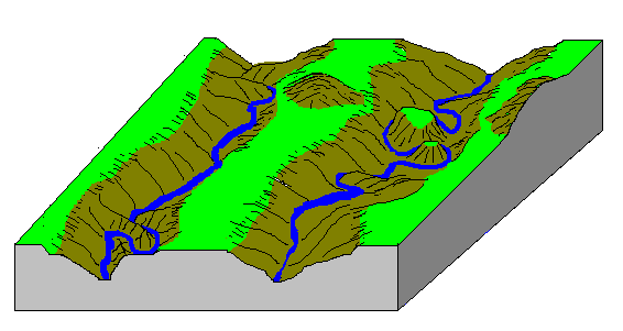 rejuvination of an old age land scape 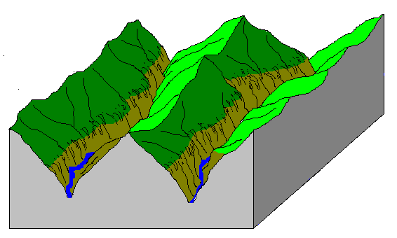 rejuvination of an early mature land scape Why the Stream Cycle Doesn't Explain Everything 1:-Rises and falls in sea level during the ice ages rejuvenated most landscapes to some extent. 2:- Climate changes mean that mass-wasting processes in temperate regions may have undergone radical changes repeatedly in the last few million years. 3:- In places where conditions have remained uniform for long times, like the stable interiors of Africa, Australia and South America, the ideal stream cycle seems to work best
__________________
GEO to aise k sab tumhara ha,MARO to aisa jaise tmhara kuch bhi nhi. Maza deti han zindagi ki thokerin unko,jinhen NAAM-E-KHUDA le kar sanbhal janey ki adat ho. |
| The Following 2 Users Say Thank You to SYEDA SABAHAT For This Useful Post: | ||
candidguy (Tuesday, May 17, 2011), DR ZHIVAGO (Sunday, February 03, 2013) | ||
|
#13
|
|||
|
|||
|
Thank u soo much ,,
at very first step, can u provide me some notes or suggest me only one book to start regards |
| The Following User Says Thank You to Do the Due For This Useful Post: | ||
SYEDA SABAHAT (Tuesday, May 17, 2011) | ||
|
#14
|
||||
|
||||
|
my pleasure dear.
 well first start with physical geo.bcoz its conceptual so you need to understand some terms. book is physical geo.by sarfaraz bajwa. he has compiled all topics in one book it would be good for you. read 1 topic daily and ask question here on forum it really help you.
__________________
GEO to aise k sab tumhara ha,MARO to aisa jaise tmhara kuch bhi nhi. Maza deti han zindagi ki thokerin unko,jinhen NAAM-E-KHUDA le kar sanbhal janey ki adat ho. |
| The Following 3 Users Say Thank You to SYEDA SABAHAT For This Useful Post: | ||
Do the Due (Tuesday, May 17, 2011), hamza786 (Thursday, August 01, 2013), SYED KAUSAR ALI SHAH (Sunday, December 18, 2011) | ||
|
#15
|
||||
|
||||
|
WORK DONE BY RIVER
WHAT IS A RIVER? ~A river is a body of water flowing along a natural channel. It is a part of the watercycle. WATER CYCLE Water evaporates from water bodies such as rivers, lakes and seas, and from plants and trees. The water vapour rises, cools and condenses to form clouds. Rain falls from the clouds . The rain water is intercepted by plants , seeps into the ground before reaching surface streams, or runs off the land surface into streams and rivers. The rivers enter lakes or seas. The water cycle is then repeated WORK DONE/TYPES 1:-EROSIONAL 2:-DEPOSIONAL RIVER EROSION AND ITS FEATURES River erosion is the gradual removal of rock material from the river banks and bed. TYPES OF EROSION A river erodes in the following ways: Corrasion (abrasion): - The river uses its load to grind against the bed and sides The action would dislodge the materials and carry them away This process operates in 2 ways (verticle--> depth; lateral--> width) Potholes are the product of corrasion Attrition: The loosened materials that are being carried away collide against the river sides and bed and against one another Over time, they would become smaller and eventually reduced to fine particles called silt Solution (corrosion): - The solvent action of water dissolves soluble materials and carry them away in solution Hydraulic action: - The breaking down of rocks Removing and dragging rocks from the bed and banks of the river by the force of the running water (like a water jet) Usually there are lines of weakness like joints and cracks in the river The work of hydraulic action forms plunge pools (small lakes) EROSIONAL FEATURES Gorges: Valleys which are steep sided, deep and narrow 2:-CANYON 3;-V-SHAPED VALLEY 4:-WATERFALLS: - Vertical flows of fast moving water flowing from great heights Formed by 2 ways: - Due to unequal resistance of rocks or faulting Unequal resistance- less resistant rocks are eroded more rapidly than resistant rocks As a result, there is a change in gradient By faulting- displacement of rocks results in a difference in height between 2 rocks, water plunges downwards 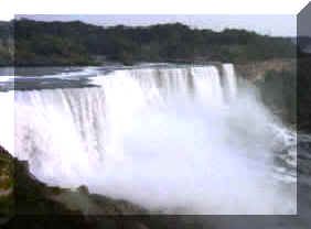 Rapids: A series of very short and fast falls Condition: an area of alternating bands of resistant and less resistant rocks 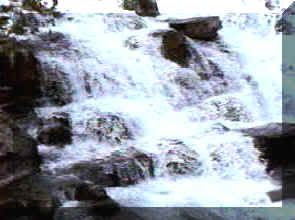 Potholes: Circular depressions on the river bed Formed by corrosion (abrasion) Most effective in flood conditions Pebbles which are trapped in hollows on the river bed are swirled about in turbulent Plunge pools: A large depression at the foot of a waterfall This depression is deepened by hydraulic action of the plunging water Condition: likely to form when the water plunges into less resistant rocks It may be further enlarged by rock debris swirling about by turbulent water at the base 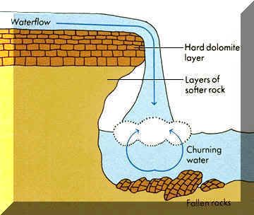 U-SHAPED VALLEY:- 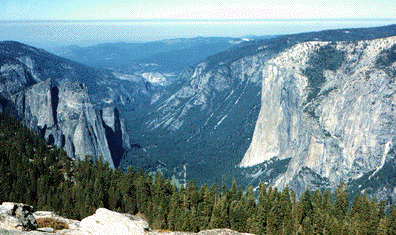
__________________
GEO to aise k sab tumhara ha,MARO to aisa jaise tmhara kuch bhi nhi. Maza deti han zindagi ki thokerin unko,jinhen NAAM-E-KHUDA le kar sanbhal janey ki adat ho. |
| The Following 3 Users Say Thank You to SYEDA SABAHAT For This Useful Post: | ||
candidguy (Thursday, May 19, 2011), DR ZHIVAGO (Sunday, February 03, 2013), SYED KAUSAR ALI SHAH (Sunday, December 18, 2011) | ||
|
#16
|
||||
|
||||
|
RIVER TRANSPORT AND DEPOSITION
A river transport its load (mud, sand, silt, boulders,dissolved materials)in the following ways : Suspension movement of fine eroded materials(silt and clay)floating in water. Solution movement of minerals dissolved in water. Saltation process by which rock fragments like gravel and pebbles are lifted briefly and then dropped on the river bed. They are thus transported in a series of hops and jumps along the river bed. Traction movement of large rocks such as boulders by being rolled along the river bed. RIVER DEPOSITION A river deposits its load of eroded materials when it is unable to transport it. This occurs when : 1:-there is not enough water to transport the load during a day season 2:-a river flows across a desert where there is a high rate of evaporation. 3:-a river flows across permeable rocks which allow water to infiltrate into the underlying rocks. 4:-a river carries a larger load than it can transport. 5:-there is a sudden change in gradient (e.g. river leaves the mountain and flows onto a plain) 6:-a river flows into a lake or sea. 7:-one side of the river is shallower than the other (e.g. the convex bank of a meander) 8:-there are aquatic plants or rocks obstructing the flow RIVER DEPOSITIONAL FEATURES ALLUVIAL CONES AND FANS 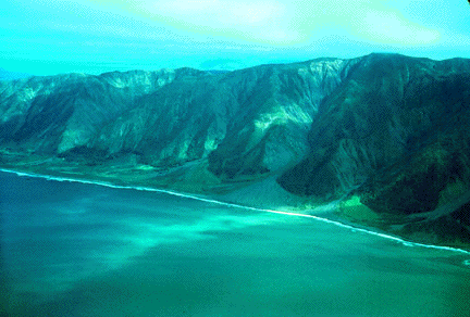 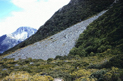 RIVER MEANDERS a:-Meanders are loop-like bends in a river. The water flows round the meander in a spiral manner. This causes erosion to take place on the outer bank and deposition on the inner bank. b:- Gradually, a steep river cliff is formed on the outer bank, making it concave in shape. On the inner bank, deposition of alluvial materials produces a gentle slip-off slope and the bank takes on a convex shape. 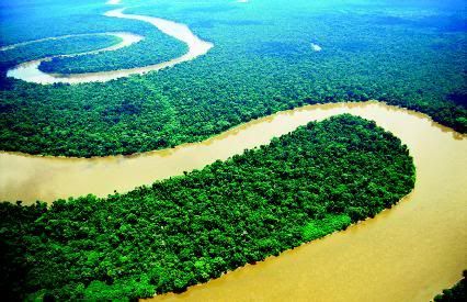 OXBOW LAKES An oxbow lake is a crescent -shaped lake formed on a river when a meander has been cut through and abandoned. When a river meanders in very big loops, the outer bank is so rapidly eroded that the river cuts through the narrow neck of the meander. The river then flows straight through the channel. When deposition seals off the cut-off from the river channel, an oxbow lake is formed. It may silt up and eventually dry up . BRAIDED STREAM 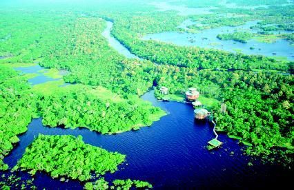 NATURAL LEVEES AND FLOOD PLAINS A floodplain is a low-lying plain on both sides of a river that has repeatedly overflowed its banks and flooded the surrounding areas. When the floods subside, alluvium is deposited on the floodplain. The larger materials, being heavier, are deposited at the river banks while the finer materials are carried and deposited further away from the river. The larger materials at the river banks build upinto embankment called levees. DELTA A delta is a flat piece of land built-up from layers of sediments deposited by a river where it enters a lake or calm sea. The river may have to branch into smaller distributaries to carry the water to the sea. Types of deltas a:-Arcuate delta ---> triangular in shape e.g. Nile Delta b:- Bird's foot delta ---> e.g. Mississippi Delta Conditions that favour the formation of deltas * A large load of sediment *Shallow sea at the river mouth *Sheltered coast with weak tides and currents *Absence of large lakes along the course of the river which will siphon off the load. 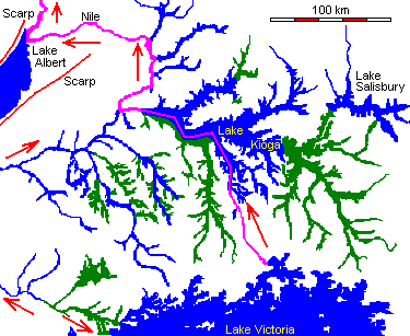 source:- the website about the more revealing facts about earth regards sabahat
__________________
GEO to aise k sab tumhara ha,MARO to aisa jaise tmhara kuch bhi nhi. Maza deti han zindagi ki thokerin unko,jinhen NAAM-E-KHUDA le kar sanbhal janey ki adat ho. |
| The Following 5 Users Say Thank You to SYEDA SABAHAT For This Useful Post: | ||
candidguy (Tuesday, June 07, 2011), DR ZHIVAGO (Sunday, February 03, 2013), mastspidy (Wednesday, January 04, 2012), Shikva (Saturday, May 21, 2011), SYED KAUSAR ALI SHAH (Sunday, December 18, 2011) | ||
|
#17
|
||||
|
||||
|
KARST TOPOGRAPHY
KARST - Introduction Throughout the world karst landscapes vary from rolling hills dotted with sinkholes, as found in portions of the central United States, to jagged hills and pinnacle karst found in the tropics. The development of all karst landforms requires the presence of rock which is capable of being dissolved by surface water or ground water. The term karst describes a distinctive topography that indicates dissolution (also called chemical solution) of underlying soluble rocks by surface water or ground water. Although commonly associated with carbonate rocks (limestone and dolomite) other highly soluble rocks such as evaporates (gypsum and rock salt) can be sculpted into karst terrain. Understanding caves and karst is important because ten percent of the Earth's surface is occupied by karst landscape and as much as a quarter of the world's population depends upon water supplied from karst areas. Though most abundant in humid regions where carbonate rock is present, karst terrain occurs in temperate, tropical, alpine and polar environments. Karst features range in scale from microscopic (chemical precipitates) to entire drainage systems and ecosystems which cover hundreds of square miles, and broad karst plateaus. Although karst processes sculpt beautiful landscapes, karst systems are very vulnerable to ground water pollution due to the relatively rapid rate of water flow and the lack of a natural filtration system. This puts local drinking water supplies at risk of being contaminated. In the mid 1980's, flooding of caves in the highly populated area of Bowling Green, Kentucky, caused industrial waste to leak into the vast system of underground fissures polluting the ground water in local wells. Due to urban expansion millions of dollars is spent annually in the United States to repair damage to roads, buildings and other structures which are built on unstable karst surfaces. The degree of development of karst landforms varies greatly from region to region. Large drainage systems in karst areas are likely to have both fluvial (surface) and karst (underground) drainage components. As stated in the introduction, the term karst describes a distinctive topography that indicates dissolution of underlying rocks by surface water or ground water. Water falls as rain or snow and soaks into the soil. The water becomes weakly acidic because it reacts chemically with carbon dioxide that occurs naturally in the atmosphere and the soil. This acid is named carbonic acid and is the same compound that makes carbonated beverages taste tangy. Rainwater seeps downward through the soil and through fractures in the rock responding to the force of gravity. The carbonic acid in the moving ground water dissolves the bedrock along the surfaces of joints, fractures and bedding planes, eventually forming cave passages and caverns. Limestone is a sedimentary rock consisting primarily of calcium carbonate in the form of the mineral calcite. Rainwater dissolves the limestone by the following reaction: Calcite + Carbonic acid = Calcium ions dissolved in ground water + Bicarbonate ions dissolved in ground water. Cracks and joints that interconnect in the soil and bedrock allow the water to reach a zone below the surface of the land where all the fractures and void spaces are completely filled (also known as saturated) with water. This water-rich zone is called the saturated zone and its upper surface is called the water table. The volume of void space (space filled with air or water) in soil or bedrock is termed porosity. The larger the proportion of voids in a given volume of soil or rock the greater the porosity. When these voids are interconnected, water or air (or other fluids) can migrate from void to void. Thus the soil or bedrock is said to be permeable because fluids (air and water) can easily move through them. Permeable bedrock makes a good aquifer, a rock layer that holds and conducts water. If the ground water that flows through the underlying permeable bedrock is acidic and the bedrock is soluble, a distinctive type of topography, karst topography, can be created.
__________________
GEO to aise k sab tumhara ha,MARO to aisa jaise tmhara kuch bhi nhi. Maza deti han zindagi ki thokerin unko,jinhen NAAM-E-KHUDA le kar sanbhal janey ki adat ho. |
| The Following 3 Users Say Thank You to SYEDA SABAHAT For This Useful Post: | ||
candidguy (Tuesday, June 07, 2011), DR ZHIVAGO (Sunday, February 03, 2013), SYED KAUSAR ALI SHAH (Sunday, December 18, 2011) | ||
|
#18
|
||||
|
||||
 ************************ Some Important Diagrames Of Karst Area 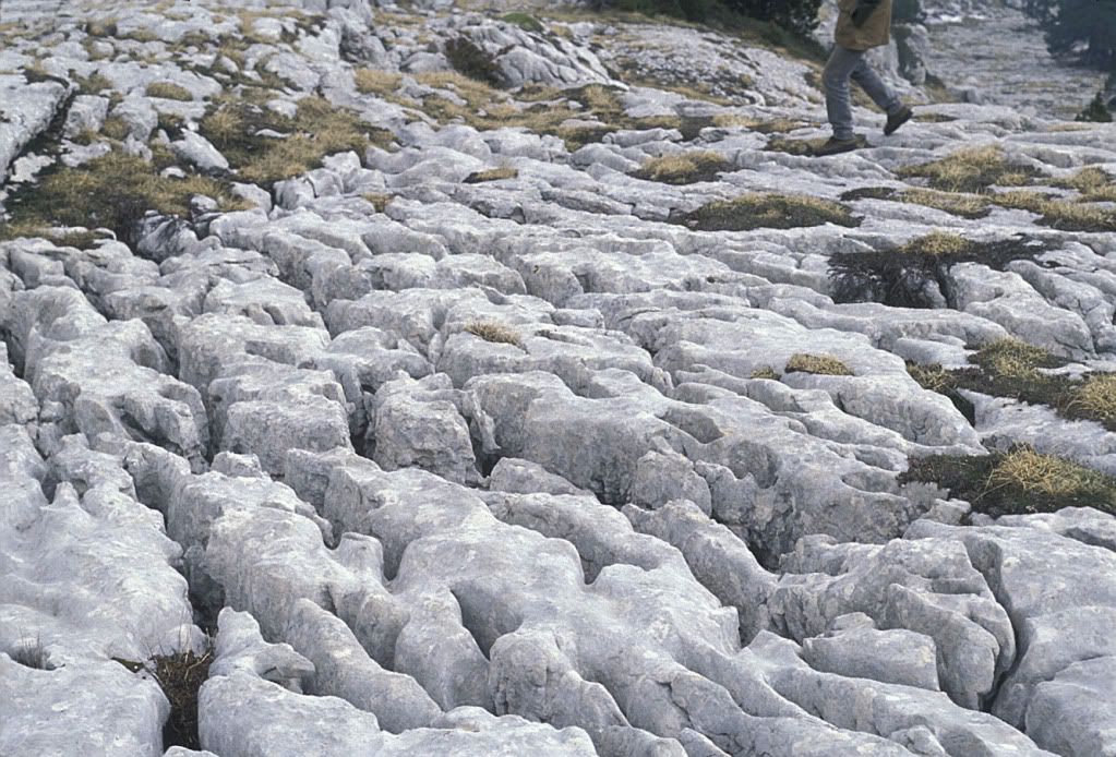 Limestone pavements 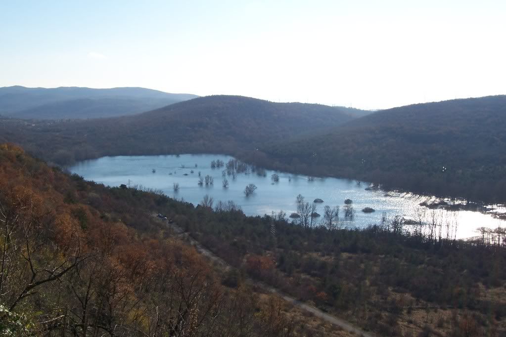 Karst lake Italy UNDERGROUND FEATURES 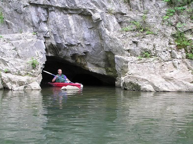 CAVES 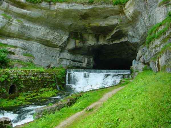 KARST SPRING 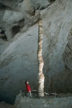 STALAGMITE regards sabahat
__________________
GEO to aise k sab tumhara ha,MARO to aisa jaise tmhara kuch bhi nhi. Maza deti han zindagi ki thokerin unko,jinhen NAAM-E-KHUDA le kar sanbhal janey ki adat ho. |
| The Following 3 Users Say Thank You to SYEDA SABAHAT For This Useful Post: | ||
candidguy (Tuesday, June 07, 2011), H. R. Akhunzada (Saturday, October 06, 2012), SYED KAUSAR ALI SHAH (Sunday, December 18, 2011) | ||
|
#19
|
||||
|
||||
|
__________________
GEO to aise k sab tumhara ha,MARO to aisa jaise tmhara kuch bhi nhi. Maza deti han zindagi ki thokerin unko,jinhen NAAM-E-KHUDA le kar sanbhal janey ki adat ho. |
| The Following 2 Users Say Thank You to SYEDA SABAHAT For This Useful Post: | ||
mehmoodahmed (Wednesday, February 29, 2012), SYED KAUSAR ALI SHAH (Sunday, December 18, 2011) | ||
|
#20
|
||||
|
||||
 salams i saw ur worh syeda sabahat y u have stop posting???many topics r still left waiting for those...thanks u
__________________
Diamond |
 |
| Tags |
| physical geo.notes |
«
Previous Thread
|
Next Thread
»
|
|
 Similar Threads
|
||||
| Thread | Thread Starter | Forum | Replies | Last Post |
| Essay Tips | Argus | Essay | 82 | Monday, December 12, 2022 11:36 PM |
| Paragraph Writing | Omer | Expansion/Paragraph | 1 | Sunday, January 11, 2009 01:55 PM |
| Guide to Essay Writing | Shaukat Munir | Essay | 0 | Wednesday, November 28, 2007 05:43 PM |
| Geography an overview | Naseer Ahmed Chandio | Geography | 9 | Wednesday, August 29, 2007 03:06 PM |
| Essays on Essay Writing | atifch | Essay | 6 | Friday, December 22, 2006 11:24 PM |


