Anguilla
Background
Colonized by English settlers from Saint Kitts in 1650, Anguilla was administered by Great Britain until the early 19th century, when the island - against the wishes of the inhabitants - was incorporated into a single British dependency, along with Saint Kitts and Nevis. Several attempts at separation failed. In 1971, two years after a revolt, Anguilla was finally allowed to secede; this arrangement was formally recognized in 1980, with Anguilla becoming a separate British dependency.
Location
Caribbean, islands between the Caribbean Sea and North Atlantic Ocean, east of Puerto Rico
Geographic co-ordinates
18 15 N, 63 10 W
Map references
Central America and the Caribbean
Area
Total: 102 sq km ; land: 102 sq km ; water: 0 sq km
Area- comparative
About half the size of Washington, DC
Climate
Tropical; moderated by northeast trade winds
Terrain
Flat and low-lying island of coral and limestone
Natural resources
Salt, fish, lobster
Natural Hazards
Frequent hurricanes and other tropical storms (July to October)
Nationality
Noun: Anguillan(s) ; adjective: Anguillan
Languages
English (official)
Country name
Conventional long form: none ; conventional short form: Anguilla
Capital
Name: The Valley ; geographic coordinates: 18 13 N, 63 04 W ; time difference: UTC-4 (1 hour ahead of Washington, DC during Standard Time)
National holiday
Anguilla Day, 30 May
Suffrage
18 years of age; universal
Flag
 Industries
Tourism, boat building, offshore financial services
Currency code
East Caribbean dollar (XCD)
Internet code
.ai
Ports and terminals
Blowing Point, Road Bay
Antarctica
Background
Speculation over the existence of a "southern land" was not confirmed until the early 1820s when British and American commercial operators and British and Russian national expeditions began exploring the Antarctic Peninsula region and other areas south of the Antarctic Circle. Not until 1840 was it established that Antarctica was indeed a continent and not just a group of islands. Several exploration "firsts" were achieved in the early 20th century. Following World War II, there was an upsurge in scientific research on the continent. A number of countries have set up year-round research stations on Antarctica. Seven have made territorial claims, but not all countries recognize these claims. In order to form a legal framework for the activities of nations on the continent, an Antarctic Treaty was negotiated that neither denies nor gives recognition to existing territorial claims; signed in 1959, it entered into force in 1961.
Location
Continent mostly south of the Antarctic Circle
Geographic co-ordinates
90 00 S, 0 00 E
Map references
Antarctic Region
Area
Total: 14 million sq km ; land: 14 million sq km (280,000 sq km ice-free, 13.72 million sq km ice-covered) (est.) ; note: fifth-largest continent, following Asia, Africa, North America, and South America, but larger than Australia and the subcontinent of Europe
Area comparative
Slightly less than 1.5 times the size of the US
Climate
Severe low temperatures vary with latitude, elevation, and distance from the ocean; East Antarctica is colder than West Antarctica because of its higher elevation; Antarctic Peninsula has the most moderate climate; higher temperatures occur in January along the coast and average slightly below freezing.
Terrain
About 98% thick continental ice sheet and 2% barren rock, with average elevations between 2,000 and 4,000 meters; mountain ranges up to nearly 5,000 meters; ice-free coastal areas include parts of southern Victoria Land, Wilkes Land, the Antarctic Peninsula area, and parts of Ross Island on McMurdo Sound; glaciers form ice shelves along about half of the coastline, and floating ice shelves constitute 11% of the area of the continent.
Natural resources
Iron ore, chromium, copper, gold, nickel, platinum and other minerals, and coal and hydrocarbons have been found in small uncommercial quantities; none presently exploited; krill, finfish, and crab have been taken by commercial fisheries
Natural hazards
Katabatic (gravity-driven) winds blow coastward from the high interior; frequent blizzards form near the foot of the plateau; cyclonic storms form over the ocean and move clockwise along the coast; volcanism on Deception Island and isolated areas of West Antarctica; other seismic activity rare and weak; large icebergs may calve from ice shelf.
Country name
Conventional long form: none ; conventional short form: Antarctica
Flag

Antigua and Barbuda
Background
The Siboney were the first to inhabit the islands of Antigua and Barbuda in 2400 B.C., but Arawak Indians populated the islands when Columbus landed on his second voyage in 1493. Early settlements by the Spanish and French were succeeded by the English who formed a colony in 1667. Slavery, established to run the sugar plantations on Antigua, was abolished in 1834. The islands became an independent state within the British Commonwealth of Nations in 1981.
Location
Caribbean, islands between the Caribbean Sea and the North Atlantic Ocean, east-southeast of Puerto Rico
Geographic co-ordinates
17 03 N, 61 48 W
Map references
Central America and the Caribbean
Area
Total: 442.6 sq km (Antigua 280 sq km; Barbuda 161 sq km) ; land: 442.6 sq km ; water: 0 sq km ; note: includes Redonda, 1.6 sq km
Area comparative
2.5 times the size of Washington, DC
Climate
Tropical maritime; little seasonal temperature variation
Terrain
Mostly low-lying limestone and coral islands, with some higher volcanic areas
Natural resources
NEGL; pleasant climate fosters tourism
Natural hazards
Hurricanes and tropical storms (July to October); periodic droughts
Nationality
Noun: Antiguan(s), Barbudan(s) ; adjective: Antiguan, Barbudan
Languages
English (official), local dialects
Country name
Conventional long form: none ; conventional short form: Antigua and Barbuda
Capital
Name: Saint John's ; geographic coordinates: 17 06 N, 61 51 W ; time difference: UTC-4 (1 hour ahead of Washington, DC during Standard Time)
Administrative division
6 parishes and 2 dependencies*; Barbuda*, Redonda*, Saint George, Saint John, Saint Mary, Saint Paul, Saint Peter, Saint Philip
National holiday
Independence Day (National Day), 1 November (1981)
Suffrage
18 years of age; universal
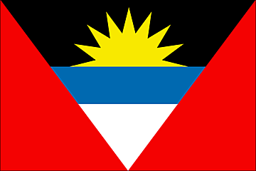
Flag
 Industries
Tourism, construction, light manufacturing (clothing, alcohol, household appliances)
Currency code
East Caribbean dollar (XCD)
Internet code
.ag
Ports and Terminals
Saint John's
Argentina
Background
In 1816, the United Provinces of the Rio Plata declared their independence from Spain. Eventually, Bolivia, Paraguay, and Uruguay went their own way, but the area that remained became Argentina. The country's population and culture were subsequently heavily shaped by immigrants from throughout Europe, but most particularly Italy and Spain, which provided the largest percentage of newcomers from 1860 to 1930. Up until about the mid-20th century, much of Argentina's history was dominated by periods of internal political conflict between Federalists and Unitarians and between civilian and military factions. After World War II, an era of Peronist authoritarian rule and interference in subsequent governments was followed by a military junta that took power in 1976. Democracy returned in 1983, and has persisted despite numerous challenges, the most formidable of which was a severe economic crisis in 2001-02 that led to violent public protests and the resignation of several interim presidents. The economy has since recovered strongly since bottoming out in 2002. The government renegotiated its public debt in 2005 and paid off its remaining obligations to the IMF in early 2006.
Location
Southern South America, bordering the South Atlantic Ocean, between Chile and Uruguay
Geographic co-ordinates
34 00 S, 64 00 W
Map references
South America
Area
Total: 2,766,890 sq km ; land: 2,736,690 sq km ; water: 30,200 sq km
Area comparative
Slightly less than three-tenths the size of the US
Land boundaries
Total: 9,861 km ; border countries: Bolivia 832 km, Brazil 1,261 km, Chile 5,308 km, Paraguay 1,880 km, Uruguay
Climate
Mostly temperate; arid in southeast; subantarctic in southwest
Terrain
Rich plains of the Pampas in northern half, flat to rolling plateau of Patagonia in south, rugged Andes along western border
Natural resources
Fertile plains of the pampas, lead, zinc, tin, copper, iron ore, manganese, petroleum, uranium
Natural hazards
San Miguel de Tucuman and Mendoza areas in the Andes subject to earthquakes; pamperos are violent windstorms that can strike the pampas and northeast; heavy flooding
Nationality
Noun: Argentine(s) ; adjective: Argentine
Languages
Spanish (official), English, Italian, German, French
Country name
Conventional long form: Argentine Republic ; conventional short form: Argentina ; local long form: Republica Argentina ; local short form: Argentina
Capital
Name: Buenos Aires ; geographic coordinates: 34 36 S, 58 27 W ; time difference: UTC-3 (2 hours ahead of Washington, DC during Standard Time)
Administrative division
23 provinces (provincias, singular - provincia) and 1 autonomous city* (distrito federal); Buenos Aires, Buenos Aires Capital Federal*, Catamarca, Chaco, Chubut, Cordoba, Corrientes, Entre Rios, Formosa, Jujuy, La Pampa, La Rioja, Mendoza, Misiones, Neuquen, Rio Negro, Salta, San Juan, San Luis, Santa Cruz, Santa Fe, Santiago del Estero, Tierra del Fuego - Antartida e Islas del Atlantico Sur, Tucuman ; note: the US does not recognize any claims to Antarctica
National holiday
Revolution Day, 25 May (1810)
Suffrage
18 years of age; universal and compulsory
Flag
 Industries
Food processing, motor vehicles, consumer durables, textiles, chemicals and petrochemicals, printing, metallurgy, steel
Currency code
Argentine peso (ARS)
Internet code
.ar
Ports and Terminals
Bahia Blanca, Buenos Aires, Concepcion del Uruguay, La Plata, Punta Colorada, Rosario, San Lorenzo-San Martin, San Nicolas
Armenia
Background
Armenia prides itself on being the first nation to formally adopt Christianity (early 4th century). Despite periods of autonomy, over the centuries Armenia came under the sway of various empires including the Roman, Byzantine, Arab, Persian, and Ottoman. During World War I in the western portion of Armenia, Ottoman Turkey instituted a policy of forced resettlement coupled with other harsh practices that resulted in an estimated 1 million Armenian deaths. The eastern area of Armenia was ceded by the Ottomans to Russia in 1828; this portion declared its independence in 1918, but was conquered by the Soviet Red Army in 1920. Armenian leaders remain preoccupied by the long conflict with Muslim Azerbaijan over Nagorno-Karabakh, a primarily Armenian-populated region, assigned to Soviet Azerbaijan in the 1920s by Moscow. Armenia and Azerbaijan began fighting over the area in 1988; the struggle escalated after both countries attained independence from the Soviet Union in 1991. By May 1994, when a cease-fire took hold, Armenian forces held not only Nagorno-Karabakh but also a significant portion of Azerbaijan proper. The economies of both sides have been hurt by their inability to make substantial progress toward a peaceful resolution. Turkey imposed an economic blockade on Armenia and closed the common border because of the Armenian occupation of Nagorno-Karabakh and surrounding areas.
Location
Southwestern Asia, east of Turkey
Geographic co-ordinates
40 00 N, 45 00 E
Map references
Asia
Area
Total: 29,800 sq km ; land: 28,400 sq km ; water: 1,400 sq km
Area comparative
Slightly smaller than Maryland
Land boundaries
Total: 1,254 km ; border countries: Azerbaijan-proper 566 km, Azerbaijan-Naxcivan exclave 221 km, Georgia 164 km, Iran 35 km, Turkey 268 km
Climate
Highland continental, hot summers, cold winters
Terrain
Armenian Highland with mountains; little forest land; fast flowing rivers; good soil in Aras River valley
Natural resources
Small deposits of gold, copper, molybdenum, zinc, alumina
Natural hazards
Occasionally severe earthquakes; droughts
Nationality
Noun: Armenian(s) ; adjective: Armenian
Country name
Conventional long form: Republic of Armenia ; conventional short form: Armenia ; local long form: Hayastani Hanrapetut'yun ; local short form: Hayastan ; former: Armenian Soviet Socialist Republic; Armenian Republic
Capital
Name: Yerevan ; geographic coordinates: 40 11 N, 44 30 E ; time difference: UTC+4 (9 hours ahead of Washington, DC during Standard Time) ; daylight saving time: +1hr, begins last Sunday in March; ends last Sunday in October
Administrative division
11 provinces (marzer, singular - marz); Aragatsotn, Ararat, Armavir, Geghark'unik', Kotayk', Lorri, Shirak, Syunik', Tavush, Vayots' Dzor, Yerevan
National holiday
Independence Day, 21 September (1991)
Suffrage
18 years of age; universal
Flag
 Industries
Diamond-processing, metal-cutting machine tools, forging-pressing machines, electric motors, tires, knitted wear, hosiery, shoes, silk fabric, chemicals, trucks, instruments, microelectronics, jewelry manufacturing, software development, food processing, brandy
Currency code
Dram (AMD)
Internet code
.am
Aruba
Background
Discovered and claimed for Spain in 1499, Aruba was acquired by the Dutch in 1636. The island's economy has been dominated by three main industries. A 19th century gold rush was followed by prosperity brought on by the opening in 1924 of an oil refinery. The last decades of the 20th century saw a boom in the tourism industry. Aruba seceded from the Netherlands Antilles in 1986 and became a separate, autonomous member of the Kingdom of the Netherlands. Movement toward full independence was halted at Aruba's request in 1990.
Location
Caribbean, island in the Caribbean Sea, north of Venezuela
Geographic co-ordinates
12 30 N, 69 58 W
Map references
Central America and the Caribbean
Area
Total: 193 sq km ; land: 193 sq km ; water: 0 sq km
Area comparative
Slightly larger than Washington, DC
Climate
Tropical marine; little seasonal temperature variation
Terrain
Flat with a few hills; scant vegetation
Natural resources
NEGL; white sandy beaches
Natural hazards
Lies outside the Caribbean hurricane belt
Nationality
Noun: Aruban(s) ; adjective: Aruban; Dutch
Languages
Dutch (official), Papiamento (a Spanish, Portuguese, Dutch, English dialect), English (widely spoken), Spanish
Country name
Conventional long form: none ; conventional short form: Aruba
Capital
Name: Oranjestad ; geographic coordinates: 12 33 N, 70 06 W ; time difference: UTC-4 (1 hour ahead of Washington, DC during Standard Time)
Administrative division
None (part of the Kingdom of the Netherlands)
National holiday
1 January 1986
Suffrage
18 years of age; universal
Flag
 Industries
Tourism, transshipment facilities, oil refining
Currency code
Aruban guilder/florin (AWG)
Internet code
.aw
Ports and terminals
Barcadera, Oranjestad, Sint Nicolaas
Ashmore and Cartier Island
Background
These uninhabited islands came under Australian authority in 1931; formal administration began two years later. Ashmore Reef supports a rich and diverse avian and marine habitat; in 1983, it became a National Nature Reserve. Cartier Island, a former bombing range, is now a marine reserve.
Location
Southeastern Asia, islands in the Indian Ocean, midway between
northwestern Australia and Timor Island
Geographic co-ordinates
12 14 S, 123 05 E
Map references
Southeast Asia
Area
Total: 5 sq km ; land: 5 sq km ; water: 0 sq km ; note: includes Ashmore Reef (West, Middle, and East Islets) and Cartier Island
Area comparative
About eight times the size of The Mall in Washington, DC
Climate
Tropical
Terrain
Low with sand and coral
Natural resources
Fish
Natural hazards
Surrounded by shoals and reefs that can pose maritime hazards
Country name
Conventional long form: Territory of Ashmore and Cartier Islands ; conventional short form: Ashmore and Cartier Islands
Flag
 Ports and Terminals
None; offshore anchorage only
Australia
Background
Aboriginal settlers arrived on the continent from Southeast Asia about 40,000 years before the first Europeans began exploration in the 17th century. No formal territorial claims were made until 1770, when Capt. James COOK took possession in the name of Great Britain. Six colonies were created in the late 18th and 19th centuries; they federated and became the Commonwealth of Australia in 1901. The new country took advantage of its natural resources to rapidly develop agricultural and manufacturing industries and to make a major contribution to the British effort in World Wars I and II. In recent decades, Australia has transformed itself into an internationally competitive, advanced market economy. It boasted one of the OECD's fastest growing economies during the 1990s, a performance due in large part to economic reforms adopted in the 1980s. Long-term concerns include pollution, particularly depletion of the ozone layer, and management and conservation of coastal areas, especially the Great Barrier Reef.
Location
Oceania, continent between the Indian Ocean and the South Pacific Ocean
Geographic co-ordinates
27 00 S, 133 00 E
Map references
Oceania
Area
Total: 7,686,850 sq km ; land: 7,617,930 sq km ; water: 68,920 sq km ; note: includes Lord Howe Island and Macquarie Island
Area comparative
Slightly smaller than the US contiguous 48 states
Climate
Generally arid to semiarid; temperate in south and east; tropical in north
Terrain
Mostly low plateau with deserts; fertile plain in southeast
Natural resources
Bauxite, coal, iron ore, copper, tin, gold, silver, uranium, nickel, tungsten, mineral sands, lead, zinc, diamonds, natural gas, petroleum.
Natural hazards
Cyclones along the coast; severe droughts; forest fires.
Nationality
Noun: Australian(s) ; adjective: Australian
Country name
Conventional long form: Commonwealth of Australia ; conventional short form: Australia
Capital
Washington, DC during Standard Time) ; daylight saving time: +1hr, begins last Sunday in October; ends last Sunday in March (ended first Sunday in April 2006) ; note: Australia is divided into three time zones
Administrative division
6 states and 2 territories*; Australian Capital Territory*, New South Wales, Northern Territory*, Queensland, South Australia, Tasmania, Victoria, Western Australia
National holiday
Australia Day, 26 January (1788); ANZAC Day (commemorated as the anniversary of the 1915 landing of troops of the Australian and New Zealand Army Corps during World War I at Gallipoli, Turkey), 25 April
Suffrage
18 years of age; universal and compulsory
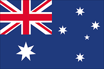
Flag
 Industries
Mining, industrial and transportation equipment, food processing, chemicals, steel
Currency code
Australian dollar (AUD)
Internet code
.au
Ports and terminals
Brisbane, Dampier, Fremantle, Gladstone, Hay Point, Melbourne, Newcastle, Port Hedland, Port Kembla, Port Walcott, Sydney
Austria
Background
Once the center of power for the large Austro-Hungarian Empire, Austria was reduced to a small republic after its defeat in World War I. Following annexation by Nazi Germany in 1938 and subsequent occupation by the victorious Allies in 1945, Austria's status remained unclear for a decade. A State Treaty signed in 1955 ended the occupation, recognized Austria's independence, and forbade unification with Germany. A constitutional law that same year declared the country's "perpetual neutrality" as a condition for Soviet military withdrawal. The Soviet Union's collapse in 1991 and Austria's entry into the European Union in 1995 have altered the meaning of this neutrality. A prosperous, democratic country, Austria entered the EU Economic Monetary Union in 1999.
Location
Central Europe, north of Italy and Slovenia
Geographic co-ordinates
47 20 N, 13 20 E
Map references
Europe
Area
Total: 83,870 sq km ; land: 82,444 sq km ; water: 1,426 sq km
Area comparative
Slightly smaller than Maine
Climate
Temperate; continental, cloudy; cold winters with frequent rain and some snow in lowlands and snow in mountains; moderate summers with occasional showers
Terrain
In the west and south mostly mountains (Alps); along the eastern and northern margins mostly flat or gently sloping
Natural resources
Oil, coal, lignite, timber, iron ore, copper, zinc, antimony, magnesite, tungsten, graphite, salt, hydropower
Natural hazards
Landslides; avalanches; earthquakes
Nationality
Noun: Austrian(s) ; adjective: Austrian
Languages
German (official nationwide), Slovene (official in Carinthia), Croatian (official in Burgenland), Hungarian (official in Burgenland)
Country name
Conventional long form: Republic of Austria ; conventional short form: Austria ; local long form: Republik Oesterreich ; local short form: Oesterreich
Capital
Name: Vienna ; geographic coordinates: 48 12 N, 16 22 E ; time difference: UTC+1 (6 hours ahead of Washington, DC during Standard Time) ; daylight saving time: +1hr, begins last Sunday in March; ends last Sunday in October
Administrative division
9 states (Bundeslaender, singular - Bundesland); Burgenland, Kaernten (Carinthia), Niederoesterreich, Oberoesterreich, Salzburg, Steiermark (Styria), Tirol, Vorarlberg, Wien (Vienna)
National holiday
National Day, 26 October (1955)
Suffrage
18 years of age; universal
Flag
 Industries
Construction, machinery, vehicles and parts, food, metals, chemicals, lumber and wood processing, paper and paperboard, communications equipment, tourism
Currency code
Euro (EUR)
Internet
.at
Ports and Terminals
Enns, Krems, Linz, Vienna
Azerbaijan
Background
Azerbaijan - a nation with a Turkic and majority-Muslim population - was briefly independent from 1918 to 1920; it regained its independence after the collapse of the Soviet Union in 1991. Despite a 1994 cease-fire, Azerbaijan has yet to resolve its conflict with Armenia over the Azerbaijani Nagorno-Karabakh enclave (largely Armenian populated). Azerbaijan has lost 16% of its territory and must support some 528,000 internally displaced persons as a result of the conflict. Corruption is ubiquitous, and the promise of widespread wealth from Azerbaijan's undeveloped petroleum resources remains largely unfulfilled.
Location
Southwestern Asia, bordering the Caspian Sea, between Iran and Russia, with a small European portion north of the Caucasus range.
Geographic co-ordinates
40 30 N, 47 30 E
Map references
Asia
Area
Total: 86,600 sq km ; land: 86,100 sq km ; water: 500 sq km ; note: includes the exclave of Naxcivan Autonomous Republic and the Nagorno-Karabakh region; the region's autonomy was abolished by Azerbaijani Supreme Soviet on 26 November 1991
Area comparative
Slightly smaller than Maine
Climate
Dry, semiarid steppe
Terrain
Large, flat Kur-Araz Ovaligi (Kura-Araks Lowland) (much of it below sea level) with Great Caucasus Mountains to the north, Qarabag Yaylasi (Karabakh Upland) in west; Baku lies on Abseron Yasaqligi (Apsheron Peninsula) that juts into Caspian Sea.
Natural resources
Petroleum, natural gas, iron ore, nonferrous metals, alumina
Natural hazards
Droughts
Nationality
Noun: Azerbaijani(s), Azeri(s) ; adjective: Azerbaijani, Azeri
Country name
Conventional long form: Republic of Azerbaijan ; conventional short form: Azerbaijan ; local long form: Azarbaycan Respublikasi ; local short form: Azarbaycan ; former: Azerbaijan Soviet Socialist Republic
Capital
Name: Baku (Baki, Baky) ; geographic coordinates: 40 23 N, 49 51 E ; time difference: UTC+4 (9 hours ahead of Washington, DC during Standard Time) ; daylight saving time: +1hr, begins last Sunday in March; ends last Sunday in October
Administrative divisions
59 rayons (rayonlar; rayon - singular), 11 cities (saharlar; sahar - singular), 1 autonomous republic (muxtar respublika) ; rayons: Abseron Rayonu, Agcabadi Rayonu, Agdam Rayonu, Agdas Rayonu, Agstafa Rayonu, Agsu Rayonu, Astara Rayonu, Balakan Rayonu, Barda Rayonu, Beylaqan Rayonu, Bilasuvar Rayonu, Cabrayil Rayonu, Calilabad Rayonu, Daskasan Rayonu, Davaci Rayonu, Fuzuli Rayonu, Gadabay Rayonu, Goranboy Rayonu, Goycay Rayonu, Haciqabul Rayonu, Imisli Rayonu, Ismayilli Rayonu, Kalbacar Rayonu, Kurdamir Rayonu, Lacin Rayonu, Lankaran Rayonu, Lerik Rayonu, Masalli Rayonu, Neftcala Rayonu, Oguz Rayonu, Qabala Rayonu, Qax Rayonu, Qazax Rayonu, Qobustan Rayonu, Quba Rayonu, Qubadli Rayonu, Qusar Rayonu, Saatli Rayonu, Sabirabad Rayonu, Saki Rayonu, Salyan Rayonu, Samaxi Rayonu, Samkir Rayonu, Samux Rayonu, Siyazan Rayonu, Susa Rayonu, Tartar Rayonu, Tovuz Rayonu, Ucar Rayonu, Xacmaz Rayonu, Xanlar Rayonu, Xizi Rayonu, Xocali Rayonu, Xocavand Rayonu, Yardimli Rayonu, Yevlax Rayonu, Zangilan Rayonu, Zaqatala Rayonu, Zardab Rayonu ; cities: Ali Bayramli Sahari, Baki Sahari, Ganca Sahari, Lankaran Sahari, Mingacevir Sahari, Naftalan Sahari, Saki Sahari, Sumqayit Sahari, Susa Sahari, Xankandi Sahari, Yevlax Sahari ; autonomous republic: Naxcivan Muxtar Respublikasi
National holiday
Founding of the Democratic Republic of Azerbaijan, 28 May (1918)
Suffrage
18 years of age; universal
Flag
 Industries
Petroleum and natural gas, petroleum products, oilfield equipment; steel, iron ore; cement; chemicals and petrochemicals; textiles
Currency code
Azerbaijani manat (AZM)
Internet code
.az
Ports and Terminals
Baku (Baki)