CSS Forums
Saturday, April 27, 2024
12:32 PM (GMT +5)
12:32 PM (GMT +5)
|
|||||||


| General Knowledge, Quizzes, IQ Tests A zone where General Knowledge related to this exam can be shared.Surveys and Threads with polls and questions that require answers can be Posted here |
 |
Share Thread:
 Facebook
 Twitter
 Google+
|
|
|
LinkBack | Thread Tools | Search this Thread |
|
#1
 Friday, April 04, 2008
|
||||
|
||||
|
Afghanistan Background Ahmad Shah DURRANI unified the Pashtun tribes and founded Afghanistan in 1747. The country served as a buffer between the British and Russian empires until it won independence from notional British control in 1919. A brief experiment in democracy ended in a 1973 coup and a 1978 Communist counter-coup. The Soviet Union invaded in 1979 to support the tottering Afghan Communist regime, touching off a long and destructive war. The USSR withdrew in 1989 under relentless pressure by internationally supported anti-Communist mujahedin rebels. Subsequently, a series of civil wars saw Kabul finally fall in 1996 to the Taliban, a hardline Pakistani-sponsored movement that emerged in 1994 to end the country's civil war and anarchy. Following the 11 September 2001 terrorist attacks, a US, Allied, and anti-Taliban Northern Alliance military action toppled the Taliban for sheltering Osama BIN LADIN. The UN-sponsored Bonn Conference in 2001 established a process for political reconstruction that included the adoption of a new constitution and a presidential election in 2004, and National Assembly elections in 2005. On 7 December 2004, Hamid KARZAI became the first democratically elected president of Afghanistan. The National Assembly was inaugurated on 19 December 2005. Location Southern Asia, north and west of Pakistan, east of Iran Geographic co ordinates 33 00 N, 65 00 E Map references Asia Area Total: 647,500 sq km ; land: 647,500 sq km ; water: 0 sq km Area-comparative Slightly smaller than Texas Land boundaries Total: 5,529 km ; border countries: China 76 km, Iran 936 km, Pakistan 2,430 km, Tajikistan 1,206 km, Turkmenistan 744 km, Uzbekistan 137 km Climate Arid to semiarid; cold winters and hot summers Terrain Mostly rugged mountains; plains in north and southwest Natural resources Natural gas, petroleum, coal, copper, chromite, talc, barites, sulfur, lead, zinc, iron ore, salt, precious and semiprecious stones Natural hazards Damaging earthquakes occur in Hindu Kush mountains; flooding; droughts Nationality Noun: Afghan(s) ; adjective: Afghan Languages Afghan Persian or Dari (official) 50%, Pashtu (official) 35%, Turkic languages (primarily Uzbek and Turkmen) 11%, 30 minor languages (primarily Balochi and Pashai) 4%, much bilingualism Country name Conventional long form: Islamic Republic of Afghanistan ; conventional short form: Afghanistan ; local long form: Jomhuri-ye Eslami-ye Afghanestan ; local short form: Afghanestan ; former: Republic of Afghanistan Islamic republic Capital Name: Kabul ; geographic coordinates: 34 31 N, 69 12 E ; time difference: UTC+4.5 (9.5 hours ahead of Washington, DC during Standard Time) Administrative division 34 provinces (velayat, singular - velayat); Badakhshan, Badghis, Baghlan, Balkh, Bamian, Daykondi, Farah, Faryab, Ghazni, Ghowr, Helmand, Herat, Jowzjan, Kabol, Kandahar, Kapisa, Khowst, Konar, Kondoz, Laghman, Lowgar, Nangarhar, Nimruz, Nurestan, Oruzgan, Paktia, Paktika, Panjshir, Parvan, Samangan, Sar-e Pol, Takhar, Vardak, Zabol National holiday Independence Day, 19 August (1919) Suffrage 18 years of age; universal Flag 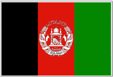 Industries Small-scale production of textiles, soap, furniture, shoes, fertilizer, cement; handwoven carpets; natural gas, coal, copper Currency code Afghani (AFA) Internet country code .af Ports and terminals Kheyrabad, Shir Khan Akrotiri Background By terms of the 1960 Treaty of Establishment that created the independent Republic of Cyprus, the UK retained full sovereignty and jurisdiction over two areas of almost 254 square kilometers - Akrotiri and Dhekelia. The southernmost and smallest of these is the Akrotiri Sovereign Base Area, which is also referred to as the Western Sovereign Base Area. Location Peninsula on the southwest coast of Cyprus Geographic co ordination 34 37 N, 32 58 E Map references Middle East Area Total: 123 sq km ; note: includes a salt lake and wetlands Area comparative About 0.7 times the size of Washington, DC Land boundaries Total: 47.4 km ; border countries: Cyprus 47.4 km Climate Temperate; Mediterranean with hot, dry summers and cool winters Natural hazards Shooting around the salt lake; note - breeding place for loggerhead and green turtles; only remaining colony of griffon vultures is on the base Languages English, Greek Country name Conventional long form: Akrotiri Sovereign Base Area ; conventional short form: Akrotiri Capital Name: Episkopi Cantonment; also serves as capital of Dhekelia ; geographic coordinates: 34 40 N, 32 51 E ; time difference: UTC+2 (7 hours ahead of Washington, DC during Standard Time) ; daylight saving time: +1hr, begins last Sunday in March; ends last Sunday in October Flag  Currency code Cypriot pound (CYP) Albania Background Between 1990 and 1992 Albania ended 46 years of xenophobic Communist rule and established a multiparty democracy. The transition has proven challenging as successive governments have tried to deal with high unemployment, widespread corruption, a dilapidated physical infrastructure, powerful organized crime networks, and combative political opponents. Albania has made progress in its democratic development since first holding multiparty elections in 1991, but deficiencies remain. International observers judged elections to be largely free and fair since the restoration of political stability following the collapse of pyramid schemes in 1997. In the 2005 general elections, the Democratic Party and its allies won a decisive victory on pledges of reducing crime and corruption, promoting economic growth, and decreasing the size of government. The election, and particularly the orderly transition of power, was considered an important step forward. Although Albania's economy continues to grow, the country is still one of the poorest in Europe, hampered by a large informal economy and an inadequate energy and transportation infrastructure. Albania has played a largely helpful role in managing inter-ethnic tensions in southeastern Europe, and is continuing to work toward joining NATO and the EU. Albania, with troops in Iraq and Afghanistan, has been a strong supporter of the global war on terrorism. Location Southeastern Europe, bordering the Adriatic Sea and Ionian Sea, between Greece and Serbia and Montenegro Geographic co ordinates 41 00 N, 20 00 E Map references Europe Area Total: 28,748 sq km ; land: 27,398 sq km ; water: 1,350 sq km Area - comparative Slightly smaller than Maryland Land boundaries Total: 720 km ; border countries: Greece 282 km, Macedonia 151 km, Montenegro 172 km, Serbia 115 km Climate Mild temperate; cool, cloudy, wet winters; hot, clear, dry summers; interior is cooler and wetter Terrain Mostly mountains and hills; small plains along coast Natural resources Petroleum, natural gas, coal, bauxite, chromite, copper, iron ore, nickel, salt, timber, hydropower Natural hazards Destructive earthquakes; tsunamis occur along southwestern coast; floods; drought Nationality Noun: Albanian(s) ; adjective: Albanian Languages Albanian (official - derived from Tosk dialect), Greek, Vlach, Romani, Slavic dialects Country name Conventional long form: Republic of Albania ; conventional short form: Albania ; local long form: Republika e Shqiperise ; local short form: Shqiperia ; former: People's Socialist Republic of Albania Capital Name: Tirana (Tirane) ; geographic coordinates: 41 20 N, 19 50 E ; time difference: UTC+1 (6 hours ahead of Washington, DC during Standard Time) ; daylight saving time: +1hr, begins last Sunday in March; ends last Sunday in October Administrative division 12 counties (qarqe, singular - qark); Qarku i Beratit, Qarku i Dibres, Qarku i Durresit, Qarku i Elbasanit, Qarku i Fierit, Qarku i Gjirokastres, Qarku i Korces, Qarku i Kukesit, Qarku i Lezhes, Qarku i Shkodres, Qarku i Tiranes, Qarku i Vlores National holiday Independence Day, 28 November (1912) Suffrage 18 years of age; universal Flag  Industries Food processing, textiles and clothing; lumber, oil, cement, chemicals, mining, basic metals, hydropower Currency code lek (ALL) ; note: the plural of lek is leke Internet code .al Ports and terminals Durres, Sarande, Shengjin, Vlore Algeria Background After more than a century of rule by France, Algerians fought through much of the 1950s to achieve independence in 1962. Algeria's primary political party, the National Liberation Front (FLN), has dominated politics ever since. Many Algerians in the subsequent generation were not satisfied, however, and moved to counter the FLN's centrality in Algerian politics. The surprising first round success of the Islamic Salvation Front (FIS) in the December 1991 balloting spurred the Algerian army to intervene and postpone the second round of elections to prevent what the secular elite feared would be an extremist-led government from assuming power. The army began a crack down on the FIS that spurred FIS supporters to begin attacking government targets. The government later allowed elections featuring pro-government and moderate religious-based parties, but did not appease the activists who progressively widened their attacks. The fighting escalated into an insurgency, which saw intense fighting between 1992-98 and which resulted in over 100,000 deaths - many attributed to indiscriminate massacres of villagers by extremists. The government gained the upper hand by the late-1990s and FIS's armed wing, the Islamic Salvation Army, disbanded in January 2000. However, small numbers of armed militants persist in confronting government forces and conducting ambushes and occasional attacks on villages. The army placed Abdelaziz BOUTEFLIKA in the presidency in 1999 in a fraudulent election but claimed neutrality in his 2004 landslide reelection victory. Longstanding problems continue to face BOUTEFLIKA in his second term, including the ethnic minority Berbers' ongoing autonomy campaign, large-scale unemployment, a shortage of housing, unreliable electrical and water supplies, government inefficiencies and corruption, and the continuing - although significantly degraded - activities of extremist militants. Algeria must also diversify its petroleum-based economy, which has yielded a large cash reserve but which has not been used to redress Algeria's many social and infrastructure problems. Location Northern Africa, bordering the Mediterranean Sea, between Morocco and Tunisia Geographic co ordinates 28 00 N, 3 00 E Map references Oceania Area Total: 2,381,740 sq km ; land: 2,381,740 sq km ; water: 0 sq km Area-comparative Slightly less than 3.5 times the size of Texas Land boundaries total: 6,343 km ; border countries: Libya 982 km, Mali 1,376 km, Mauritania 463 km, Morocco 1,559 km, Niger 956km, Tunisia 965 km, Western Sahara 42 km Climate Arid to semiarid; mild, wet winters with hot, dry summers along coast; drier with cold winters and hot summers on high plateau; sirocco is a hot, dust/sand-laden wind especially common in summer Terrain Mostly high plateau and desert; some mountains; narrow, discontinuous coastal plai Natural resources Petroleum, natural gas, iron ore, phosphates, uranium, lead, zinc Natural hazards Mountainous areas subject to severe earthquakes; mudslides and floods in rainy season Nationality Noun: Algerian(s) ; adjective: Algerian Languages Arabic (official), French, Berber dialects Country name Conventional long form: People's Democratic Republic of Algeria ; conventional short form: Algeria ; local long form: Al Jumhuriyah al Jaza'iriyah ad Dimuqratiyah ash Sha'biyah ; local short form: Al Jaza'ir republic Capital Name: Algiers ; geographic coordinates: 36 47 N, 2 03 E ; time difference: UTC+1 (6 hours ahead of Washington, DC during Standard Time) Administrative division 48 provinces (wilayat, singular - wilaya); Adrar, Ain Defla, Ain Temouchent, Alger, Annaba, Batna, Bechar, Bejaia, Biskra, Blida, Bordj Bou Arreridj, Bouira, Boumerdes, Chlef, Constantine, Djelfa, El Bayadh, El Oued, El Tarf, Ghardaia, Guelma, Illizi, Jijel, Khenchela, Laghouat, Mascara, Medea, Mila, Mostaganem, M'Sila, Naama, Oran, Ouargla, Oum el Bouaghi, Relizane, Saida, Setif, Sidi Bel Abbes, Skikda, Souk Ahras, Tamanghasset, Tebessa, Tiaret, Tindouf, Tipaza, Tissemsilt, Tizi Ouzou, Tlemcen National holiday Revolution Day, 1 November (1954) Suffrage 18 years of age; universal Flag  Industries Petroleum, natural gas, light industries, mining, electrical, petrochemical, food processing Currency code Algerian dinar (DZD) Internet code .dz Ports and terminals Algiers, Annaba, Arzew, Bejaia, Djendjene, Jijel, Mostaganem, Oran, Ski American Samoa Background Settled as early as 1000 B.C., Samoa was "discovered" by European explorers in the 18th century . International rivalries in the latter half of the 19th century were settled by an 1899 treaty in which Germany and the US divided the Samoan archipelago. The US formally occupied its portion - a smaller group of eastern islands with the excellent harbor of Pago Pago - the following year. Location Oceania, group of islands in the South Pacific Ocean, about half way between Hawaii and New Zealand Geographic co- ordinates 14 20 S, 170 00 W Map references Oceania Area Total: 199 sq km ; land: 199 sq km ; water: 0 sq km ; note: includes Rose Island and Swains Island Area – comparative Slightly larger than Washington, DC Land boundaries 0 km Climate Tropical marine, moderated by southeast trade winds; annual rainfall averages about 3 m; rainy season (November to April), dry season (May to October); little seasonal temperature variation Terrain Five volcanic islands with rugged peaks and limited coastal plains, two coral atolls (Rose Island, Swains Island Natural resources Pumice, pumicite Natural hazards Typhoons common from December to March Nationality Noun: American Samoan(s) (US nationals) ; adjective: American Samoan Languages Samoan 90.6% (closely related to Hawaiian and other Polynesian languages), English 2.9%, Tongan 2.4%, other Pacific islander 2.1%, other 2% ; note: most people are bilingual (2000 census) Country name Conventional long form: Territory of American Samoa ; conventional short form: American Samoa ; abbreviation: AS Capital Name: Pago Pago ; geographic coordinates: 14 16 S, 170 42 W ; time difference: UTC-11 (6 hours behind Washington, DC during Standard Time) Administrative division None (territory of the US); there are no first-order administrative divisions as defined by the US Government, but there are three districts and two islands* at the second order; Eastern, Manu'a, Rose Island*, Swains Island*, Western National holiday Flag Day, 17 April (1900) Suffrage 18 years of age; universal Flag  Industries Tuna canneries (largely supplied by foreign fishing vessels), handicrafts Currency code US dollar (USD) Internet code .as Andorra Background For 715 years, from 1278 to 1993, Andorrans lived under a unique co-principality, ruled by French and Spanish leaders (from 1607 onward, the French chief of state and the Spanish bishop of Urgel). In 1993, this feudal system was modified with the titular heads of state retained, but the government transformed into a parliamentary democracy. Long isolated and impoverished, mountainous Andorra achieved considerable prosperity since World War II through its tourist industry. Many immigrants (legal and illegal) are attracted to the thriving economy with its lack of income taxes. Location Southwestern Europe, between France and Spain Geographic co ordinates 42 30 N, 1 30 E Map references Europe Area Total: 468 sq km ; land: 468 sq km ; water: 0 sq km Area comparative 2.5 times the size of Washington, DC Land boundaries Total: 120.3 km ; border countries: France 56.6 km, Spain 63.7 km Climate Temperate; snowy, cold winters and warm, dry summers Terrain Rugged mountains dissected by narrow valleys Natural resources Hydropower, mineral water, timber, iron ore, lead Natural hazards Avalanches Nationality Noun: Andorran(s) ; adjective: Andorran Languages Catalan (official), French, Castilian, Portuguese Country name Conventional long form: Principality of Andorra ; conventional short form: Andorra ; local long form: Principat d'Andorra ; local short form: Andorra Capital Name: Andorra la Vella ; geographic coordinates: 42 30 N, 1 30 E ; time difference: UTC+1 (6 hours ahead of Washington, DC during Standard Time) ; daylight saving time: +1hr, begins last Sunday in March; ends last Sunday in October Administrative division 7 parishes (parroquies, singular - parroquia); Andorra la Vella, Canillo, Encamp, Escaldes-Engordany, La Massana, Ordino, Sant Julia de Loria National holiday Our Lady of Meritxell Day, 8 September (1278) Suffrage 18 years of age; universal Flag  Industries Tourism (particularly skiing), cattle raising, timber, banking, tobacco, furniture Currency code Euro (EUR) Internet code .ad Angola Background Angola is slowly rebuilding its country after the end of a 27-year civil war in 2002. Fighting between the Popular Movement for the Liberation of Angola (MPLA), led by Jose Eduardo DOS SANTOS, and the National Union for the Total Independence of Angola (UNITA), led by Jonas SAVIMBI, followed independence from Portugal in 1975. Peace seemed imminent in 1992 when Angola held national elections, but UNITA renewed fighting after being beaten by the MPLA at the polls. Up to 1.5 million lives may have been lost - and 4 million people displaced - in the quarter century of fighting. SAVIMBI's death in 2002 ended UNITA's insurgency and strengthened the MPLA's hold on power. DOS SANTOS has pledged to hold legislative elections in 2007, but 2008 may be more realistic. Location Southern Africa, bordering the South Atlantic Ocean, between Namibia and Democratic Republic of the Congo Geographic co –ordinates 12 30 S, 18 30 E Map references Africa Area Total: 1,246,700 sq km ; land: 1,246,700 sq km ; water: 0 sq km Area - comparative Slightly less than twice the size of Texas Land boundaries Total: 5,198 km ; border countries: Democratic Republic of the Congo 2,511 km (of which 225 km is the boundary of discontiguous Cabinda Province), Republic of the Congo 201 km, Namibia 1,376 km, Zambia 1,110 km Climate Semiarid in south and along coast to Luanda; north has cool, dry season (May to October) and hot, rainy season (November to April) Terrain Narrow coastal plain rises abruptly to vast interior plateau Natural resources Petroleum, diamonds, iron ore, phosphates, copper, feldspar, gold, bauxite, uranium Natural hazards Locally heavy rainfall causes periodic flooding on the plateau Nationality Noun: Angolan(s) ; adjective: Angolan Languages Portuguese (official), Bantu and other African languages Country name Conventional long form: Republic of Angola; conventional short form: Angola ; local long form: Republica de Angola ; local short form: Angola ; former: People's Republic of Angola Capital Name: Luanda; geographic coordinates: 8 48 S, 13 14 E ; time difference: UTC+1 (6 hours ahead of Washington, DC during Standard Time) Administrative division 18 provinces (provincias, singular - provincia); Bengo, Benguela, Bie, Cabinda, Cuando Cubango, Cuanza Norte, Cuanza Sul, Cunene, Huambo, Huila, Luanda, Lunda Norte, Lunda Sul, Malanje, Moxico, Namibe, Uige, Zaire National holiday Independence Day, 11 November (1975) Suffrage 18 years of age; universal Flag  Industries petroleum; diamonds, iron ore, phosphates, feldspar, bauxite, uranium, and gold; cement; basic metal products; fish processing; food processing, brewing, tobacco products, sugar; textiles; ship repair Currency code kwanza (AOA) Internet code .ao Ports and terminals Cabinda, Luanda, Soyo
__________________
Time is the longest distance between two places. 
|


|
#2
Thursday, April 10, 2008
|
||||
|
||||
|
Anguilla Background Colonized by English settlers from Saint Kitts in 1650, Anguilla was administered by Great Britain until the early 19th century, when the island - against the wishes of the inhabitants - was incorporated into a single British dependency, along with Saint Kitts and Nevis. Several attempts at separation failed. In 1971, two years after a revolt, Anguilla was finally allowed to secede; this arrangement was formally recognized in 1980, with Anguilla becoming a separate British dependency. Location Caribbean, islands between the Caribbean Sea and North Atlantic Ocean, east of Puerto Rico Geographic co-ordinates 18 15 N, 63 10 W Map references Central America and the Caribbean Area Total: 102 sq km ; land: 102 sq km ; water: 0 sq km Area- comparative About half the size of Washington, DC Climate Tropical; moderated by northeast trade winds Terrain Flat and low-lying island of coral and limestone Natural resources Salt, fish, lobster Natural Hazards Frequent hurricanes and other tropical storms (July to October) Nationality Noun: Anguillan(s) ; adjective: Anguillan Languages English (official) Country name Conventional long form: none ; conventional short form: Anguilla Capital Name: The Valley ; geographic coordinates: 18 13 N, 63 04 W ; time difference: UTC-4 (1 hour ahead of Washington, DC during Standard Time) National holiday Anguilla Day, 30 May Suffrage 18 years of age; universal Flag  Industries Tourism, boat building, offshore financial services Currency code East Caribbean dollar (XCD) Internet code .ai Ports and terminals Blowing Point, Road Bay Antarctica Background Speculation over the existence of a "southern land" was not confirmed until the early 1820s when British and American commercial operators and British and Russian national expeditions began exploring the Antarctic Peninsula region and other areas south of the Antarctic Circle. Not until 1840 was it established that Antarctica was indeed a continent and not just a group of islands. Several exploration "firsts" were achieved in the early 20th century. Following World War II, there was an upsurge in scientific research on the continent. A number of countries have set up year-round research stations on Antarctica. Seven have made territorial claims, but not all countries recognize these claims. In order to form a legal framework for the activities of nations on the continent, an Antarctic Treaty was negotiated that neither denies nor gives recognition to existing territorial claims; signed in 1959, it entered into force in 1961. Location Continent mostly south of the Antarctic Circle Geographic co-ordinates 90 00 S, 0 00 E Map references Antarctic Region Area Total: 14 million sq km ; land: 14 million sq km (280,000 sq km ice-free, 13.72 million sq km ice-covered) (est.) ; note: fifth-largest continent, following Asia, Africa, North America, and South America, but larger than Australia and the subcontinent of Europe Area comparative Slightly less than 1.5 times the size of the US Climate Severe low temperatures vary with latitude, elevation, and distance from the ocean; East Antarctica is colder than West Antarctica because of its higher elevation; Antarctic Peninsula has the most moderate climate; higher temperatures occur in January along the coast and average slightly below freezing. Terrain About 98% thick continental ice sheet and 2% barren rock, with average elevations between 2,000 and 4,000 meters; mountain ranges up to nearly 5,000 meters; ice-free coastal areas include parts of southern Victoria Land, Wilkes Land, the Antarctic Peninsula area, and parts of Ross Island on McMurdo Sound; glaciers form ice shelves along about half of the coastline, and floating ice shelves constitute 11% of the area of the continent. Natural resources Iron ore, chromium, copper, gold, nickel, platinum and other minerals, and coal and hydrocarbons have been found in small uncommercial quantities; none presently exploited; krill, finfish, and crab have been taken by commercial fisheries Natural hazards Katabatic (gravity-driven) winds blow coastward from the high interior; frequent blizzards form near the foot of the plateau; cyclonic storms form over the ocean and move clockwise along the coast; volcanism on Deception Island and isolated areas of West Antarctica; other seismic activity rare and weak; large icebergs may calve from ice shelf. Country name Conventional long form: none ; conventional short form: Antarctica Flag  Antigua and Barbuda Background The Siboney were the first to inhabit the islands of Antigua and Barbuda in 2400 B.C., but Arawak Indians populated the islands when Columbus landed on his second voyage in 1493. Early settlements by the Spanish and French were succeeded by the English who formed a colony in 1667. Slavery, established to run the sugar plantations on Antigua, was abolished in 1834. The islands became an independent state within the British Commonwealth of Nations in 1981. Location Caribbean, islands between the Caribbean Sea and the North Atlantic Ocean, east-southeast of Puerto Rico Geographic co-ordinates 17 03 N, 61 48 W Map references Central America and the Caribbean Area Total: 442.6 sq km (Antigua 280 sq km; Barbuda 161 sq km) ; land: 442.6 sq km ; water: 0 sq km ; note: includes Redonda, 1.6 sq km Area comparative 2.5 times the size of Washington, DC Climate Tropical maritime; little seasonal temperature variation Terrain Mostly low-lying limestone and coral islands, with some higher volcanic areas Natural resources NEGL; pleasant climate fosters tourism Natural hazards Hurricanes and tropical storms (July to October); periodic droughts Nationality Noun: Antiguan(s), Barbudan(s) ; adjective: Antiguan, Barbudan Languages English (official), local dialects Country name Conventional long form: none ; conventional short form: Antigua and Barbuda Capital Name: Saint John's ; geographic coordinates: 17 06 N, 61 51 W ; time difference: UTC-4 (1 hour ahead of Washington, DC during Standard Time) Administrative division 6 parishes and 2 dependencies*; Barbuda*, Redonda*, Saint George, Saint John, Saint Mary, Saint Paul, Saint Peter, Saint Philip National holiday Independence Day (National Day), 1 November (1981) Suffrage 18 years of age; universal Flag 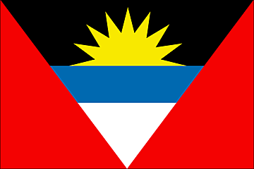 Industries Tourism, construction, light manufacturing (clothing, alcohol, household appliances) Currency code East Caribbean dollar (XCD) Internet code .ag Ports and Terminals Saint John's Argentina Background In 1816, the United Provinces of the Rio Plata declared their independence from Spain. Eventually, Bolivia, Paraguay, and Uruguay went their own way, but the area that remained became Argentina. The country's population and culture were subsequently heavily shaped by immigrants from throughout Europe, but most particularly Italy and Spain, which provided the largest percentage of newcomers from 1860 to 1930. Up until about the mid-20th century, much of Argentina's history was dominated by periods of internal political conflict between Federalists and Unitarians and between civilian and military factions. After World War II, an era of Peronist authoritarian rule and interference in subsequent governments was followed by a military junta that took power in 1976. Democracy returned in 1983, and has persisted despite numerous challenges, the most formidable of which was a severe economic crisis in 2001-02 that led to violent public protests and the resignation of several interim presidents. The economy has since recovered strongly since bottoming out in 2002. The government renegotiated its public debt in 2005 and paid off its remaining obligations to the IMF in early 2006. Location Southern South America, bordering the South Atlantic Ocean, between Chile and Uruguay Geographic co-ordinates 34 00 S, 64 00 W Map references South America Area Total: 2,766,890 sq km ; land: 2,736,690 sq km ; water: 30,200 sq km Area comparative Slightly less than three-tenths the size of the US Land boundaries Total: 9,861 km ; border countries: Bolivia 832 km, Brazil 1,261 km, Chile 5,308 km, Paraguay 1,880 km, Uruguay Climate Mostly temperate; arid in southeast; subantarctic in southwest Terrain Rich plains of the Pampas in northern half, flat to rolling plateau of Patagonia in south, rugged Andes along western border Natural resources Fertile plains of the pampas, lead, zinc, tin, copper, iron ore, manganese, petroleum, uranium Natural hazards San Miguel de Tucuman and Mendoza areas in the Andes subject to earthquakes; pamperos are violent windstorms that can strike the pampas and northeast; heavy flooding Nationality Noun: Argentine(s) ; adjective: Argentine Languages Spanish (official), English, Italian, German, French Country name Conventional long form: Argentine Republic ; conventional short form: Argentina ; local long form: Republica Argentina ; local short form: Argentina Capital Name: Buenos Aires ; geographic coordinates: 34 36 S, 58 27 W ; time difference: UTC-3 (2 hours ahead of Washington, DC during Standard Time) Administrative division 23 provinces (provincias, singular - provincia) and 1 autonomous city* (distrito federal); Buenos Aires, Buenos Aires Capital Federal*, Catamarca, Chaco, Chubut, Cordoba, Corrientes, Entre Rios, Formosa, Jujuy, La Pampa, La Rioja, Mendoza, Misiones, Neuquen, Rio Negro, Salta, San Juan, San Luis, Santa Cruz, Santa Fe, Santiago del Estero, Tierra del Fuego - Antartida e Islas del Atlantico Sur, Tucuman ; note: the US does not recognize any claims to Antarctica National holiday Revolution Day, 25 May (1810) Suffrage 18 years of age; universal and compulsory Flag  Industries Food processing, motor vehicles, consumer durables, textiles, chemicals and petrochemicals, printing, metallurgy, steel Currency code Argentine peso (ARS) Internet code .ar Ports and Terminals Bahia Blanca, Buenos Aires, Concepcion del Uruguay, La Plata, Punta Colorada, Rosario, San Lorenzo-San Martin, San Nicolas Armenia Background Armenia prides itself on being the first nation to formally adopt Christianity (early 4th century). Despite periods of autonomy, over the centuries Armenia came under the sway of various empires including the Roman, Byzantine, Arab, Persian, and Ottoman. During World War I in the western portion of Armenia, Ottoman Turkey instituted a policy of forced resettlement coupled with other harsh practices that resulted in an estimated 1 million Armenian deaths. The eastern area of Armenia was ceded by the Ottomans to Russia in 1828; this portion declared its independence in 1918, but was conquered by the Soviet Red Army in 1920. Armenian leaders remain preoccupied by the long conflict with Muslim Azerbaijan over Nagorno-Karabakh, a primarily Armenian-populated region, assigned to Soviet Azerbaijan in the 1920s by Moscow. Armenia and Azerbaijan began fighting over the area in 1988; the struggle escalated after both countries attained independence from the Soviet Union in 1991. By May 1994, when a cease-fire took hold, Armenian forces held not only Nagorno-Karabakh but also a significant portion of Azerbaijan proper. The economies of both sides have been hurt by their inability to make substantial progress toward a peaceful resolution. Turkey imposed an economic blockade on Armenia and closed the common border because of the Armenian occupation of Nagorno-Karabakh and surrounding areas. Location Southwestern Asia, east of Turkey Geographic co-ordinates 40 00 N, 45 00 E Map references Asia Area Total: 29,800 sq km ; land: 28,400 sq km ; water: 1,400 sq km Area comparative Slightly smaller than Maryland Land boundaries Total: 1,254 km ; border countries: Azerbaijan-proper 566 km, Azerbaijan-Naxcivan exclave 221 km, Georgia 164 km, Iran 35 km, Turkey 268 km Climate Highland continental, hot summers, cold winters Terrain Armenian Highland with mountains; little forest land; fast flowing rivers; good soil in Aras River valley Natural resources Small deposits of gold, copper, molybdenum, zinc, alumina Natural hazards Occasionally severe earthquakes; droughts Nationality Noun: Armenian(s) ; adjective: Armenian Country name Conventional long form: Republic of Armenia ; conventional short form: Armenia ; local long form: Hayastani Hanrapetut'yun ; local short form: Hayastan ; former: Armenian Soviet Socialist Republic; Armenian Republic Capital Name: Yerevan ; geographic coordinates: 40 11 N, 44 30 E ; time difference: UTC+4 (9 hours ahead of Washington, DC during Standard Time) ; daylight saving time: +1hr, begins last Sunday in March; ends last Sunday in October Administrative division 11 provinces (marzer, singular - marz); Aragatsotn, Ararat, Armavir, Geghark'unik', Kotayk', Lorri, Shirak, Syunik', Tavush, Vayots' Dzor, Yerevan National holiday Independence Day, 21 September (1991) Suffrage 18 years of age; universal Flag  Industries Diamond-processing, metal-cutting machine tools, forging-pressing machines, electric motors, tires, knitted wear, hosiery, shoes, silk fabric, chemicals, trucks, instruments, microelectronics, jewelry manufacturing, software development, food processing, brandy Currency code Dram (AMD) Internet code .am Aruba Background Discovered and claimed for Spain in 1499, Aruba was acquired by the Dutch in 1636. The island's economy has been dominated by three main industries. A 19th century gold rush was followed by prosperity brought on by the opening in 1924 of an oil refinery. The last decades of the 20th century saw a boom in the tourism industry. Aruba seceded from the Netherlands Antilles in 1986 and became a separate, autonomous member of the Kingdom of the Netherlands. Movement toward full independence was halted at Aruba's request in 1990. Location Caribbean, island in the Caribbean Sea, north of Venezuela Geographic co-ordinates 12 30 N, 69 58 W Map references Central America and the Caribbean Area Total: 193 sq km ; land: 193 sq km ; water: 0 sq km Area comparative Slightly larger than Washington, DC Climate Tropical marine; little seasonal temperature variation Terrain Flat with a few hills; scant vegetation Natural resources NEGL; white sandy beaches Natural hazards Lies outside the Caribbean hurricane belt Nationality Noun: Aruban(s) ; adjective: Aruban; Dutch Languages Dutch (official), Papiamento (a Spanish, Portuguese, Dutch, English dialect), English (widely spoken), Spanish Country name Conventional long form: none ; conventional short form: Aruba Capital Name: Oranjestad ; geographic coordinates: 12 33 N, 70 06 W ; time difference: UTC-4 (1 hour ahead of Washington, DC during Standard Time) Administrative division None (part of the Kingdom of the Netherlands) National holiday 1 January 1986 Suffrage 18 years of age; universal Flag  Industries Tourism, transshipment facilities, oil refining Currency code Aruban guilder/florin (AWG) Internet code .aw Ports and terminals Barcadera, Oranjestad, Sint Nicolaas Ashmore and Cartier Island Background These uninhabited islands came under Australian authority in 1931; formal administration began two years later. Ashmore Reef supports a rich and diverse avian and marine habitat; in 1983, it became a National Nature Reserve. Cartier Island, a former bombing range, is now a marine reserve. Location Southeastern Asia, islands in the Indian Ocean, midway between northwestern Australia and Timor Island Geographic co-ordinates 12 14 S, 123 05 E Map references Southeast Asia Area Total: 5 sq km ; land: 5 sq km ; water: 0 sq km ; note: includes Ashmore Reef (West, Middle, and East Islets) and Cartier Island Area comparative About eight times the size of The Mall in Washington, DC Climate Tropical Terrain Low with sand and coral Natural resources Fish Natural hazards Surrounded by shoals and reefs that can pose maritime hazards Country name Conventional long form: Territory of Ashmore and Cartier Islands ; conventional short form: Ashmore and Cartier Islands Flag  Ports and Terminals None; offshore anchorage only Australia Background Aboriginal settlers arrived on the continent from Southeast Asia about 40,000 years before the first Europeans began exploration in the 17th century. No formal territorial claims were made until 1770, when Capt. James COOK took possession in the name of Great Britain. Six colonies were created in the late 18th and 19th centuries; they federated and became the Commonwealth of Australia in 1901. The new country took advantage of its natural resources to rapidly develop agricultural and manufacturing industries and to make a major contribution to the British effort in World Wars I and II. In recent decades, Australia has transformed itself into an internationally competitive, advanced market economy. It boasted one of the OECD's fastest growing economies during the 1990s, a performance due in large part to economic reforms adopted in the 1980s. Long-term concerns include pollution, particularly depletion of the ozone layer, and management and conservation of coastal areas, especially the Great Barrier Reef. Location Oceania, continent between the Indian Ocean and the South Pacific Ocean Geographic co-ordinates 27 00 S, 133 00 E Map references Oceania Area Total: 7,686,850 sq km ; land: 7,617,930 sq km ; water: 68,920 sq km ; note: includes Lord Howe Island and Macquarie Island Area comparative Slightly smaller than the US contiguous 48 states Climate Generally arid to semiarid; temperate in south and east; tropical in north Terrain Mostly low plateau with deserts; fertile plain in southeast Natural resources Bauxite, coal, iron ore, copper, tin, gold, silver, uranium, nickel, tungsten, mineral sands, lead, zinc, diamonds, natural gas, petroleum. Natural hazards Cyclones along the coast; severe droughts; forest fires. Nationality Noun: Australian(s) ; adjective: Australian Country name Conventional long form: Commonwealth of Australia ; conventional short form: Australia Capital Washington, DC during Standard Time) ; daylight saving time: +1hr, begins last Sunday in October; ends last Sunday in March (ended first Sunday in April 2006) ; note: Australia is divided into three time zones Administrative division 6 states and 2 territories*; Australian Capital Territory*, New South Wales, Northern Territory*, Queensland, South Australia, Tasmania, Victoria, Western Australia National holiday Australia Day, 26 January (1788); ANZAC Day (commemorated as the anniversary of the 1915 landing of troops of the Australian and New Zealand Army Corps during World War I at Gallipoli, Turkey), 25 April Suffrage 18 years of age; universal and compulsory Flag 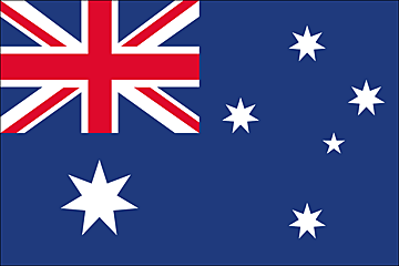 Industries Mining, industrial and transportation equipment, food processing, chemicals, steel Currency code Australian dollar (AUD) Internet code .au Ports and terminals Brisbane, Dampier, Fremantle, Gladstone, Hay Point, Melbourne, Newcastle, Port Hedland, Port Kembla, Port Walcott, Sydney Austria Background Once the center of power for the large Austro-Hungarian Empire, Austria was reduced to a small republic after its defeat in World War I. Following annexation by Nazi Germany in 1938 and subsequent occupation by the victorious Allies in 1945, Austria's status remained unclear for a decade. A State Treaty signed in 1955 ended the occupation, recognized Austria's independence, and forbade unification with Germany. A constitutional law that same year declared the country's "perpetual neutrality" as a condition for Soviet military withdrawal. The Soviet Union's collapse in 1991 and Austria's entry into the European Union in 1995 have altered the meaning of this neutrality. A prosperous, democratic country, Austria entered the EU Economic Monetary Union in 1999. Location Central Europe, north of Italy and Slovenia Geographic co-ordinates 47 20 N, 13 20 E Map references Europe Area Total: 83,870 sq km ; land: 82,444 sq km ; water: 1,426 sq km Area comparative Slightly smaller than Maine Climate Temperate; continental, cloudy; cold winters with frequent rain and some snow in lowlands and snow in mountains; moderate summers with occasional showers Terrain In the west and south mostly mountains (Alps); along the eastern and northern margins mostly flat or gently sloping Natural resources Oil, coal, lignite, timber, iron ore, copper, zinc, antimony, magnesite, tungsten, graphite, salt, hydropower Natural hazards Landslides; avalanches; earthquakes Nationality Noun: Austrian(s) ; adjective: Austrian Languages German (official nationwide), Slovene (official in Carinthia), Croatian (official in Burgenland), Hungarian (official in Burgenland) Country name Conventional long form: Republic of Austria ; conventional short form: Austria ; local long form: Republik Oesterreich ; local short form: Oesterreich Capital Name: Vienna ; geographic coordinates: 48 12 N, 16 22 E ; time difference: UTC+1 (6 hours ahead of Washington, DC during Standard Time) ; daylight saving time: +1hr, begins last Sunday in March; ends last Sunday in October Administrative division 9 states (Bundeslaender, singular - Bundesland); Burgenland, Kaernten (Carinthia), Niederoesterreich, Oberoesterreich, Salzburg, Steiermark (Styria), Tirol, Vorarlberg, Wien (Vienna) National holiday National Day, 26 October (1955) Suffrage 18 years of age; universal Flag  Industries Construction, machinery, vehicles and parts, food, metals, chemicals, lumber and wood processing, paper and paperboard, communications equipment, tourism Currency code Euro (EUR) Internet .at Ports and Terminals Enns, Krems, Linz, Vienna Azerbaijan Background Azerbaijan - a nation with a Turkic and majority-Muslim population - was briefly independent from 1918 to 1920; it regained its independence after the collapse of the Soviet Union in 1991. Despite a 1994 cease-fire, Azerbaijan has yet to resolve its conflict with Armenia over the Azerbaijani Nagorno-Karabakh enclave (largely Armenian populated). Azerbaijan has lost 16% of its territory and must support some 528,000 internally displaced persons as a result of the conflict. Corruption is ubiquitous, and the promise of widespread wealth from Azerbaijan's undeveloped petroleum resources remains largely unfulfilled. Location Southwestern Asia, bordering the Caspian Sea, between Iran and Russia, with a small European portion north of the Caucasus range. Geographic co-ordinates 40 30 N, 47 30 E Map references Asia Area Total: 86,600 sq km ; land: 86,100 sq km ; water: 500 sq km ; note: includes the exclave of Naxcivan Autonomous Republic and the Nagorno-Karabakh region; the region's autonomy was abolished by Azerbaijani Supreme Soviet on 26 November 1991 Area comparative Slightly smaller than Maine Climate Dry, semiarid steppe Terrain Large, flat Kur-Araz Ovaligi (Kura-Araks Lowland) (much of it below sea level) with Great Caucasus Mountains to the north, Qarabag Yaylasi (Karabakh Upland) in west; Baku lies on Abseron Yasaqligi (Apsheron Peninsula) that juts into Caspian Sea. Natural resources Petroleum, natural gas, iron ore, nonferrous metals, alumina Natural hazards Droughts Nationality Noun: Azerbaijani(s), Azeri(s) ; adjective: Azerbaijani, Azeri Country name Conventional long form: Republic of Azerbaijan ; conventional short form: Azerbaijan ; local long form: Azarbaycan Respublikasi ; local short form: Azarbaycan ; former: Azerbaijan Soviet Socialist Republic Capital Name: Baku (Baki, Baky) ; geographic coordinates: 40 23 N, 49 51 E ; time difference: UTC+4 (9 hours ahead of Washington, DC during Standard Time) ; daylight saving time: +1hr, begins last Sunday in March; ends last Sunday in October Administrative divisions 59 rayons (rayonlar; rayon - singular), 11 cities (saharlar; sahar - singular), 1 autonomous republic (muxtar respublika) ; rayons: Abseron Rayonu, Agcabadi Rayonu, Agdam Rayonu, Agdas Rayonu, Agstafa Rayonu, Agsu Rayonu, Astara Rayonu, Balakan Rayonu, Barda Rayonu, Beylaqan Rayonu, Bilasuvar Rayonu, Cabrayil Rayonu, Calilabad Rayonu, Daskasan Rayonu, Davaci Rayonu, Fuzuli Rayonu, Gadabay Rayonu, Goranboy Rayonu, Goycay Rayonu, Haciqabul Rayonu, Imisli Rayonu, Ismayilli Rayonu, Kalbacar Rayonu, Kurdamir Rayonu, Lacin Rayonu, Lankaran Rayonu, Lerik Rayonu, Masalli Rayonu, Neftcala Rayonu, Oguz Rayonu, Qabala Rayonu, Qax Rayonu, Qazax Rayonu, Qobustan Rayonu, Quba Rayonu, Qubadli Rayonu, Qusar Rayonu, Saatli Rayonu, Sabirabad Rayonu, Saki Rayonu, Salyan Rayonu, Samaxi Rayonu, Samkir Rayonu, Samux Rayonu, Siyazan Rayonu, Susa Rayonu, Tartar Rayonu, Tovuz Rayonu, Ucar Rayonu, Xacmaz Rayonu, Xanlar Rayonu, Xizi Rayonu, Xocali Rayonu, Xocavand Rayonu, Yardimli Rayonu, Yevlax Rayonu, Zangilan Rayonu, Zaqatala Rayonu, Zardab Rayonu ; cities: Ali Bayramli Sahari, Baki Sahari, Ganca Sahari, Lankaran Sahari, Mingacevir Sahari, Naftalan Sahari, Saki Sahari, Sumqayit Sahari, Susa Sahari, Xankandi Sahari, Yevlax Sahari ; autonomous republic: Naxcivan Muxtar Respublikasi National holiday Founding of the Democratic Republic of Azerbaijan, 28 May (1918) Suffrage 18 years of age; universal Flag  Industries Petroleum and natural gas, petroleum products, oilfield equipment; steel, iron ore; cement; chemicals and petrochemicals; textiles Currency code Azerbaijani manat (AZM) Internet code .az Ports and Terminals Baku (Baki)
__________________
Time is the longest distance between two places.
|
|
#3
Sunday, April 13, 2008
|
||||
|
||||
|
Bahamas, The Background Lucayan Indians inhabited the islands when Christopher Columbus first set foot in the New World on San Salvador in 1492. British settlement of the islands began in 1647; the islands became a colony in 1783. Since attaining independence from the UK in 1973, The Bahamas have prospered through tourism and international banking and investment management. Because of its geography, the country is a major transshipment point for illegal drugs, particularly shipments to the US, and its territory is used for smuggling illegal migrants into the US Location Caribbean, chain of islands in the North Atlantic Ocean, southeast of Florida, northeast of Cuba Geographic co-ordinates 24 15 N, 76 00 W Map references Central America and the Caribbean Area Total: 13,940 sq km ; land: 10,070 sq km ; water: 3,870 sq km Area comparative Slightly smaller than Connecticut Climate Tropical marine; moderated by warm waters of Gulf Stream Terrain Long, flat coral formations with some low rounded hills Natural resources Salt, aragonite, timber, arable land Natural hazards Hurricanes and other tropical storms cause extensive flood and wind damage Nationality Noun: Bahamian(s) ; adjective: Bahamian Languages English (official), Creole (among Haitian immigrants) Country name Conventional long form: Commonwealth of The Bahamas ; conventional short form: The Bahamas Capital Name: Nassau ; geographic coordinates: 25 05 N, 77 21 W ; time difference: UTC-5 (same time as Washington, DC during Standard Time) ; daylight saving time: +1hr, begins first Sunday in April; ends last Sunday in October Administrative divisions 21 districts; Acklins and Crooked Islands, Bimini, Cat Island, Exuma, Freeport, Fresh Creek, Governor's Harbour, Green Turtle Cay, Harbour Island, High Rock, Inagua, Kemps Bay, Long Island, Marsh Harbour, Mayaguana, New Providence, Nichollstown and Berry Islands, Ragged Island, Rock Sound, Sandy Point, San Salvador and Rum Cay National holiday Independence Day, 10 July (1973) Suffrage 18 years of age; universal Flag  Industries Tourism, banking, cement, oil transshipment, salt, rum, aragonite, pharmaceuticals, spiral-welded steel pipe Currency code Bahamian dollar (BSD) Internet code .bs Ports and Terminals Freeport, Nassau, South Riding Point Bahrain Background In 1782, the Al Khalifa family captured Bahrain from the Persians. In order to secure these holdings, it entered into a series of treaties with the UK during the 19th century that made Bahrain a British protectorate. The archipelago attained its independence in 1971. Bahrain's small size and central location among Persian Gulf countries require it to play a delicate balancing act in foreign affairs among its larger neighbors. Facing declining oil reserves, Bahrain has turned to petroleum processing and refining and has transformed itself into an international banking center. King HAMAD bin Isa Al Khalifa, after coming to power in 1999, pushed economic and political reforms to improve relations with the Shia community. Shia discontent has resurfaced in recent years, however, with opposition parties taking part in elections, street demonstrations, and low-level violence. Wifaq, the largest Shia opposition movement, in late 2006 won a plurality of seats in the elected half of the legislature. Location Middle East, archipelago in the Persian Gulf, east of Saudi Arabia Geographic co-ordinates 26 00 N, 50 33 E Map references Middle East Area Total: 665 sq km ; land: 665 sq km ; water: 0 sq km Area comparative 3.5 times the size of Washington, DC Climate Arid; mild, pleasant winters; very hot, humid summers Terrain Mostly low desert plain rising gently to low central escarpment Natural resources Oil, associated and nonassociated natural gas, fish, pearls Natural hazards Periodic droughts; dust storms Nationality Noun: Bahraini(s) ; adjective: Bahraini Languages Arabic, English, Farsi, Urdu Country name Conventional long form: Kingdom of Bahrain ; conventional short form: Bahrain ; local long form: Mamlakat al Bahrayn ; local short form: Al Bahrayn ; former: Dilmun Capital Name: Manama ; geographic coordinates: 26 13 N, 50 35 E ; time difference: UTC+3 (8 hours ahead of Washington, DC during Standard Time) Administrative divisions 5 governorates; Asamah, Janubiyah, Muharraq, Shamaliyah, Wasat ; note: each governorate administered by an appointed governor National holiday National Day, 16 December (1971) Suffrage 18 years of age; universal Flag  Industries Petroleum processing and refining, aluminum smelting, iron pelletization, fertilizers, offshore banking, ship repairing, tourism Currency code Bahraini dinar (BHD) Internet code .bh Ports and Terminals Mina' Salman, Sitrah Bangladesh Background Europeans began to set up trading posts in the area of Bangladesh in the 16th century; eventually the British came to dominate the region and it became part of British India. In 1947, West Pakistan and East Bengal (both primarily Muslim) separated from India (largely Hindu) and jointly became the new country of Pakistan. East Bengal became East Pakistan in 1955, but the awkward arrangement of a two-part country with its territorial units separated by 1,600 km left the Bengalis marginalized and dissatisfied. East Pakistan seceded from its union with West Pakistan in 1971 and was renamed Bangladesh. About a third of this extremely poor country floods annually during the monsoon rainy season, hampering economic development. Location Southern Asia, bordering the Bay of Bengal, between Burma and India Geographic co-ordinates 24 00 N, 90 00 E Map references Asia Area Total: 144,000 sq km ; land: 133,910 sq km ; water: 10,090 sq km Area comparative Slightly smaller than Iowa Climate Tropical; mild winter (October to March); hot, humid summer (March to June); humid, warm rainy monsoon (June to October) Terrain Mostly flat alluvial plain; hilly in southeast Natural resources Natural gas, arable land, timber, coal Natural hazards Droughts, cyclones; much of the country routinely inundated during the summer monsoon season Nationality Noun: Bangladeshi(s) ; adjective: Bangladeshi Languages Bangla (official, also known as Bengali), English Country name Conventional long form: People's Republic of Bangladesh ; conventional short form: Bangladesh ; local long form: Gana Prajatantri Banladesh ; local short form: Banladesh ; former: East Bengal, East Pakistan Capital Name: Dhaka ; geographic coordinates: 23 43 N, 90 25 E ; time difference: UTC+6 (11 hours ahead of Washington, DC during Standard Time) Administrative divisions 6 divisions; Barisal, Chittagong, Dhaka, Khulna, Rajshahi, Sylhet National holiday 16 December 1971 is known as Victory Day and commemorates the official creation of the state of Bangladesh Independence Day, 26 March (1971) Flag 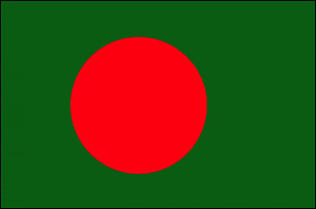 Industries Cotton textiles, jute, garments, tea processing, paper newsprint, cement, chemical fertilizer, light engineering, sugar Currency code Taka (BDT) Internet code .bd Ports and Terminals Chittagong, Mongla Port Barbados Background The island was uninhabited when first settled by the British in 1627. Slaves worked the sugar plantations established on the island until 1834 when slavery was abolished. The economy remained heavily dependent on sugar, rum, and molasses production through most of the 20th century. The gradual introduction of social and political reforms in the 1940s and 1950s led to complete independence from the UK in 1966. In the 1990s, tourism and manufacturing surpassed the sugar industry in economic importance. Location Caribbean, island in the North Atlantic Ocean, northeast of Venezuela Geographic co-ordinates 13 10 N, 59 32 W Map references Central America and the Caribbean Area Total: 431 sq km ; land: 431 sq km ; water: 0 sq km Area comparative 2.5 times the size of Washington, DC Climate Tropical; rainy season (June to October) Terrain Relatively flat; rises gently to central highland region Natural resources Petroleum, fish, natural gas Natural hazards Pollution of coastal waters from waste disposal by ships; soil erosion; illegal solid waste disposal threatens contamination of aquifers Nationality Noun: Barbadian(s) or Bajan (colloquial) ; adjective: Barbadian or Bajan (colloquial) Country name Conventional long form: none ; conventional short form: Barbados Capital Name: Bridgetown ; geographic coordinates: 13 06 N, 59 37 W ; time difference: UTC-4 (1 hour ahead of Washington, DC during Standard Time) Administrative divisions 11 parishes and 1 city*; Bridgetown*, Christ Church, Saint Andrew, Saint George, Saint James, Saint John, Saint Joseph, Saint Lucy, Saint Michael, Saint Peter, Saint Philip, Saint Thomas National holiday Independence Day, 30 November (1966) Suffrage 18 years of age; universal Flag  Industries Tourism, sugar, light manufacturing, component assembly for export Currency code Barbadian dollar (BBD) Internet code .bb Ports and Terminals Bridgetown
__________________
Time is the longest distance between two places.
|
|
#4
Sunday, April 20, 2008
|
||||
|
||||
|
Belarus Background After seven decades as a constituent republic of the USSR, Belarus attained its independence in 1991. It has retained closer political and economic ties to Russia than any of the other former Soviet republics. Belarus and Russia signed a treaty on a two-state union on 8 December 1999 envisioning greater political and economic integration. Although Belarus agreed to a framework to carry out the accord, serious implementation has yet to take place. Since his election in July 1994 as the country's first president, Alexandr LUKASHENKO has steadily consolidated his power through authoritarian means. Government restrictions on freedom of speech and the press, peaceful assembly, and religion continue. Location Eastern Europe, east of Poland Geographic co-ordinates 53 00 N, 28 00 E Map references Europe Area Total: 207,600 sq km ; land: 207,600 sq km ; water: 0 sq km Area Comparative Slightly smaller than Kansas Climate Cold winters, cool and moist summers; transitional between continental and maritime Terrain Generally flat and contains much marshland Natural resources Forests, peat deposits, small quantities of oil and natural gas, granite, dolomitic limestone, marl, chalk, sand, gravel, clay Nationality Noun: Belarusian(s) ; adjective: Belarusian Country name Conventional long form: Republic of Belarus ; conventional short form: Belarus ; local long form: Respublika Byelarus' ; local short form: Byelarus' ; former: Belorussian (Byelorussian) Soviet Socialist Republic Capital Name: Minsk ; geographic coordinates: 53 54 N, 27 34 E ; time difference: UTC+2 (7 hours ahead of Washington, DC during Standard Time) ; daylight saving time: +1hr, begins last Sunday in March; ends last Sunday in October Administrative division 6 provinces (voblastsi, singular - voblasts') and 1 municipality* (horad); Brest, Homyel', Horad Minsk*, Hrodna, Mahilyow, Minsk, Vitsyebsk ; note: administrative divisions have the same names as their administrative centers National Holiday Independence Day, 3 July (1944); note - 3 July 1944 was the date Minsk was liberated from German troops, 25 August 1991 was the date of independence from the Soviet Union Suffrage 18 years of age; universal Flag  Industries Metal-cutting machine tools, tractors, trucks, earthmovers, motorcycles, televisions, chemical fibers, fertilizer, textiles, radios, refrigerators Currency code Belarusian ruble (BYB/BYR) Internet code .by Ports and Terminals Mazyr Belgium Background Belgium became independent from the Netherlands in 1830; it was occupied by Germany during World Wars I and II. The country prospered in the past half century as a modern, technologically advanced European state and member of NATO and the EU. Tensions between the Dutch-speaking Flemings of the north and the French-speaking Walloons of the south have led in recent years to constitutional amendments granting these regions formal recognition and autonomy. Location Western Europe, bordering the North Sea, between France and the Netherlands Geographic co-ordinates 50 50 N, 4 00 E Map references Europe Area Total: 30,528 sq km ; land: 30,278 sq km ; water: 250 sq km Area comparative About the size of Maryland Climate Temperate; mild winters, cool summers; rainy, humid, cloudy Terrain Flat coastal plains in northwest, central rolling hills, rugged mountains of Ardennes Forest in southeast Natural resources Construction materials, silica sand, carbonates Natural hazards Flooding is a threat along rivers and in areas of reclaimed coastal land, protected from the sea by concrete dikes Nationality Noun: Belgian(s) ; adjective: Belgian Country name Conventional long form: Kingdom of Belgium ; conventional short form: Belgium ; local long form: Royaume de Belgique/Koninkrijk Belgie ; local short form: Belgique/Belgie Capital Name: Brussels ; geographic coordinates: 50 50 N, 4 20 E ; time difference: UTC+1 (6 hours ahead of Washington, DC during Standard Time) ; daylight saving time: +1hr, begins last Sunday in March; ends last Sunday in October Administrative division 10 provinces (French: provinces, singular - province; Dutch: provincies, singular - provincie) and 3 regions* (French: regions; Dutch: gewesten); Antwerpen, Brabant Wallon, Brussels* (Bruxelles), Flanders*, Hainaut, Liege, Limburg, Luxembourg, Namur, Oost-Vlaanderen, Vlaams-Brabant, Wallonia*, West-Vlaanderen ; note: as a result of the 1993 constitutional revision that furthered devolution into a federal state, there are now three levels of government (federal, regional, and linguistic community) with a complex division of responsibilities National Holiday 21 July (1831) ascension to the Throne of King Leopold I Suffrage 18 years of age; universal and compulsory Flag  Industries Engineering and metal products, motor vehicle assembly, transportation equipment, scientific instruments, processed food and beverages, chemicals, basic metals, textiles, glass, petroleum Currency code Euro (EUR) Internet code .be Ports and Terminals Antwerp, Brussels, Gent, Liege, Oostende, Zeebrugge Belize Background Belize was the site of several Mayan city states until their decline at the end of the first millennium A.D. The British and Spanish disputed the region in the 17th and 18th centuries; it formally became the colony of British Honduras in 1854. Territorial disputes between the UK and Guatemala delayed the independence of Belize until 1981. Guatemala refused to recognize the new nation until 1992. Tourism has become the mainstay of the economy. Current concerns include high unemployment, growing involvement in the South American drug trade, and increasing urban crime. Location Central America, bordering the Caribbean Sea, between Guatemala and Mexico Geographic co-ordinates 17 15 N, 88 45 W Map references Central America and the Caribbean Area Total: 22,966 sq km ; land: 22,806 sq km ; water: 160 sq km Area comparative Slightly smaller than Massachusetts Climate Tropical; very hot and humid; rainy season (May to November); dry season (February to May) Terrain Flat, swampy coastal plain; low mountains in south Natural resources Arable land potential, timber, fish, hydropower Natural Hazards Frequent, devastating hurricanes (June to November) and coastal flooding (especially in south) Nationality Noun: Belizean(s) ; adjective: Belizean Languages English (official), Spanish, Mayan, Garifuna (Carib), Creole Country name Conventional long form: none ; conventional short form: Belize ; former: British Honduras Capital Name: Belmopan ; geographic coordinates: 17 15 N, 88 46 W ; time difference: UTC-6 (1 hour behind Washington, DC during Standard Time) Administrative divisions 6 districts; Belize, Cayo, Corozal, Orange Walk, Stann Creek, Toledo National holiday Independence Day, 21 September (1981) Suffrage 18 years of age; universal Flag  Industries Garment production, food processing, tourism, construction Currency code Belizean dollar (BZD) Internet code .bz Ports and Terminals Belize City
__________________
Time is the longest distance between two places.
|
|
#5
Saturday, April 26, 2008
|
||||
|
||||
|
Benin Background Present day Benin was the site of Dahomey, a prominent West African kingdom that rose in the 15th century. The territory became a French Colony in 1872 and achieved independence on 1 August 1960, as the Republic of Benin. A succession of military governments ended in 1972 with the rise to power of Mathieu KEREKOU and the establishment of a government based on Marxist-Leninist principles. A move to representative government began in 1989. Two years later, free elections ushered in former Prime Minister Nicephore SOGLO as president, marking the first successful transfer of power in Africa from a dictatorship to a democracy. KEREKOU was returned to power by elections held in 1996 and 2001, though some irregularities were alleged. KEREKOU stepped down at the end of his second term in 2006 and was succeeded by Thomas YAYI BONI, a political outsider and independent. Location Western Africa, bordering the Bight of Benin, between Nigeria and Togo Geographic co-ordinates 9 30 N, 2 15 E Map references Africa Area Total: 112,620 sq km ; land: 110,620 sq km ; water: 2,000 sq km Area comparative Slightly smaller than Pennsylvania Climate Tropical; hot, humid in south; semiarid in north Terrain Mostly flat to undulating plain; some hills and low mountains Natural resources Small offshore oil deposits, limestone, marble, timber Natural hazards Inadequate supplies of potable water; poaching threatens wildlife populations; deforestation; desertification Nationality Noun: Beninese (singular and plural) ; adjective: Beninese Languages French (official), Fon and Yoruba (most common vernaculars in south), tribal languages (at least six major ones in north) Country name Conventional long form: Republic of Benin ; conventional short form: Benin ; local long form: Republique du Benin ; local short form: Benin ; former: Dahomey Capital Name: Porto-Novo (official capital) ; geographic coordinates: 6 29 N, 2 37 E ; time difference: UTC+1 (6 hours ahead of Washington, DC during Standard Time) ; note: Cotonou (seat of government) Administrative division 12 departments; Alibori, Atakora, Atlantique, Borgou, Collines, Kouffo, Donga, Littoral, Mono, Oueme, Plateau, Zou National holiday National Day, 1 August (1960) Suffrage 18 years of age; universal Flag  Industries Textiles, food processing, construction materials, cement Currency code Internet code .bj Ports and Terminals Cotonou Bermuda Background Bermuda was first settled in 1609 by shipwrecked English colonists headed for Virginia. Tourism to the island to escape North American winters first developed in Victorian times. Tourism continues to be important to the island's economy, although international business has overtaken it in recent years. Bermuda has developed into a highly successful offshore financial center. Although a referendum on independence from the UK was soundly defeated in 1995, the present government has reopened debate on the issue. Location North America, group of islands in the North Atlantic Ocean, east of South Carolina (US) Geographic co-ordinates 32 20 N, 64 45 W Map references North America Area Total: 53.3 sq km ; land: 53.3 sq km ; water: 0 sq km Area comparative About one-third the size of Washington, DC Climate Subtropical; mild, humid; gales, strong winds common in winter Terrain Low hills separated by fertile depressions Natural resources Limestone, pleasant climate fostering tourism Natural hazards Hurricanes (June to November) Nationality Noun: Bermudian(s) ; adjective: Bermudian Languages English (official), Portuguese Country name Conventional long form: none ; conventional short form: Bermuda ; former: Somers Islands Capital Name: Hamilton ; geographic coordinates: 32 17 N, 64 46 W ; time difference: UTC-4 (1 hour ahead of Washington, DC during Standard Time) ; daylight saving time: +1hr, begins first Sunday in April; ends last Sunday in October Administrative division 9 parishes and 2 municipalities*; Devonshire, Hamilton, Hamilton*, Paget, Pembroke, Saint George*, Saint George's, Sandys, Smith's, Southampton, Warwick National holiday Bermuda Day, 24 May Suffrage 18 years of age; universal Flag  Industries International business, tourism, light manufacturing Currency code Bermudian dollar (BMD) Internet code .bm Ports and Terminals Hamilton, Saint George Bhutan Background In 1865, Britain and Bhutan signed the Treaty of Sinchulu, under which Bhutan would receive an annual subsidy in exchange for ceding some border land to British India. Under British influence, a monarchy was set up in 1907; three years later, a treaty was signed whereby the British agreed not to interfere in Bhutanese internal affairs and Bhutan allowed Britain to direct its foreign affairs. This role was assumed by independent India after 1947. Two years later, a formal Indo-Bhutanese accord returned the areas of Bhutan annexed by the British, formalized the annual subsidies the country received, and defined India's responsibilities in defense and foreign relations. A refugee issue of some 100,000 Bhutanese in Nepal remains unresolved; 90% of the refugees are housed in seven United Nations Office of the High Commissioner for Refugees (UNHCR) camps. In March 2005, King Jigme Singye WANGCHUCK unveiled the government's draft constitution - which would introduce major democratic reforms - and pledged to hold a national referendum for its approval. A referendum date has yet to be named. Location Southern Asia, between China and India Geographic co-ordinates 27 30 N, 90 30 E Map references Asia Area Total: 47,000 sq km ; land: 47,000 sq km ; water: 0 sq km Area comparative About half the size of Indiana Climate Varies; tropical in southern plains; cool winters and hot summers in central valleys; severe winters and cool summers in Himalayas Terrain Mostly mountainous with some fertile valleys and savanna Natural resources Timber, hydropower, gypsum, calcium carbonate Natural hazards Violent storms from the Himalayas are the source of the country's name, which translates as Land of the Thunder Dragon; frequent landslides during the rainy season Nationality Noun: Bhutanese (singular and plural) ; adjective: Bhutanese Languages Dzongkha (official), Bhotes speak various Tibetan dialects, Nepalese speak various Nepalese dialects Country name Conventional long form: Kingdom of Bhutan ; conventional short form: Bhutan ; local long form: Druk Gyalkhap ; local short form: Druk Yul Capital Name: Thimphu ; geographic coordinates: 27 28 N, 89 39 E ; time difference: UTC+6 (11 hours ahead of Washington, DC during Standard Time) Administrative division 18 districts (dzongkhag, singular and plural); Bumthang, Chhukha, Chirang, Dagana, Geylegphug, Ha, Lhuntshi, Mongar, Paro, Pemagatsel, Punakha, Samchi, Samdrup Jongkhar, Shemgang, Tashigang, Thimphu, Tongsa, Wangdi Phodrang ; note: there may be two new districts named Gasa and Yangtse National holiday National Day (Ugyen WANGCHUCK became first hereditary king), 17 December (1907) Suffrage Each family has one vote in village-level elections; note - in late 2003 Bhutan's legislature passed a new election law Flag  Industries Cement, wood products, processed fruits, alcoholic beverages, calcium carbid Currency code Ngultrum (BTN); Indian rupee (INR) Internet code .bt Bolivia Background Bolivia, named after independence fighter Simon BOLIVAR, broke away from Spanish rule in 1825; much of its subsequent history has consisted of a series of nearly 200 coups and countercoups. Democratic civilian rule was established in 1982, but leaders have faced difficult problems of deep-seated poverty, social unrest, and illegal drug production. In December 2005, Bolivians elected Movement Toward Socialism leader Evo MORALES president - by the widest margin of any leader since the restoration of civilian rule in 1982 - after he ran on a promise to change the country's traditional political class and empower the nation's poor majority. However, since taking office, his controversial strategies have exacerbated racial and economic tensions between the Amerindian populations of the Andean west and the non-indigenous communities of the eastern lowlands. Location Central South America, southwest of Brazil Geographic co-ordinates 17 00 S, 65 00 W Map references South America Area Total: 1,098,580 sq km ; land: 1,084,390 sq km ; water: 14,190 sq km Area comparative Slightly less than three times the size of Montana Climate Varies with altitude; humid and tropical to cold and semiarid Terrain Rugged Andes Mountains with a highland plateau (Altiplano), hills, lowland plains of the Amazon Basin Natural resources Tin, natural gas, petroleum, zinc, tungsten, antimony, silver, iron, lead, gold, timber, hydropower Natural hazards Flooding in the northeast (March-April) Nationality Noun: Bolivian(s) ; adjective: Bolivian Languages Spanish (official), Quechua (official), Aymara (official) Country name Conventional long form: Republic of Bolivia ; conventional short form: Bolivia ; local long form: Republica de Bolivia ; local short form: Bolivia Capital Name: La Paz (administrative capital) ; geographic coordinates: 16 30 S, 68 09 W ; time difference: UTC-4 (1 hour ahead of Washington, DC during Standard Time) ; note: Sucre (constitutional capital) Administrative division 9 departments (departamentos, singular - departamento); Beni, Chuquisaca, Cochabamba, La Paz, Oruro, Pando, Potosi, Santa Cruz, Tarija National holiday Independence Day, 6 August (1825) Suffrage 18 years of age, universal and compulsory (married); 21 years of age, universal and compulsory (single) Flag  Industries Mining, smelting, petroleum, food and beverages, tobacco, handicrafts, clothing Currency code Boliviano (BOB) Internet code .bo Ports and Terminals Puerto Aguirre (on the Paraguay/Parana waterway, at the Bolivia/Brazil border); also, Bolivia has free port privileges in maritime ports in Argentina, Brazil, Chile, and Paraguay
__________________
Time is the longest distance between two places.
|
|
#6
Sunday, April 27, 2008
|
||||
|
||||
|
Bosnia and Herzegovina Background Bosnia and Herzegovina's declaration of sovereignty in October 1991 was followed by a declaration of independence from the former Yugoslavia on 3 March 1992 after a referendum boycotted by ethnic Serbs. The Bosnian Serbs - supported by neighboring Serbia and Montenegro - responded with armed resistance aimed at partitioning the republic along ethnic lines and joining Serb-held areas to form a "Greater Serbia." In March 1994, Bosniaks and Croats reduced the number of warring factions from three to two by signing an agreement creating a joint Bosniak/Croat Federation of Bosnia and Herzegovina. On 21 November 1995, in Dayton, Ohio, the warring parties initialed a peace agreement that brought to a halt three years of interethnic civil strife (the final agreement was signed in Paris on 14 December 1995). The Dayton Peace Accords retained Bosnia and Herzegovina's international boundaries and created a joint multi-ethnic and democratic government charged with conducting foreign, diplomatic, and fiscal policy. Also recognized was a second tier of government comprised of two entities roughly equal in size: the Bosniak/Croat Federation of Bosnia and Herzegovina and the Bosnian Serb-led Republika Srpska (RS). The Federation and RS governments were charged with overseeing most government functions. The Office of the High Representative (OHR) was established to oversee the implementation of the civilian aspects of the agreement. In 1995-96, a NATO-led international peacekeeping force (IFOR) of 60,000 troops served in Bosnia to implement and monitor the military aspects of the agreement. IFOR was succeeded by a smaller, NATO-led Stabilization Force (SFOR) whose mission was to deter renewed hostilities. European Union peacekeeping troops (EUFOR) replaced SFOR in December 2004; their mission is to maintain peace and stability throughout the country. EUFOR plans to phase out its mission beginning in 2007. Location Southeastern Europe, bordering the Adriatic Sea and Croatia Geographic co-ordinates 44 00 N, 18 00 E Map references Europe Area Total: 51,129 sq km ; land: 51,129 sq km ; water: 0 sq km Area comparative Slightly smaller than West Virginia Climate Hot summers and cold winters; areas of high elevation have short, cool summers and long, severe winters; mild, rainy winters along coast Terrain Mountains and valleys Natural resources Coal, iron ore, bauxite, copper, lead, zinc, chromite, cobalt, manganese, nickel, clay, gypsum, salt, sand, forests, hydropower Natural hazards Destructive earthquakes Nationality Noun: Bosnian(s), Herzegovinian(s) ; adjective: Bosnian, Herzegovinia Languages Bosnian, Croatian, Serbian Country name Conventional long form: none ; conventional short form: Bosnia and Herzegovina ; local long form: none ; local short form: Bosna i Hercegovina ; former: People's Republic of Bosnia and Herzegovina, Socialist Republic of Bosnia and Herzegovina Capital Name: Sarajevo ; geographic coordinates: 43 52 N, 18 25 E ; time difference: UTC+1 (6 hours ahead of Washington, DC during Standard Time) ; daylight saving time: +1hr, begins last Sunday in March; ends last Sunday in October Administrative division 2 first-order administrative divisions and 1 internationally supervised district* - Brcko district (Brcko Distrikt)*, the Bosniak/Croat Federation of Bosnia and Herzegovina (Federacija Bosna i Hercegovina) and the Bosnian Serb-led Republika Srpska; note - Brcko district is in northeastern Bosnia and is an administrative unit under the sovereignty of Bosnia and Herzegovina; the district remains under international supervision National holiday National Day, 25 November (1943) Suffrage 18 years of age, universal Flag  Industries Furniture, tank and aircraft assembly, domestic appliances, oil refining Currency code Marka (BAM) Internet code .ba Ports and Terminals Bosanska Gradiska, Bosanski Brod, Bosanski Samac, and Brcko (all inland waterway ports on the Sava), Orasje Botswana Background Formerly the British protectorate of Bechuanaland, Botswana adopted its new name upon independence in 1966. Four decades of uninterrupted civilian leadership, progressive social policies, and significant capital investment have created one of the most dynamic economies in Africa. Mineral extraction, principally diamond mining, dominates economic activity, though tourism is a growing sector due to the country's conservation practices and extensive nature preserves.Botswana has one of the world's highest known rates of HIV/AIDS infection, but also one of Africa's most progressive and comprehensive programs for dealing with the disease. Location Southern Africa, north of South Africa Geographic co-ordinates 22 00 S, 24 00 E Map references Africa Area Total: 600,370 sq km ; land: 585,370 sq km ; water: 15,000 sq km Area comparative Slightly smaller than Texas Climate Semiarid; warm winters and hot summers Terrain Predominantly flat to gently rolling tableland; Kalahari Desert in southwest Natural resources Diamonds, copper, nickel, salt, soda ash, potash, coal, iron ore, silver Periodic droughts; seasonal August winds blow from the west, carrying sand and dust across the country, which can obscure visibilityNatural hazards Nationality Noun: Motswana (singular), Batswana (plural) ; adjective: Motswana (singular), Batswana (plural) Country name Conventional long form: Republic of Botswana ; conventional short form: Botswana ; local long form: Republic of Botswana ; local short form: Botswana ; former: Bechuanaland Capital Name: Gaborone ; geographic coordinates: 24 45 S, 25 55 E ; time difference: UTC+2 (7 hours ahead of Washington, DC during Standard Time) Administrative division 9 districts and 5 town councils*; Central, Francistown*, Gaborone*, Ghanzi, Jwaneng*, Kgalagadi, Kgatleng, Kweneng, Lobatse*, Northeast, Northwest, Selebi-Pikwe*, Southeast, Southern National holiday Independence Day (Botswana Day), 30 September (1966) Suffrage 18 years of age; universal Flag  Industries Diamonds, copper, nickel, salt, soda ash, potash; livestock processing; textiles Currency code Pula (BWP) Internet code .bw Bouvet Island Background This uninhabited volcanic island is almost entirely covered by glaciers and is difficult to approach. It was discovered in 1739 by a French naval officer after whom the island was named. No claim was made until 1825, when the British flag was raised. In 1928, the UK waived its claim in favor of Norway, which had occupied the island the previous year. In 1971, Bouvet Island and the adjacent territorial waters were designated a nature reserve. Since 1977, Norway has run an automated meteorological station on the island. Location Island in the South Atlantic Ocean, southwest of the Cape of Good Hope (South Africa) Geographic co-ordinates 54 26 S, 3 24 E Map references Antarctic Region Area Total: 49 sq km ; land: 49 sq km ; water: 0 sq km Area comparative About 0.3 times the size of Washington, DC Climate Antarctic Terrain Volcanic; coast is mostly inaccessible Natural resources None Country name Conventional long form: none ; conventional short form: Bouvet Island Flag  Ports and Terminals None; offshore anchorage only Brazil Background Following three centuries under the rule of Portugal, Brazil became an independent nation in 1822 and a republic in 1889. By far the largest and most populous country in South America, Brazil overcame more than half a century of military intervention in the governance of the country when in 1985 the military regime peacefully ceded power to civilian rulers. Brazil continues to pursue industrial and agricultural growth and development of its interior. Exploiting vast natural resources and a large labor pool, it is today South America's leading economic power and a regional leader. Highly unequal income distribution remains a pressing problem. Location Eastern South America, bordering the Atlantic Ocean Geographic co-ordinates 10 00 S, 55 00 W Map references South America Area Total: 8,511,965 sq km ; land: 8,456,510 sq km ; water: 55,455 sq km ; note: includes Arquipelago de Fernando de Noronha, Atol das Rocas, Ilha da Trindade, Ilhas Martin Vaz, and Penedos de Sao Pedro e Sao Paulo Area comparative Slightly smaller than the US Climate Mostly tropical, but temperate in south Terrain Mostly flat to rolling lowlands in north; some plains, hills, mountains, and narrow coastal belt Natural resources Bauxite, gold, iron ore, manganese, nickel, phosphates, platinum, tin, uranium, petroleum, hydropower, timber Natural hazards Recurring droughts in northeast; floods and occasional frost in south Nationality Noun: Brazilian(s) ; adjective: Brazilian Languages Portuguese (official), Spanish, English, French Country name Conventional long form: Federative Republic of Brazil ; conventional short form: Brazil ; local long form: Republica Federativa do Brasil ; local short form: Brasil Capital Name: Brasilia ; geographic coordinates: 15 47 S, 47 55 W ; time difference: UTC-3 (2 hours ahead of Washington, DC during Standard Time) ; daylight saving time: +1hr, begins third Sunday in October; ends third Sunday in February ; note: Brazil is divided into four time zones, including one for the Fernando de Noronha islands Administrative division 26 states (estados, singular - estado) and 1 federal district* (distrito federal); Acre, Alagoas, Amapa, Amazonas, Bahia, Ceara, Distrito Federal*, Espirito Santo, Goias, Maranhao, Mato Grosso, Mato Grosso do Sul, Minas Gerais, Para, Paraiba, Parana, Pernambuco, Piaui, Rio de Janeiro, Rio Grande do Norte, Rio Grande do Sul, Rondonia, Roraima, Santa Catarina, Sao Paulo, Sergipe, Tocantins National holiday Independence Day, 7 September (1822) Suffrage Voluntary between 16 and 18 years of age and over 70; compulsory over 18 and under 70 years of age; note - military conscripts do not vote Flag  Industries Textiles, shoes, chemicals, cement, lumber, iron ore, tin, steel, aircraft, motor vehicles and parts, other machinery and equipment Currency code Real (BRL) Internet code .br Ports and Terminals Gebig, Itaqui, Rio de Janeiro, Rio Grande, San Sebasttiao, Santos, Sepetiba Terminal, Tubarao, Vitoria
__________________
Time is the longest distance between two places.
|
|
#7
Sunday, May 04, 2008
|
||||
|
||||
|
British Indian Ocean Territory Background Established as a territory of the UK in 1965, a number of the British Indian Ocean Territory (BIOT) islands were transferred to the Seychelles when it attained independence in 1976. Subsequently, BIOT has consisted only of the six main island groups comprising the Chagos Archipelago. The largest and most southerly of the islands, Diego Garcia, contains a joint UK-US naval support facility. All of the remaining islands are uninhabited. Former agricultural workers, earlier residents in the islands, were relocated primarily to Mauritius but also to the Seychelles, between 1967 and 1973. In 2000, a British High Court ruling invalidated the local immigration order that had excluded them from the archipelago, but upheld the special military status of Diego Garcia. Location Archipelago in the Indian Ocean, south of India, about one-half the way from Africa to Indonesia Geographic co-ordinates 6 00 S, 71 30 E; note - Diego Garcia 7 20 S, 72 25 E Map references Political Map of the World Area Total: 54,400 sq km ; land: 60 sq km; Diego Garcia 44 sq km ; water: 54,340 sq km ; note: includes the entire Chagos Archipelago of 55 islands Area comparative Land area is about 0.3 times the size of Washington, DC Climate Tropical marine; hot, humid, moderated by trade winds Terrain Flat and low (most areas do not exceed two meters in elevation) Natural resources Coconuts, fish, sugarcane Country name Conventional long form: British Indian Ocean Territory ; conventional short form: none ; abbreviation: BIOT Flag  Ports and Terminals Diego Garcia British Virgin Islands Background First inhabited by Arawak and later by Carib Indians, the Virgin Islands were settled by the Dutch in 1648 and then annexed by the English in 1672. The islands were part of the British colony of the Leeward Islands from 1872-1960; they were granted autonomy in 1967. The economy is closely tied to the larger and more populous US Virgin Islands to the west; the US dollar is the legal currency. Location Caribbean, between the Caribbean Sea and the North Atlantic Ocean, east of Puerto Rico Geographic co-ordinates 18 30 N, 64 30 W Map references Central America and the Caribbean Area Total: 153 sq km ; land: 153 sq km ; water: 0 sq km ; note: comprised of 16 inhabited and more than 20 uninhabited islands; includes the islands of Tortola, Anegada, Virgin Gorda, Jost van Dyke Area comparative About 0.9 times the size of Washington, DC Climate Subtropical; humid; temperatures moderated by trade winds Terrain Coral islands relatively flat; volcanic islands steep, hilly Natural hazards Hurricanes and tropical storms (July to October) Nationality Noun: British Virgin Islander(s) ; adjective: British Virgin Islander Country name Conventional long form: none ; conventional short form: British Virgin Islands ; abbreviation: BVI Capital Name: Road Town ; geographic coordinates: 18 27 N, 64 37 W ; time difference: UTC-4 (1 hour ahead of Washington, DC during Standard Time) Administrative divisions none (overseas territory of the UK) National holiday Territory Day, 1 July Suffrage 18 years of age; universal Flag  Industries Tourism, light industry, construction, rum, concrete block, offshore financial center Currency code US dollar (USD) Internet code .vg Ports and Terminals Road Town Brunei Background The Sultanate of Brunei's influence peaked between the 15th and 17th centuries when its control extended over coastal areas of northwest Borneo and the southern Philippines. Brunei subsequently entered a period of decline brought on by internal strife over royal succession, colonial expansion of European powers, and piracy. In 1888, Brunei became a British protectorate; independence was achieved in 1984. The same family has ruled Brunei for over six centuries. Brunei benefits from extensive petroleum and natural gas fields, the source of one of the highest per capita GDPs in the developing world. Location Southeastern Asia, bordering the South China Sea and Malaysia Geographic co-ordinates 4 30 N, 114 40 E Map references Southeast Asia Area Total: 5,770 sq km ; land: 5,270 sq km ; water: 500 sq km Area comparative Slightly smaller than Delaware Climate Tropical; hot, humid, rainy Terrain Flat coastal plain rises to mountains in east; hilly lowland in west Natural resources Petroleum, natural gas, timber Natural hazards Typhoons, earthquakes, and severe flooding are rare Nationality Noun: Bruneian(s) ; adjective: Bruneian Languages Malay (official), English, Chinese Country name Conventional long form: Negara Brunei Darussalam ; conventional short form: Brunei ; local long form: Negara Brunei Darussalam ; local short form: Brunei Capital Name: Bandar Seri Begawan ; geographic coordinates: 4 52 S, 114 55 E ; time difference: UTC+8 (13 hours ahead of Washington, DC during Standard Time) Administrative divisions 4 districts (daerah-daerah, singular - daerah); Belait, Brunei and Muara, Temburong, Tutong National holiday National Day, 23 February (1984); note - 1 January 1984 was the date of independence from the UK, 23 February 1984 was the date of independence from British protection Flag  Industries Petroleum, petroleum refining, liquefied natural gas, construction Currency code Bruneian dollar (BND) Internet code .bn Ports and Terminals Lumut, Muara, Seria Bulgaria Background The Bulgars, a Central Asian Turkic tribe, merged with the local Slavic inhabitants in the late 7th century to form the first Bulgarian state. In succeeding centuries, Bulgaria struggled with the Byzantine Empire to assert its place in the Balkans, but by the end of the 14th century the country was overrun by the Ottoman Turks. Northern Bulgaria attained autonomy in 1878 and all of Bulgaria became independent from the Ottoman Empire in 1908. Having fought on the losing side in both World Wars, Bulgaria fell within the Soviet sphere of influence and became a People's Republic in 1946. Communist domination ended in 1990, when Bulgaria held its first multiparty election since World War II and began the contentious process of moving toward political democracy and a market economy while combating inflation, unemployment, corruption, and crime. The country joined NATO in 2004 and the EU in 2007. Location Southeastern Europe, bordering the Black Sea, between Romania and Turkey Geographic co-ordinates 43 00 N, 25 00 E Map references Europe Area Total: 110,910 sq km ; land: 110,550 sq km ; water: 360 sq km Area comparative Slightly larger than Tennessee Climate Temperate; cold, damp winters; hot, dry summers Terrain Mostly mountains with lowlands in north and southeast Natural resources Bauxite, copper, lead, zinc, coal, timber, arable land Natural hazards Earthquakes, landslides Nationality Noun: Bulgarian(s) ; adjective: Bulgarian Country name Conventional long form: Republic of Bulgaria ; conventional short form: Bulgaria ; local long form: Republika Balgariya ; local short form: Balgariya Capital Name: Sofia ; geographic coordinates: 42 41 N, 23 19 E ; time difference: UTC+2 (7 hours ahead of Washington, DC during Standard Time) ; daylight saving time: +1hr, begins last Sunday in March; ends last Sunday in October Administrative divisions 28 provinces (oblasti, singular - oblast); Blagoevgrad, Burgas, Dobrich, Gabrovo, Khaskovo, Kurdzhali, Kyustendil, Lovech, Montana, Pazardzhik, Pernik, Pleven, Plovdiv, Razgrad, Ruse, Shumen, Silistra, Sliven, Smolyan, Sofiya, Sofiya-Grad, Stara Zagora, Turgovishte, Varna, Veliko Turnovo, Vidin, Vratsa, Yambol National holiday Liberation Day, 3 March (1878) Suffrage 18 years of age; universal Flag 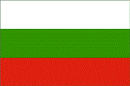 Industries Electricity, gas, water; food, beverages, tobacco; machinery and equipment, base metals, chemical products, coke, refined petroleum, nuclear fuel Currency code Lev (BGL) Internet code .bg Ports and Terminals Burgas, Varna Burkina Faso Background Burkina Faso (formerly Upper Volta) achieved independence from France in 1960. Repeated military coups during the 1970s and 1980s were followed by multiparty elections in the early 1990s. Current President Blaise COMPAORE came to power in a 1987 military coup and has won every election since then. Burkina Faso's high population density and limited natural resources result in poor economic prospects for the majority of its citizens. Recent unrest in Cote d'Ivoire and northern Ghana has hindered the ability of several hundred thousand seasonal Burkinabe farm workers to find employment in neighboring countries. Location Western Africa, north of Ghana Geographic co-ordinates 13 00 N, 2 00 W Map references Africa Area Total: 274,200 sq km ; land: 273,800 sq km ; water: 400 sq km Area comparative Slightly larger than Colorado Climate Tropical; warm, dry winters; hot, wet summers Terrain Mostly flat to dissected, undulating plains; hills in west and southeast Natural resources Manganese, limestone, marble; small deposits of gold, phosphates, pumice, salt Natural hazards Recurring droughts Nationality Noun: Burkinabe (singular and plural) ; adjective: Burkinabe Country name Conventional long form: none ; conventional short form: Burkina Faso ; local long form: none ; local short form: Burkina Faso ; former: Upper Volta, Republic of Upper Volta Capital Name: Ouagadougou ; geographic coordinates: 12 22 N, 1 31 W ; time difference: UTC 0 (5 hours ahead of Washington, DC during Standard Time) Administrative divisions 45 provinces; Bale, Bam, Banwa, Bazega, Bougouriba, Boulgou, Boulkiemde, Comoe, Ganzourgou, Gnagna, Gourma, Houet, Ioba, Kadiogo, Kenedougou, Komondjari, Kompienga, Kossi, Koulpelogo, Kouritenga, Kourweogo, Leraba, Loroum, Mouhoun, Nahouri, Namentenga, Nayala, Noumbiel, Oubritenga, Oudalan, Passore, Poni, Sanguie, Sanmatenga, Seno, Sissili, Soum, Sourou, Tapoa, Tuy, Yagha, Yatenga, Ziro, Zondoma, Zoundweogo National holiday Republic Day, 11 December (1958) Suffrage universal Flag  Industries Cotton lint, beverages, agricultural processing, soap, cigarettes, textiles, gold Currency code Communaute Financiere Africaine franc (XOF) Internet code .bf Burma Background Britain conquered Burma over a period of 62 years (1824-1886) and incorporated it into its Indian Empire. Burma was administered as a province of India until 1937 when it became a separate, self-governing colony; independence from the Commonwealth was attained in 1948. Gen. NE WIN dominated the government from 1962 to 1988, first as military ruler, then as self-appointed president, and later as political kingpin. Despite multiparty legislative elections in 1990 that resulted in the main opposition party - the National League for Democracy (NLD) - winning a landslide victory, the ruling junta refused to hand over power. NLD leader and Nobel Peace Prize recipient AUNG SAN SUU KYI, who was under house arrest from 1989 to 1995 and 2000 to 2002, was imprisoned in May 2003 and subsequently transferred to house arrest, where she remains virtually incommunicado. In February 2006, the junta extended her detention for another year. Her supporters, as well as all those who promote democracy and improved human rights, are routinely harassed or jailed. Location Southeastern Asia, bordering the Andaman Sea and the Bay of Bengal, between Bangladesh and Thailand Geographic co-ordinates 22 00 N, 98 00 E Map references Southeast Asia Area Total: 678,500 sq km ; land: 657,740 sq km ; water: 20,760 sq km Area comparative Slightly smaller than Texas Climate Tropical monsoon; cloudy, rainy, hot, humid summers (southwest monsoon, June to September); less cloudy, scant rainfall, mild temperatures, lower humidity during winter (northeast monsoon, December to April) Terrain Central lowlands ringed by steep, rugged highlands Natural resources Petroleum, timber, tin, antimony, zinc, copper, tungsten, lead, coal, some marble, limestone, precious stones, natural gas, hydropower Natural hazards Destructive earthquakes and cyclones; flooding and landslides common during rainy season (June to September); periodic droughts Nationality Noun: Burmese (singular and plural) ; adjective: Burmese Country name Conventional long form: Union of Burma ; conventional short form: Burma ; local long form: Pyidaungzu Myanma Naingngandaw (translated by the US Government as Union of Myanma and by the Burmese as Union of Myanmar) ; local short form: Myanma Naingngandaw ; former: Socialist Republic of the Union of Burma Capital Name: Rangoon (Yangon) ; geographic coordinates: 16 47 N, 96 10 E ; time difference: UTC+6.5 (11.5 hours ahead of Washington, DC during Standard Time) ; note: Nay Pyi Taw is administrative capital Administrative divisions 7 divisions (taing-myar, singular - taing) and 7 states (pyi ne-myar, singular - pyi ne) ; divisions: Ayeyarwady, Bago, Magway, Mandalay, Sagaing, Tanintharyi, Yangon ; states: Chin State, Kachin State, Kayah State, Kayin State, Mon State, Rakhine State, Shan State National holiday Independence Day, 4 January (1948); Union Day, 12 February (1947) Suffrage 18 years of age; universal Flag 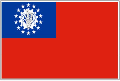 Industries Agricultural processing; knit and woven apparel; wood and wood products; copper, tin, tungsten, iron; construction materials; pharmaceuticals; fertilizer; cement; natural gas Currency code Kyat (MMK) Internet code .mm Ports and Terminals Moulmein, Rangoon, Sittwe Burundi Background Burundi's first democratically elected president was assassinated in October 1993 after only 100 days in office, triggering widespread ethnic violence between Hutu and Tutsi factions. Over 200,000 Burundians perished during the conflict that spanned almost a dozen years. Hundreds of thousands of Burundians were internally displaced or became refugees in neighboring countries. An internationally brokered power-sharing agreement between the Tutsi-dominated government and the Hutu rebels in 2003 paved the way for a transition process that led to an integrated defense force, established a new constitution in 2005, and elected a majority Hutu government in 2005. The new government, led by President Pierre NKURUNZIZA, signed a South African brokered ceasefire with the country's last rebel group in September of 2006 but still faces many challenges. Location Central Africa, east of Democratic Republic of the Congo Geographic co-ordinates 3 30 S, 30 00 E Map references Africa Area Total: 27,830 sq km ; land: 25,650 sq km ; water: 2,180 sq km Area comparative Slightly smaller than Maryland Climate Equatorial; high plateau with considerable altitude variation (772 m to 2,670 m above sea level); average annual temperature varies with altitude from 23 to 17 degrees centigrade but is generally moderate as the average altitude is about 1,700 m; average annual rainfall is about 150 cm; two wet seasons (February to May and September to November), and two dry seasons (June to August and December to Januar) Terrain Hilly and mountainous, dropping to a plateau in east, some plains Natural resources Tantalum, gold, tin, tungsten, kaolin, limestone Natural hazards Flooding, landslides, drought Nationality Noun: Burundian(s) ; adjective: Burundian Country name Conventional long form: Republic of Burundi ; conventional short form: Burundi ; local long form: Republique du Burundi/Republika y'u Burundi ; local short form: Burundi ; former: Urundi Capital Name: Bujumbura ; geographic coordinates: 3 23 S, 29 22 E ; time difference: UTC+2 (7 hours ahead of Washington, DC during Standard Time) Administrative divisions 17 provinces; Bubanza, Bujumbura Mairie, Bujumbura Rurale, Bururi, Cankuzo, Cibitoke, Gitega, Karuzi, Kayanza, Kirundo, Makamba, Muramvya, Muyinga, Mwaro, Ngozi, Rutana, Ruyigi National holiday Independence Day, 1 July (1962) Suffrage NA years of age; universal adult Flag  Industries Light consumer goods such as blankets, shoes, soap; assembly of imported components; public works construction; food processing Currency code Burundi franc (BIF) Internet code .bi Ports and Terminals Bujumbura
__________________
Time is the longest distance between two places.
|
|
#8
Thursday, May 15, 2008
|
||||
|
||||
|
Cambodia Background Most Cambodians consider themselves to be Khmers, descendants of the Angkor Empire that extended over much of Southeast Asia and reached its zenith between the 10th and 13th centuries. Attacks by the Thai and Cham (from present-day Vietnam) weakened the empire ushering in a long period of decline. The king placed the country under French protection in 1863. Cambodia became part of French Indochina in 1887. Following Japanese occupation in World War II, Cambodia gained full independence from France in 1953. In April 1975, after a five-year struggle, Communist Khmer Rouge forces captured Phnom Penh and evacuated all cities and towns. At least 1.5 million Cambodians died from execution, forced hardships, or starvation during the Khmer Rouge regime under POL POT. A December 1978 Vietnamese invasion drove the Khmer Rouge into the countryside, began a 10-year Vietnamese occupation, and touched off almost 13 years of civil war. The 1991 Paris Peace Accords mandated democratic elections and a ceasefire, which was not fully respected by the Khmer Rouge. UN-sponsored elections in 1993 helped restore some semblance of normalcy under a coalition government. Factional fighting in 1997 ended the first coalition government, but a second round of national elections in 1998 led to the formation of another coalition government and renewed political stability. The remaining elements of the Khmer Rouge surrendered in early 1999. Some of the remaining Khmer Rouge leaders are awaiting trial by a UN-sponsored tribunal for crimes against humanity. Elections in July 2003 were relatively peaceful, but it took one year of negotiations between contending political parties before a coalition government was formed. Location Southeastern Asia, bordering the Gulf of Thailand, between Thailand, Vietnam, and Laos Geographic co-ordinates 13 00 N, 105 00 E Map references Southeast Asia Area Total: 181,040 sq km ; land: 176,520 sq km ; water: 4,520 sq km Area comparative Slightly smaller than Oklahoma Climate Tropical; rainy, monsoon season (May to November); dry season (December to April); little seasonal temperature variation Terrain Mostly low, flat plains; mountains in southwest and north Natural resources Oil and gas, timber, gemstones, some iron ore, manganese, phosphates, hydropower potential Natural hazards Monsoonal rains (June to November); flooding; occasional droughts Nationality Noun: Cambodian(s) ; adjective: Cambodian Languages Khmer (official) , French, English Country name Conventional long form: Kingdom of Cambodia ; conventional short form: Cambodia ; local long form: Preahreacheanachakr Kampuchea (phonetic pronunciation) ; local short form: Kampuchea ; former: Kingdom of Cambodia, Khmer Republic, Democratic Kampuchea, People's Republic of Kampuchea, State of Cambodia Capital Name: Phnom Penh ; geographic coordinates: 11 33 N, 104 55 E ; time difference: UTC+7 (12 hours ahead of Washington, DC during Standard Time) Administrative divisions 20 provinces (khaitt, singular and plural) and 4 municipalities* (krong, singular and plural) ; provinces: Banteay Mean Cheay, Batdambang, Kampong Cham, Kampong Chhnang, Kampong Spoe, Kampong Thum, Kampot, Kandal, Kaoh Kong, Krachen, Mondol Kiri, Otdar Mean Cheay, Pouthisat, Preah Vihear, Prey Veng, Rotanah Kiri, Siem Reab, Stoeng Treng, Svay Rieng, Takev ; municipalities: Keb, Pailin, Phnum Penh (Phnom Penh), Preah Seihanu (Sihanoukville) National holiday Independence Day, 9 November (1953) Suffrage 18 years of age; universal Flag 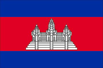 Industries Tourism, garments, rice milling, fishing, wood and wood products, rubber, cement, gem mining, textiles Currency code Riel (KHR) Internet code .kh Ports and Terminals Phnom Penh, Preah Seihanu (Sihanoukville) Cameroon Background The former French Cameroon and part of British Cameroon merged in 1961 to form the present country. Cameroon has generally enjoyed stability, which has permitted the development of agriculture, roads, and railways, as well as a petroleum industry. Despite a slow movement toward democratic reform, political power remains firmly in the hands of an ethnic oligarchy headed by President Paul BIYA. Location Western Africa, bordering the Bight of Biafra, between Equatorial Guinea and Nigeria Geographic co-ordinates 6 00 N, 12 00 E Map references Africa Area Total: 475,440 sq km ; land: 469,440 sq km ; water: 6,000 sq km Area comparative Slightly larger than California Climate Varies with terrain, from tropical along coast to semiarid and hot in north Terrain Diverse, with coastal plain in southwest, dissected plateau in center, mountains in west, plains in north Natural resources Petroleum, bauxite, iron ore, timber, hydropower Natural hazards Volcanic activity with periodic releases of poisonous gases from Lake Nyos and Lake Monoun volcanoes Nationality Noun: Cameroonian(s) ; adjective: Cameroonian Languages 24 major African language groups, English (official), French (official) Country name Conventional long form: Republic of Cameroon ; conventional short form: Cameroon ; local long form: Republique du Cameroun/Republic of Cameroon ; local short form: Cameroun/Cameroon ; former: French Cameroon, British Cameroon, Federal Republic of Cameroon, United Republic of Cameroon Capital Name: Yaounde ; geographic coordinates: 3 52 N, 11 31 E ; time difference: UTC+1 (6 hours ahead of Washington, DC during Standard Time) Administrative divisions10 provinces; Adamaoua, Centre, Est, Extreme-Nord, Littoral, Nord, Nord-Ouest, Ouest, Sud, Sud-Ouest National holiday Republic Day (National Day), 20 May (1972) Suffrage 20 years of age; universal Flag  Industries Petroleum production and refining, aluminum production, food processing, light consumer goods, textiles, lumber, ship repair Currency code Communaute Financiere Africaine franc (XAF) Internet code .cm Ports and Terminals Douala, Limboh Terminal Canada Background A land of vast distances and rich natural resources, Canada became a self-governing dominion in 1867 while retaining ties to the British crown. Economically and technologically the nation has developed in parallel with the US, its neighbor to the south across an unfortified border. Canada faces the political challenges of meeting public demands for quality improvements in health care and education services, as well as responding to separatist's concerns in predominantly francophone Quebec. Canada also aims to develop its diverse energy resources while maintaining its commitment to the environment. Location Northern North America, bordering the North Atlantic Ocean on the east, North Pacific Ocean on the west, and the Arctic Ocean on the north, north of the conterminous US Geographic co-ordinates 60 00 N, 95 00 W Map references North America Area Total: 9,984,670 sq km ; land: 9,093,507 sq km ; water: 891,163 sq km Area comparative Comewhat larger than the US Climate Varies from temperate in south to subarctic and arctic in north Terrain Mostly plains with mountains in west and lowlands in southeast Natural resources Iron ore, nickel, zinc, copper, gold, lead, molybdenum, potash, diamonds, silver, fish, timber, wildlife, coal, petroleum, natural gas, hydropower Natural hazards Continuous permafrost in north is a serious obstacle to development; cyclonic storms form east of the Rocky Mountains, a result of the mixing of air masses from the Arctic, Pacific, and North American interior, and produce most of the country's rain and snow east of the mountains Nationality Noun: Canadian(s) ; adjective: Canadian Country name Conventional long form: none ; conventional short form: Canada Capital Name: Ottawa ; geographic coordinates: 45 25 N, 75 40 W ; time difference: UTC-5 (same time as Washington, DC during Standard Time) ; daylight saving time: +1hr, begins second Sunday in March; ends first Sunday in November ; note: Canada is divided into six time zones Administrative divisions 10 provinces and 3 territories*; Alberta, British Columbia, Manitoba, New Brunswick, Newfoundland and Labrador, Northwest Territories*, Nova Scotia, Nunavut*, Ontario, Prince Edward Island, Quebec, Saskatchewan, Yukon Territory* National holiday Canada Day, 1 July (1867) Suffrage 18 years of age; universal Flag  Industries Transportation equipment, chemicals, processed and unprocessed minerals, food products, wood and paper products, fish products, petroleum and natural gas Currency code Canadian dollar (CAD) Internet code .ca Ports and Terminals Fraser River Port, Halifax, Montreal, Port Cartier, Quebec, Saint John's (Newfoundland), Sept Isles, Vancouver Cape Verde Background The uninhabited islands were discovered and colonized by the Portuguese in the 15th century; Cape Verde subsequently became a trading center for African slaves and later an important coaling and resupply stop for whaling and transatlantic shipping. Following independence in 1975, and a tentative interest in unification with Guinea-Bissau, a one-party system was established and maintained until multi-party elections were held in 1990. Cape Verde continues to exhibit one of Africa's most stable democratic governments. Repeated droughts during the second half of the 20th century caused significant hardship and prompted heavy emigration. As a result, Cape Verde's expatriate population is greater than its domestic one. Most Cape Verdeans have both African and Portuguese antecedents. Location Western Africa, group of islands in the North Atlantic Ocean, west of Senegal Geographic co-ordinates 16 00 N, 24 00 W Map references Political Map of the World Area Total: 4,033 sq km ; land: 4,033 sq km ; water: 0 sq km Area comparative Slightly larger than Rhode Island Climate Temperate; warm, dry summer; precipitation meager and very erratic Terrain Steep, rugged, rocky, volcanic Natural resources Salt, basalt rock, limestone, kaolin, fish, clay, gypsum Natural hazards Prolonged droughts; seasonal harmattan wind produces obscuring dust; volcanically and seismically active Nationality Noun: Cape Verdean(s) ; adjective: Cape Verdean Languages Portuguese, Crioulo (a blend of Portuguese and West African words) Country name Conventional long form: Republic of Cape Verde ; conventional short form: Cape Verde ; local long form: Republica de Cabo Verde ; local short form: Cabo Verde Capital Name: Praia ; geographic coordinates: 14 55 N, 23 31 W ; time difference: UTC-1 (4 hours ahead of Washington, DC during Standard Time) Administrative divisions 17 municipalities (concelhos, singular - concelho); Boa Vista, Brava, Maio, Mosteiros, Paul, Praia, Porto Novo, Ribeira Grande, Sal, Santa Catarina, Santa Cruz, Sao Domingos, Sao Filipe, Sao Miguel, Sao Nicolau, Sao Vicente, Tarrafal National holiday Independence Day, 5 July (1975) Suffrage 18 years of age; universal Flag  Industries Food and beverages, fish processing, shoes and garments, salt mining, ship repair Currency code Cape Verdean escudo (CVE) Internet code .cv Ports and Terminals Mindelo, Praia, Tarrafal Cayman Islands Background The Cayman Islands were colonized from Jamaica by the British during the 18th and 19th centuries, and were administered by Jamaica after 1863. In 1959, the islands became a territory within the Federation of the West Indies, but when the Federation dissolved in 1962, the Cayman Islands chose to remain a British dependency Location Caribbean, three island (Grand Cayman, Cayman Brac, Little Cayman) group in Caribbean Sea, 240 km south of Cuba and 268 km northwest of Jamaica Geographic co-ordinates 19 30 N, 80 30 W Map references Central America and the Caribbean Area Total: 262 sq km ; land: 262 sq km ; water: 0 sq km Area comparative 1.5 times the size of Washington, DC Climate Tropical marine; warm, rainy summers (May to October) and cool, relatively dry winters (November to April) Terrain Low-lying limestone base surrounded by coral reefs Natural resources Fish, climate and beaches that foster tourism Natural hazards Hurricanes (July to November) Nationality Noun: Caymanian(s) ; adjective: Caymanian Languages English Country name Conventional long form: none ; conventional short form: Cayman Islands Capital Name: George Town (on Grand Cayman) ; geographic coordinates: 19 20 N, 81 23 W ; time difference: UTC-5 (same time as Washington, DC during Standard Time) Administrative divisions 8 districts; Creek, Eastern, Midland, South Town, Spot Bay, Stake Bay, West End, Western National holiday Prolonged droughts; seasonal harmattan wind produces obscuring dust; volcanically and seismically active Suffrage 18 years of age; universal Flag  Industries Tourism, banking, insurance and finance, construction, construction materials, furniture Currency code Caymanian dollar (KYD) Internet code .ky Ports and Terminals Cayman Brac, George Town
__________________
Time is the longest distance between two places.
|
|
#9
Wednesday, May 21, 2008
|
||||
|
||||
|
Central African Republic Background The former French colony of Ubangi-Shari became the Central African Republic upon independence in 1960. After three tumultuous decades of misrule - mostly by military governments - civilian rule was established in 1993 and lasted for one decade. President Ange-Felix PATASSE's civilian government was plagued by unrest, and in March 2003 he was deposed in a military coup led by General Francois BOZIZE, who established a transitional government. Though the government has the tacit support of civil society groups and the main parties, a wide field of candidates contested the municipal, legislative, and presidential elections held in March and May of 2005 in which General BOZIZE was affirmed as president. The government still does not fully control the countryside, where pockets of lawlessness persist. Location Central Africa, north of Democratic Republic of the Congo Geographic co ordinates 7 00 N, 21 00 E Map references Africa Area Total: 622,984 sq km ; land: 622,984 sq km ; water: 0 sq km Area-comparative Slightly smaller than Texas Climate Tropical; hot, dry winters; mild to hot, wet summers Terrain Vast, flat to rolling, monotonous plateau; scattered hills in northeast and southwest Natural resources Diamonds, uranium, timber, gold, oil, hydropower Natural hazards Hot, dry, dusty harmattan winds affect northern areas; floods are common Nationality Noun: Central African(s) ; adjective: Central African Languages French (official), Sangho (lingua franca and national language), tribal languages Country name Conventional long form: Central African Republic ; conventional short form: none ; local long form: Republique Centrafricaine ; local short form: none ; former: Ubangi-Shari, Central African Empire ; abbreviation: CAR Capital Name: Bangui ; geographic coordinates: 4 22 N, 18 35 E ; time difference: UTC+1 (6 hours ahead of Washington, DC during Standard Time) Administrative division 14 prefectures (prefectures, singular - prefecture), 2 economic prefectures* (prefectures economiques, singular - prefecture economique), and 1 commune**; Bamingui-Bangoran, Bangui**, Basse-Kotto, Haute-Kotto, Haut-Mbomou, Kemo, Lobaye, Mambere-Kadei, Mbomou, Nana-Grebizi*, Nana-Mambere, Ombella-Mpoko, Ouaka, Ouham, Ouham-Pende, Sangha-Mbaere*, Vakaga National holiday Republic Day, 1 December (1958) Suffrage 21 years of age; universal Flag  Industries Gold and diamond mining, logging, brewing, textiles, footwear, assembly of bicycles and motorcycles Currency code Communaute Financiere Africaine franc (XAF) Internet country code .cf Ports and terminals Bangui, Nola, Salo, Nzinga Chad Background Chad, part of France's African holdings until 1960, endured three decades of civil warfare as well as invasions by Libya before a semblance of peace was finally restored in 1990. The government eventually drafted a democratic constitution, and held flawed presidential elections in 1996 and 2001. In 1998, a rebellion broke out in northern Chad, which sporadically flares up despite several peace agreements between the government and the rebels. In 2005 new rebel groups emerged in western Sudan and have made probing attacks into eastern Chad. Power remains in the hands of an ethnic minority. In June 2005, President Idriss DEBY held a referendum successfully removing constitutional term limits. Location Central Africa, south of Libya Geographic co ordinates 15 00 N, 19 00 E Map references Africa Area Total: 1.284 million sq km ; land: 1,259,200 sq km ; water: 24,800 sq km Area-comparative Slightly more than three times the size of California Land boundaries Total: 5,968 km ; border countries: Cameroon 1,094 km, Central African Republic 1,197 km, Libya 1,055 km, Niger 1,175 km, Nigeria 87 km, Sudan 1,360 km Climate Tropical in south, desert in north Terrain Broad, arid plains in center, desert in north, mountains in northwest, lowlands in south Natural resources Petroleum, uranium, natron, kaolin, fish (Lake Chad), gold, limestone, sand and gravel, salt Natural hazards Hot, dry, dusty harmattan winds occur in north; periodic droughts; locust plagues Nationality Noun: Chadian(s) ; adjective: Chadian Languages French (official), Arabic (official), Sara (in south), more than 120 different languages and dialects Country name Conventional long form: Republic of Chad ; conventional short form: Chad ; local long form: Republique du Tchad/Jumhuriyat Tshad ; local short form: Tchad/Tshad Capital Name: N'Djamena ; geographic coordinates: 12 07 N, 15 03 E ; time difference: UTC+1 (6 hours ahead of Washington, DC during Standard Time) Administrative division 14 prefectures (prefectures, singular - prefecture); Batha, Biltine, Borkou-Ennedi-Tibesti, Chari-Baguirmi, Guera, Kanem, Lac, Logone Occidental, Logone Oriental, Mayo-Kebbi, Moyen-Chari, Ouaddai, Salamat, Tandjile ; note: instead of 14 prefectures, there may be a new administrative structure of 28 departments (departments, singular - department) and 1 city*; Assongha, Baguirmi, Bahr El Gazal, Bahr Koh, Batha Oriental, Batha Occidental, Biltine, Borkou, Dababa, Ennedi, Guera, Hadjer Lamis, Kabia, Kanem, Lac, Lac Iro, Logone Occidental, Logone Oriental, Mandoul, Mayo-Boneye, Mayo-Dallah, Monts de Lam, N'Djamena*, Ouaddai, Salamat, Sila, Tandjile Oriental, Tandjile Occidental, Tibesti National holiday Independence Day, 11 August (1960) Suffrage 18 years of age; universal Flag  Industries Oil, cotton textiles, meatpacking, beer brewing, natron (sodium carbonate), soap, cigarettes, construction materials Currency code Communaute Financiere Africaine franc (XAF) Internet country code .td Chile Background Prior to the coming of the Spanish in the 16th century, northern Chile was under Inca rule while Araucanian Indians inhabited central and southern Chile; the latter were not completely subjugated by Spain until the early 1880s. Although Chile declared its independence in 1810, decisive victory over the Spanish was not achieved until 1818. In the War of the Pacific (1879-84), Chile defeated Peru and Bolivia and won its present northern lands. A three-year-old Marxist government of Salvador ALLENDE was overthrown in 1973 by a dictatorial military regime led by Augusto PINOCHET, who ruled until a freely elected president was installed in 1990. Sound economic policies, maintained consistently since the 1980s, have contributed to steady growth and have helped secure the country's commitment to democratic and representative government. Chile has increasingly assumed regional and international leadership roles befitting its status as a stable, democratic nation.. Location Southern South America, bordering the South Pacific Ocean, between Argentina and Peru Geographic co ordinates 30 00 S, 71 00 W Map references South America Area Total: 756,950 sq km ; land: 748,800 sq km ; water: 8,150 sq km ; note: includes Easter Island (Isla de Pascua) and Isla Sala y Gomez Area-comparative Slightly smaller than twice the size of Montana Land boundaries Total: 6,339 km ; border countries: Argentina 5,308 km, Bolivia 860 km, Peru 171 km Climate temperate; desert in north; Mediterranean in central region; cool and damp in south Terrain Low coastal mountains; fertile central valley; rugged Andes in east Natural resources Copper, timber, iron ore, nitrates, precious metals, molybdenum, hydropower Natural hazards Severe earthquakes; active volcanism; tsunamis Nationality Noun: Chilean(s) ; adjective: Chilean Languages Spanish Country name Conventional long form: Republic of Chile ; conventional short form: Chile ; local long form: Republica de Chile ; local short form: Chile Capital Name: Santiago ; geographic coordinates: 33 27 S, 70 40 W ; time difference: UTC-4 (1 hour ahead of Washington, DC during Standard Time) ; daylight saving time: +1hr, begins second Sunday in October; ends second Sunday in March Administrative division 13 regions (regiones, singular - region); Aisen del General Carlos Ibanez del Campo, Antofagasta, Araucania, Atacama, Bio-Bio, Coquimbo, Libertador General Bernardo O'Higgins, Los Lagos, Magallanes y de la Antartica Chilena, Maule, Region Metropolitana (Santiago), Tarapaca, Valparaiso ; note: the US does not recognize claims to Antarctica National holiday Independence Day, 18 September (1810) Suffrage 18 years of age; universal and compulsory Flag 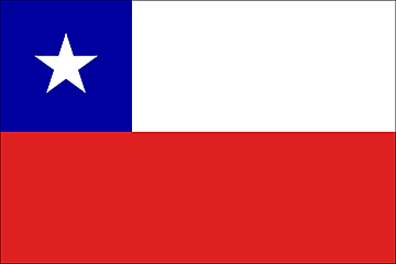 Industries Copper, other minerals, foodstuffs, fish processing, iron and steel, wood and wood products, transport equipment, cement, textiles Currency code Chilean peso (CLP) Internet country code .cl Ports and terminals Antofagasta, Arica, Huasco, Iquique, Lirquen, San Antonio, San Vicente, Valparaiso
__________________
Time is the longest distance between two places.
|
|
#10
Friday, May 23, 2008
|
||||
|
||||
|
China Background For centuries China stood as a leading civilization, outpacing the rest of the world in the arts and sciences, but in the 19th and early 20th centuries, the country was beset by civil unrest, major famines, military defeats, and foreign occupation. After World War II, the Communists under MAO Zedong established an autocratic socialist system that, while ensuring China's sovereignty, imposed strict controls over everyday life and cost the lives of tens of millions of people. After 1978, his successor DENG Xiaoping and other leaders focused on market-oriented economic development and by 2000 output had quadrupled. For much of the population, living standards have improved dramatically and the room for personal choice has expanded, yet political controls remain tight. Location Eastern Asia, bordering the East China Sea, Korea Bay, Yellow Sea, and South China Sea, between North Korea and Vietnam Geographic co ordinates 35 00 N, 105 00 E Map references Asia Area Total: 9,596,960 sq km ; land: 9,326,410 sq km ; water: 270,550 sq km Area-comparative Slightly smaller than the US Climate Extremely diverse; tropical in south to subarctic in north Terrain Mostly mountains, high plateaus, deserts in west; plains, deltas, and hills in east Natural resources Magnetite, aluminum, lead, zinc, uranium, hydropower potential (world's largest) Natural hazards Earthquakes; droughts; land subsidence Nationality Noun: Chinese (singular and plural) ; adjective: Chinese Country name Conventional long form: People's Republic of China ; conventional short form: China ; local long form: Zhonghua Renmin Gongheguo ; local short form: Zhongguo ; abbreviation: PRC Capital Name: Beijing ; geographic coordinates: 39 56 N, 116 24 E ; time difference: UTC+8 (13 hours ahead of Washington, DC during Standard Time) Administrative division 23 provinces (sheng, singular and plural), 5 autonomous regions (zizhiqu, singular and plural), and 4 municipalities (shi, singular and plural) ; provinces: Anhui, Fujian, Gansu, Guangdong, Guizhou, Hainan, Hebei, Heilongjiang, Henan, Hubei, Hunan, Jiangsu, Jiangxi, Jilin, Liaoning, Qinghai, Shaanxi, Shandong, Shanxi, Sichuan, Yunnan, Zhejiang; (see note on Taiwan) ; autonomous regions: Guangxi, Nei Mongol, Ningxia, Xinjiang, Xizang (Tibet) ; municipalities: Beijing, Chongqing, Shanghai, Tianji National holiday Anniversary of the Founding of the People's Republic of China, 1 October (1949) Suffrage 18 years of age; universal Flag  Industries Mining and ore processing, iron, steel, aluminum, and other metals, coal; machine building; armaments; textiles and apparel; petroleum; cement; chemicals; fertilizers; consumer products, including footwear, toys, and electronics; food processing; transportation equipment, including automobiles, rail cars and locomotives, ships, and aircraft; telecommunications equipment, commercial space launch vehicles, satellites Currency code Yuan (CNY) Internet country code .cn Ports and terminals Dalian, Guangzhou, Nanjing, Ningbo, Qingdao, Qinhuangdao, Shanghai Christmas Island Background Named in 1643 for the day of its discovery, the island was annexed and settlement began by the UK in 1888. Phosphate mining began in the 1890s. The UK transferred sovereignty to Australia in 1958. Almost two-thirds of the island has been declared a national park. Location Southeastern Asia, island in the Indian Ocean, south of Indonesia Geographic co ordinates 10 30 S, 105 40 E Map references Southeast Asia Area Total: 135 sq km ; land: 135 sq km ; water: 0 sq km Area-comparative About three-quarters the size of Washington, DC Climate Tropical with a wet and dry season; heat and humidity moderated by trade winds; wet season (December to April) Terrain Steep cliffs along coast rise abruptly to central plateau Natural resources Phosphate, beaches Natural hazards Loss of rainforest; impact of phosphate mining Nationality Noun: Christmas Islander(s) ; adjective: Christmas Island Languages English (official), Chinese, Malay Country name Conventional long form: Territory of Christmas Island ; conventional short form: Christmas Island Capital Name: The Settlement ; geographic coordinates: 18 44 N, 64 19 W ; time difference: UTC+7 (12 hours ahead of Washington, DC during Standard Time) Administrative division None (territory of Australia) National holiday Australia Day, 26 January (1788) Flag  Ports and terminals Flying Fish Cove Clipperton Island Background This isolated island was named for John CLIPPERTON, a pirate who made it his hideout early in the 18th century. Annexed by France in 1855, it was seized by Mexico in 1897. Arbitration eventually awarded the island to France, which took possession in 1935. Location Middle America, atoll in the North Pacific Ocean, 1,120 km southwest of Mexico Geographic co ordinates 10 17 N, 109 13 W Map references Political Map of the World Area Total: 6 sq km ; land: 6 sq km ; water: 0 sq km Area-comparative About 12 times the size of The Mall in Washington, DC Climate Tropical; humid, average temperature 20-32 degrees C, wet season (May to October) Country name Conventional long form: none ; conventional short form: Clipperton Island ; local long form: none ; local short form: Ile Clipperton ; former: sometimes called Ile de la Passion Flag  Cocos (Keeling) Islands Background There are 27 coral islands in the group. Captain William KEELING discovered the islands in 1609, but they remained uninhabited until the 19th century. Annexed by the UK in 1857, they were transferred to the Australian Government in 1955. The population on the two inhabited islands generally is split between the ethnic Europeans on West Island and the ethnic Malays on Home Island. Location Southeastern Asia, group of islands in the Indian Ocean, southwest of Indonesia, about halfway from Australia to Sri Lanka Geographic co ordinates 12 30 S, 96 50 E Map references Southeast Asia Area Total: 14 sq km ; land: 14 sq km ; water: 0 sq km ; note: includes the two main islands of West Island and Home Island Area-comparative About 24 times the size of The Mall in Washington, DC Climate Tropical with high humidity, moderated by the southeast trade winds for about nine months of the year Terrain Flat, low-lying coral atolls Natural resources Fish Natural hazards Cyclone season is October to April Nationality Noun: Cocos Islander(s) ; adjective: Cocos Islander Languages Malay (Cocos dialect), English Country name Conventional long form: Territory of Cocos (Keeling) Islands ; conventional short form: Cocos (Keeling) Islands Capital Name: West Island ; geographic coordinates: 12 10 S, 96 55 E ; time difference: UTC+6.5 (11.5 hours ahead of Washington, DC during Standard Time) Administrative division None (territory of Australia) National holiday Cocos (Keeling) Islands Act of 1955 (23 November 1955) as amended by the Territories Law Reform Act of 1992 Flag  Currency code Australian dollar (AUD) Internet country code .cc Ports and terminals Port Refuge
__________________
Time is the longest distance between two places.
|
|
«
Previous Thread
|
Next Thread
»
|
|

 Similar Threads
|
||||
| Thread | Thread Starter | Forum | Replies | Last Post |
| The Religion Of Islam | MUKHTIAR ALI | Islamiat | 3 | Friday, April 03, 2020 10:31 AM |
| Islamic Information | safdarmehmood | Islamiat | 4 | Thursday, June 28, 2018 08:09 AM |
| Enligtened Moderation | Aarwaa | Current Affairs Notes | 3 | Sunday, March 30, 2008 08:22 AM |
| The Globalization of World Politics: Revision guide 3eBaylis & Smith: | hellowahab | International Relations | 0 | Wednesday, October 17, 2007 03:13 PM |
| What Is The New World Order?? | MUKHTIAR ALI | International Relations | 1 | Monday, January 08, 2007 09:39 PM |

