East Timor
Background
The Portuguese began to trade with the island of Timor in the early 16th century and colonized it in mid-century. Skirmishing with the Dutch in the region eventually resulted in an 1859 treaty in which Portugal ceded the western portion of the island. Imperial Japan occupied East Timor from 1942 to 1945, but Portugal resumed colonial authority after the Japanese defeat in World War II. East Timor declared itself independent from Portugal on 28 November 1975 and was invaded and occupied by Indonesian forces nine days later. It was incorporated into Indonesia in July 1976 as the province of East Timor. An unsuccessful campaign of pacification followed over the next two decades, during which an estimated 100,000 to 250,000 individuals lost their lives. On 30 August 1999, in a UN-supervised popular referendum, an overwhelming majority of the people of East Timor voted for independence from Indonesia. Between the referendum and the arrival of a multinational peacekeeping force in late September 1999, anti-independence Timorese militias - organized and supported by the Indonesian military - commenced a large-scale, scorched-earth campaign of retribution. The militias killed approximately 1,400 Timorese and forcibly pushed 300,000 people into West Timor as refugees. The majority of the country's infrastructure, including homes, irrigation systems, water supply systems, and schools, and nearly 100% of the country's electrical grid were destroyed. On 20 September 1999 the Australian-led peacekeeping troops of the International Force for East Timor (INTERFET) deployed to the country and brought the violence to an end. On 20 May 2002, East Timor was internationally recognized as an independent state. In March of 2006, a military strike led to violence and a near breakdown of law and order. Over 2,000 Australian, New Zealand, and Portuguese police and peacekeepers deployed to East Timor in late May. Although many of the peacekeepers were replaced by UN police officers, 850 Australian soldiers remained as of 1 January 2007.
Location
Southeastern Asia, northwest of Australia in the Lesser Sunda Islands at the eastern end of the Indonesian archipelago; note - East Timor includes the eastern half of the island of Timor, the Oecussi (Ambeno) region on the northwest portion of the island of Timor, and the islands of Pulau Atauro and Pulau Jaco
Geographic co-ordinates
8 50 S, 125 55 E
Map references
Southeast Asia
Area
Total: 15,007 sq km ; land: NA sq km ; water: NA sq km
Area- comparative
Slightly larger than Connecticut
Climate
Tropical; hot, humid; distinct rainy and dry seasons
Terrain
Mountainous
Natural resources
Gold, petroleum, natural gas, manganese, marble
Natural Hazards
Floods and landslides are common; earthquakes, tsunamis, tropical cyclones
Nationality
Noun: Timorese ; adjective: Timorese
Languages
Tetum (official), Portuguese (official), Indonesian, English ; note: there are about 16 indigenous languages; Tetum, Galole, Mambae, and Kemak are spoken by significant numbers of people
Country name
Conventional long form: Democratic Republic of Timor-Leste ; conventional short form: East Timor ; local long form: Republika Demokratika Timor Lorosa'e [Tetum]; Republica Democratica de Timor-Leste [Portuguese] ; local short form: Timor Lorosa'e [Tetum]; Timor-Leste [Portuguese] ; former: Portuguese Timor
Capital
Name: Dili ; geographic coordinates: 8 35 S, 125 36 E ; time difference: UTC+9 (14 hours ahead of Washington, DC during Standard Time)
Administrative division
13 administrative districts; Aileu, Ainaro, Baucau, Bobonaro (Maliana), Cova-Lima (Suai), Dili, Ermera, Lautem (Los Palos), Liquica, Manatuto, Manufahi (Same), Oecussi (Ambeno), Viqueque
National holiday
Independence Day, 28 November (1975)
Suffrage
17 years of age; universal
Flag
 Industries
Printing, soap manufacturing, handicrafts, woven cloth
Currency code
US dollar (USD)
Internet code
.tl
Ports and terminals
Dili
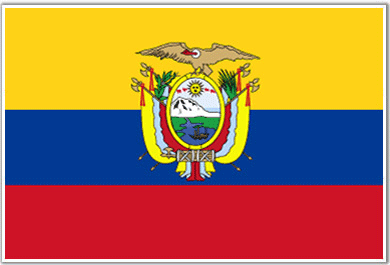
Ecuador
Background
What is now Ecuador formed part of the northern Inca Empire until the Spanish conquest in 1533. Quito became a seat of Spanish colonial government in 1563 and part of the Viceroyalty of New Granada in 1717. The territories of the Viceroyalty - New Granada (Colombia), Venezuela, and Quito - gained their independence by 1819 and formed a federation known as Gran Colombia. When Quito withdrew in 1830, the traditional name was changed in favor of the "Republic of the Equator." Between 1904 and 1942, Ecuador lost territories in a series of conflicts with its neighbors. A border war with Peru that flared in 1995 was resolved in 1999. Although Ecuador marked 25 years of civilian governance in 2004, the period has been marred by political instability. Protests in Quito have contributed to the mid-term ouster of Ecuador's last three democratically elected Presidents.
Location
Western South America, bordering the Pacific Ocean at the Equator, between Colombia and Peru
Geographic co-ordinates
2 00 S, 77 30 W
Map references
South America
Area
Total: 283,560 sq km ; land: 276,840 sq km ; water: 6,720 sq km ; note: includes Galapagos Islands
Area- comparative
Slightly smaller than Nevada
Climate
Tropical along coast, becoming cooler inland at higher elevations; tropical in Amazonian jungle lowlands
Terrain
Coastal plain (costa), inter-Andean central highlands (sierra), and flat to rolling eastern jungle (oriente)
Natural resources
Petroleum, fish, timber, hydropower
Natural Hazards
Frequent earthquakes, landslides, volcanic activity; floods; periodic droughts
Nationality
Noun: Ecuadorian(s) ; adjective: Ecuadorian
Languages
Spanish (official), Amerindian languages (especially Quechua)
Country name
Conventional long form: Republic of Ecuador ; conventional short form: Ecuador ; local long form: Republica del Ecuador ; local short form: Ecuador
Capital
Name: Quito ; geographic coordinates: 0 13 S, 78 30 W ; time difference: UTC-5 (same time as Washington, DC during Standard Time)
Administrative division
22 provinces (provincias, singular - provincia); Azuay, Bolivar, Canar, Carchi, Chimborazo, Cotopaxi, El Oro, Esmeraldas, Galapagos, Guayas, Imbabura, Loja, Los Rios, Manabi, Morona-Santiago, Napo, Orellana, Pastaza, Pichincha, Sucumbios, Tungurahua, Zamora-Chinchipe
National holiday
Independence Day (independence of Quito), 10 August (1809)
Suffrage
18 years of age; universal, compulsory for literate persons ages 18-65, optional for other eligible voters
Flag
 Industries
Petroleum, food processing, textiles, wood products, chemicals
Currency code
US dollar (USD)
Internet code
.ec
Ports and terminals
Esmeraldas, Guayaquil, La Libertad, Manta, Puerto Bolivar
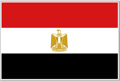
Egypt
Background
The regularity and richness of the annual Nile River flood, coupled with semi-isolation provided by deserts to the east and west, allowed for the development of one of the world's great civilizations. A unified kingdom arose circa 3200 B.C., and a series of dynasties ruled in Egypt for the next three millennia. The last native dynasty fell to the Persians in 341 B.C., who in turn were replaced by the Greeks, Romans, and Byzantines. It was the Arabs who introduced Islam and the Arabic language in the 7th century and who ruled for the next six centuries. A local military caste, the Mamluks took control about 1250 and continued to govern after the conquest of Egypt by the Ottoman Turks in 1517. Following the completion of the Suez Canal in 1869, Egypt became an important world transportation hub, but also fell heavily into debt. Ostensibly to protect its investments, Britain seized control of Egypt's government in 1882, but nominal allegiance to the Ottoman Empire continued until 1914. Partially independent from the UK in 1922, Egypt acquired full sovereignty following World War II. The completion of the Aswan High Dam in 1971 and the resultant Lake Nasser have altered the time-honored place of the Nile River in the agriculture and ecology of Egypt. A rapidly growing population (the largest in the Arab world), limited arable land, and dependence on the Nile all continue to overtax resources and stress society. The government has struggled to ready the economy for the new millennium through economic reform and massive investment in communications and physical infrastructure.
Location
Northern Africa, bordering the Mediterranean Sea, between Libya and the Gaza Strip, and the Red Sea north of Sudan, and includes the Asian Sinai Peninsula
Geographic co-ordinates
27 00 N, 30 00 E
Map references
Africa
Area
Total: 1,001,450 sq km ; land: 995,450 sq km ; water: 6,000 sq km
Area- comparative
Slightly more than three times the size of New Mexico
Climate
Desert; hot, dry summers with moderate winters
Terrain
Vast desert plateau interrupted by Nile valley and delta
Natural resources
Petroleum, natural gas, iron ore, phosphates, manganese, limestone, gypsum, talc, asbestos, lead, zinc
Natural Hazards
Periodic droughts; frequent earthquakes, flash floods, landslides; hot, driving windstorm called khamsin occurs in spring; dust storms, sandstorms
Nationality
Noun: Egyptian(s) ; adjective: Egyptian
Languages
Arabic (official), English and French widely understood by educated classes
Country name
Conventional long form: Arab Republic of Egypt ; conventional short form: Egypt ; local long form: Jumhuriyat Misr al-Arabiyah ; local short form: Misr ; former: United Arab Republic (with Syria)
Capital
Name: Cairo ; geographic coordinates: 30 03 N, 31 15 E ; time difference: UTC+2 (7 hours ahead of Washington, DC during Standard Time) ; daylight saving time: +1hr, begins last Friday in April; ends last Thursday in September
Administrative division
26 governorates (muhafazat, singular - muhafazah); Ad Daqahliyah, Al Bahr al Ahmar, Al Buhayrah, Al Fayyum, Al Gharbiyah, Al Iskandariyah, Al Isma'iliyah, Al Jizah, Al Minufiyah, Al Minya, Al Qahirah, Al Qalyubiyah, Al Wadi al Jadid, As Suways, Ash Sharqiyah, Aswan, Asyut, Bani Suwayf, Bur Sa'id, Dumyat, Janub Sina', Kafr ash Shaykh, Matruh, Qina, Shamal Sina', Suhaj
National holiday
Revolution Day, 23 July (1952)
Suffrage
18 years of age; universal and compulsory
Flag
 Industries
Textiles, food processing, tourism, chemicals, pharmaceuticals, hydrocarbons, construction, cement, metals, light manufactures
Currency code
Egyptian pound (EGP)
Internet code
.eg
Ports and terminals
Alexandria, Damietta, El Dekheila, Port Said, Suez, Zeit
El Salvador
Background
El Salvador achieved independence from Spain in 1821 and from the Central American Federation in 1839. A 12-year civil war, which cost about 75,000 lives, was brought to a close in 1992 when the government and leftist rebels signed a treaty that provided for military and political reforms.
Location
Central America, bordering the North Pacific Ocean, between Guatemala and Honduras
Geographic co-ordinates
13 50 N, 88 55 W
Map references
Central America and the Caribbean
Area
Total: 21,040 sq km ; land: 20,720 sq km ; water: 320 sq km
Area- comparative
Slightly smaller than Massachusetts
Climate
Tropical; rainy season (May to October); dry season (November to April); tropical on coast; temperate in uplands
Terrain
Mostly mountains with narrow coastal belt and central plateau
Natural resources
Hydropower, geothermal power, petroleum, arable land
Natural Hazards
Deforestation; soil erosion; water pollution; contamination of soils from disposal of toxic wastes
Nationality
Noun: Salvadoran(s) ; adjective: Salvadoran
Languages
Conventional long form: Republic of El Salvador ; conventional short form: El Salvador ; local long form: Republica de El Salvador ; local short form: El Salvador
Country name
Name: San Salvador ; geographic coordinates: 13 42 N, 89 12 W ; time difference: UTC-6 (1 hour behind Washington, DC during Standard Time)
Capital
Name: San Salvador ; geographic coordinates: 13 42 N, 89 12 W ; time difference: UTC-6 (1 hour behind Washington, DC during Standard Time)
Administrative division
14 departments (departamentos, singular - departamento); Ahuachapan, Cabanas, Chalatenango, Cuscatlan, La Libertad, La Paz, La Union, Morazan, San Miguel, San Salvador, San Vicente, Santa Ana, Sonsonate, Usulutan
National holiday
Independence Day, 15 September (1821)
Suffrage
18 years of age; universal
Flag
 Industries
Food processing, beverages, petroleum, chemicals, fertilizer, textiles, furniture, light metals
Currency code
US dollar (USD)
Internet code
.sv
Ports and terminals
Acajutla, Puerto Cutuco
Equatorial Guinea
Background
Equatorial Guinea gained independence in 1968 after 190 years of Spanish rule. This tiny country, composed of a mainland portion plus five inhabited islands, is one of the smallest on the African continent. President Teodoro OBIANG NGUEMA MBASOGO has ruled the country since 1979 when he seized power in a coup. Although nominally a constitutional democracy since 1991, the 1996 and 2002 presidential elections - as well as the 1999 and 2004 legislative elections - were widely seen as flawed. The president exerts almost total control over the political system and has discouraged political opposition. Equatorial Guinea has experienced rapid economic growth due to the discovery of large offshore oil reserves, and in the last decade has become Sub-Saharan Africa's third largest oil exporter. Despite the country's economic windfall from oil production resulting in a massive increase in government revenue in recent years, there have been few improvements in the population's living standards.
Location
Western Africa, bordering the Bight of Biafra, between Cameroon and Gabon
Geographic co-ordinates
2 00 N, 10 00 E
Map references
Africa
Area
Total: 28,051 sq km ; land: 28,051 sq km ; water: 0 sq km
Area- comparative
Slightly smaller than Maryland
Climate
Total: 539 km ; border countries: Cameroon 189 km, Gabon 350 km
Terrain
Topical; always hot, humid
Natural resources
Petroleum, natural gas, timber, gold, bauxite, diamonds, tantalum, sand and gravel, clay
Natural Hazards
Violent windstorms, flash floods
Nationality
Noun: Equatorial Guinean(s) or Equatoguinean(s) ; adjective: Equatorial Guinean or Equatoguinean
Languages
Spanish (official), French (official), pidgin English, Fang, Bubi, Ibo
Country name
Conventional long form: Republic of Equatorial Guinea ; conventional short form: Equatorial Guinea ; local long form: Republica de Guinea Ecuatorial/Republique de Guinee equatoriale ; local short form: Guinea Ecuatorial/Guinee equatoriale ; former: Spanish Guinea
Capital
Name: Malabo ; geographic coordinates: 3 45 N, 8 47 E ; time difference: UTC+1 (6 hours ahead of Washington, DC during Standard Time)
Administrative division
7 provinces (provincias, singular - provincia); Annobon, Bioko Norte, Bioko Sur, Centro Sur, Kie-Ntem, Litoral, Wele-Nzas
National holiday
Independence Day, 12 October (1968)
Suffrage
18 years of age; universal adult
Flag
 Industries
Petroleum, fishing, sawmilling, natural gas
Currency code
Communaute Financiere Africaine franc (XAF)
Internet code
.gq
Ports and terminals
Malabo
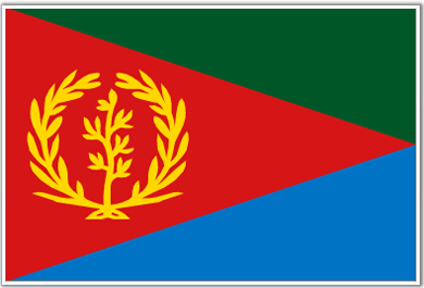
Eritrea
Background
Eritrea was awarded to Ethiopia in 1952 as part of a federation. Ethiopia's annexation of Eritrea as a province 10 years later sparked a 30-year struggle for independence that ended in 1991 with Eritrean rebels defeating governmental forces; independence was overwhelmingly approved in a 1993 referendum. A two-and-a-half-year border war with Ethiopia that erupted in 1998 ended under UN auspices in December 2000. Eritrea currently hosts a UN peacekeeping operation that is monitoring a 25 km-wide Temporary Security Zone on the border with Ethiopia. An international commission, organized to resolve the border dispute, posted its findings in 2002 but final demarcation is on hold due to Ethiopian objections.
Location
Eastern Africa, bordering the Red Sea, between Djibouti and Sudan
Geographic co-ordinates
15 00 N, 39 00 E
Map references
Africa
Area
Total: 121,320 sq km ; land: 121,320 sq km ; water: 0 sq km
Area- comparative
Slightly larger than Pennsylvania
Climate
Hot, dry desert strip along Red Sea coast; cooler and wetter in the central highlands (up to 61 cm of rainfall annually, heaviest June to September); semiarid in western hills and lowlands
Terrain
Dominated by extension of Ethiopian north-south trending highlands, descending on the east to a coastal desert plain, on the northwest to hilly terrain and on the southwest to flat-to-rolling plains
Natural resources
Gold, potash, zinc, copper, salt, possibly oil and natural gas, fish
Natural Hazards
Frequent droughts; locust swarms
Nationality
Noun: Eritrean(s) ; adjective: Eritrean
Languages
Afar, Arabic, Tigre and Kunama, Tigrinya, other Cushitic languages
Country name
Conventional long form: State of Eritrea ; conventional short form: Eritrea ; local long form: Hagere Ertra ; local short form: Ertra ; former: Eritrea Autonomous Region in Ethiopia
Capital
Name: Asmara (Asmera) ; geographic coordinates: 15 20 N, 38 53 E ; time difference: UTC+3 (8 hours ahead of Washington, DC during Standard Time)
Administrative division
6 regions (zobatat, singular - zoba); Anseba, Debub (Southern), Debubawi K'eyih Bahri (Southern Red Sea), Gash Barka, Ma'akel (Central), Semenawi Keyih Bahri (Northern Red Sea)
National holiday
Independence Day, 24 May (1993)
Suffrage
18 years of age; universal
Flag
 Industries
Food processing, beverages, clothing and textiles, salt, cement, commercial ship repair
Currency code
Nakfa (ERN)
Internet code
.er
Ports and terminals
Assab, Massawa