CSS Forums
Sunday, April 28, 2024
08:40 PM (GMT +5)
08:40 PM (GMT +5)
|
|||||||


| General Knowledge, Quizzes, IQ Tests A zone where General Knowledge related to this exam can be shared.Surveys and Threads with polls and questions that require answers can be Posted here |
 |
Share Thread:
 Facebook
 Twitter
 Google+
|
|
|
LinkBack | Thread Tools | Search this Thread |
|
#11
 Monday, June 02, 2008
|
||||
|
||||
|
Colombia Background Colombia was one of the three countries that emerged from the collapse of Gran Colombia in 1830 (the others are Ecuador and Venezuela). A 40-year conflict between government forces and anti-government insurgent groups and illegal paramilitary groups - both heavily funded by the drug trade - escalated during the 1990s. The insurgents lack the military or popular support necessary to overthrow the government, and violence has been decreasing since about 2002, but insurgents continue attacks against civilians and large swaths of the countryside are under guerrilla influence. Paramilitary groups challenge the insurgents for control of territory and the drug trade. Most paramilitary members have demobilized since 2002 in an ongoing peace process, although their commitment to ceasing illicit activity is unclear. The Colombian Government has stepped up efforts to reassert government control throughout the country, and now has a presence in every one of its municipalities. However, neighboring countries worry about the violence spilling over their borders. Location Northern South America, bordering the Caribbean Sea, between Panama and Venezuela, and bordering the North Pacific Ocean, between Ecuador and Panama Geographic co ordinates 4 00 N, 72 00 W Map references South America Area Total: 1,138,910 sq km ; land: 1,038,700 sq km ; water: 100,210 sq km ; note: includes Isla de Malpelo, Roncador Cay, and Serrana Bank Area-comparative Slightly less than twice the size of Texas Climate Tropical along coast and eastern plains; cooler in highlands Terrain Flat coastal lowlands, central highlands, high Andes Mountains, eastern lowland plains Natural resources Petroleum, natural gas, coal, iron ore, nickel, gold, copper, emeralds, hydropower Natural hazards Highlands subject to volcanic eruptions; occasional earthquakes; periodic droughts Nationality Noun: Colombian(s) ; adjective: Colombian Country name Conventional long form: Republic of Colombia ; conventional short form: Colombia ; local long form: Republica de Colombia ; local short form: Colombia Capital Name: Bogota ; geographic coordinates: 4 36 N, 74 05 W ; time difference: UTC-5 (same time as Washington, DC during Standard Time) Administrative division 32 departments (departamentos, singular - departamento) and 1 capital district* (distrito capital); Amazonas, Antioquia, Arauca, Atlantico, Bogota*, Bolivar, Boyaca, Caldas, Caqueta, Casanare, Cauca, Cesar, Choco, Cordoba, Cundinamarca, Guainia, Guaviare, Huila, La Guajira, Magdalena, Meta, Narino, Norte de Santander, Putumayo, Quindio, Risaralda, San Andres y Providencia, Santander, Sucre, Tolima, Valle del Cauca, Vaupes, Vichada National holiday Independence Day, 20 July (1810) Suffrage 18 years of age; universal Flag 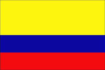 Industries Textiles, food processing, oil, clothing and footwear, beverages, chemicals, cement; gold, coal, emeralds Currency code Colombian peso (COP) Internet country code .co Ports and terminals Barranquilla, Buenaventura, Cartagena, Muelles El Bosque, Puerto Bolivar, Santa Marta, Turbo Comoros Background Comoros has endured 19 coups or attempted coups since gaining independence from France in 1975. In 1997, the islands of Anjouan and Moheli declared independence from Comoros. In 1999, military chief Col. AZALI seized power. He pledged to resolve the secessionist crisis through a confederal arrangement named the 2000 Fomboni Accord. In December 2001, voters approved a new constitution and presidential elections took place in the spring of 2002. Each island in the archipelago elected its own president and a new union president took office in May 2002. Location Southern Africa, group of islands at the northern mouth of the Mozambique Channel, about two-thirds of the way between northern Madagascar and northern Mozambique Geographic co-ordinates 12 10 S, 44 15 E Map references Africa Area Total: 2,170 sq km ; land: 2,170 sq km ; water: 0 sq km Area- comparative Slightly more than 12 times the size of Washington, DC Climate Tropical marine; rainy season (November to May) Terrain Volcanic islands, interiors vary from steep mountains to low hills Natural Hazards Cyclones possible during rainy season (December to April); Le Kartala on Grand Comore is an active volcano Nationality Noun: Comoran(s) ; adjective: Comoran Languages Arabic (official), French (official), Shikomoro (a blend of Swahili and Arabic) Country name Conventional long form: Union of the Comoros ; conventional short form: Comoros ; local long form: Union des Comores ; local short form: Comores Capital Name: Moroni ; geographic coordinates: 11 41 S, 43 16 E ; time difference: UTC+3 (8 hours ahead of Washington, DC during Standard Time) National holiday Independence Day, 6 July (1975) Suffrage 18 years of age; universal Flag  Industries Tourism, perfume distillation Currency code Comoran franc (KMF) Internet code .km Ports and terminals Mayotte, Moutsamoudou Congo , democratic republic of the Background Established as a Belgian colony in 1908, the Republic of the Congo gained its independence in 1960, but its early years were marred by political and social instability. Col. Joseph MOBUTU seized power and declared himself president in a November 1965 coup. He subsequently changed his name - to MOBUTU Sese Seko - as well as that of the country - to Zaire. MOBUTU retained his position for 32 years through several subsequent sham elections, as well as through the use of brutal force. Ethnic strife and civil war, touched off by a massive inflow of refugees in 1994 from fighting in Rwanda and Burundi, led in May 1997 to the toppling of the MOBUTU regime by a rebellion led by Laurent KABILA. He renamed the country the Democratic Republic of the Congo (DRC), but in August 1998 his regime was itself challenged by an insurrection backed by Rwanda and Uganda. Troops from Angola, Chad, Namibia, Sudan, and Zimbabwe intervened to support the Kinshasa regime. A cease-fire was signed in July 1999 by the DRC, Congolese armed rebel groups, Angola, Namibia, Rwanda, Uganda, and Zimbabwe but sporadic fighting continued. Laurent KABILA was assassinated in January 2001 and his son, Joseph KABILA, was named head of state. In October 2002, the new president was successful in negotiating the withdrawal of Rwandan forces occupying eastern Congo; two months later, the Pretoria Accord was signed by all remaining warring parties to end the fighting and establish a government of national unity. A transitional government was set up in July 2003; with Joseph KABILA as president and joined by four vice presidents representing the former government, former rebel groups, and the political opposition. The transitional government held a successful constitutional referendum in December 2005 and elections for the presidency, National Assembly, and provincial legislatures in 2006. KABILA was inaugurated president in December 2006. Location Central Africa, northeast of Angola Geographic co-ordinates 0 00 N, 25 00 E Map references Africa Area Total: 2,345,410 sq km ; land: 2,267,600 sq km ; water: 77,810 sq km Area- comparative Slightly less than one-fourth the size of the US Climate Tropical; hot and humid in equatorial river basin; cooler and drier in southern highlands; cooler and wetter in eastern highlands; north of Equator - wet season (April to October), dry season (December to February); south of Equator - wet season (November to March), dry season (April to October) Terrain Vast central basin is a low-lying plateau; mountains in east Natural resources Diamonds, gold, silver, zinc, manganese, tin, uranium, coal, hydropower, timber Natural Hazards Periodic droughts in south; Congo River floods (seasonal); in the east, in the Great Rift Valley, there are active volcanoes Nationality Noun: Congolese (singular and plural) ; adjective: Congolese or Congo Languages French (official), Lingala (a lingua franca trade language), Kingwana (a dialect of Kiswahili or Swahili), Kikongo, Tshiluba Country name Conventional long form: Democratic Republic of the Congo ; conventional short form: none ; local long form: Republique Democratique du Congo ; local short form: none ; former: Congo Free State, Belgian Congo, Congo/Leopoldville, Congo/Kinshasa, Zaire ; abbreviation: DRC Capital Name: Kinshasa ; geographic coordinates: 4 18 S, 15 18 E ; time difference: UTC+1 (six hours ahead of Washington, DC during Standard Time) Administrative division 10 provinces (provinces, singular - province) and 1 city* (ville); Bandundu, Bas-Congo, Equateur, Kasai-Occidental, Kasai-Oriental, Katanga, Kinshasa*, Maniema, Nord-Kivu, Orientale, Sud-Kivu ; note: According to the Constitution adopted in December 2005, the current administrative divisions will be subdivided into 26 new provinces 30 June 1960 (from Belgium) National holiday Independence Day, 30 June (1960) Suffrage 18 years of age; universal and compulsory Flag Industries Mining (diamonds, copper, zinc), mineral processing, consumer products (including textiles, footwear, cigarettes, processed foods and beverages), cement, commercial ship repair Currency code Congolese franc (CDF) Internet code .cd Ports and terminals Banana, Boma, Bukavu, Bumba, Goma, Kalemie, Kindu, Kinshasa, Kisangani, Matadi, Mbandaka Congo, Republic of the Background Upon independence in 1960, the former French region of Middle Congo became the Republic of the Congo. A quarter century of experimentation with Marxism was abandoned in 1990 and a democratically elected government took office in 1992. A brief civil war in 1997 restored former Marxist President Denis SASSOU-NGUESSO, and ushered in a period of ethnic and political unrest. Southern-based rebel groups agreed to a final peace accord in March 2003, but the calm is tenuous and refugees continue to present a humanitarian crisis. The Republic of Congo was once one of Africa's largest petroleum producers, but with declining production it will need to hope for new offshore oil finds to sustain its oil earnings over the long term. Location Western Africa, bordering the South Atlantic Ocean, between Angola and Gabon Geographic co-ordinates 1 00 S, 15 00 E Map references Africa Area Total: 342,000 sq km ; land: 341,500 sq km ; water: 500 sq km Area- comparative Slightly smaller than Montana Climate Topical; rainy season (March to June); dry season (June to October); persistent high temperatures and humidity; particularly enervating climate astride the Equator Terrain Castal plain, southern basin, central plateau, northern basin Natural resources Petroleum, timber, potash, lead, zinc, uranium, copper, phosphates, gold, magnesium, natural gas, hydropower Natural Hazards Air pollution from vehicle emissions; water pollution from the dumping of raw sewage; tap water is not potable; deforestation Nationality Noun: Congolese (singular and plural) ; adjective: Congolese or Congo Languages French (official), Lingala and Monokutuba (lingua franca trade languages), many local languages and dialects (of which Kikongo is the most widespread) Country name Conventional long form: Republic of the Congo ; conventional short form: Congo (Brazzaville) ; local long form: Republique du Congo ; local short form: none ; former: Middle Congo, Congo/Brazzaville, Congo Capital Name: Brazzaville ; geographic coordinates: 4 16 S, 15 17 E ; time difference: UTC+1 (six hours ahead of Washington, DC during Standard Time) National holiday Independence Day, 15 August (1960) Suffrage 18 years of age; universal Flag  Industries Petroleum extraction, cement, lumber, brewing, sugar, palm oil, soap, flour, cigarettes Currency code Communaute Financiere Africaine franc (XAF) Internet code .cg Ports and terminals Brazzaville, Djeno, Impfondo, Ouesso, Oyo, Pointe-Noire Cook Islands Background Named after Captain COOK, who sighted them in 1770, the islands became a British protectorate in 1888. By 1900, administrative control was transferred to New Zealand; in 1965 residents chose self-government in free association with New Zealand. The emigration of skilled workers to New Zealand and government deficits are continuing problems. Location Oceania, group of islands in the South Pacific Ocean, about one-half of the way from Hawaii to New Zealand Geographic co-ordinates 21 14 S, 159 46 W Map references Oceania Area Total: 236.7 sq km ; land: 236.7 sq km ; water: 0 sq km Area- comparative 1.3 times the size of Washington, DC Climate Tropical oceanic; moderated by trade winds; a dry season from April to November and a more humid season from December to March Terrain Low coral atolls in north; volcanic, hilly islands in south Natural Hazards Typhoons (November to March) Nationality Noun: Cook Islander(s) ; adjective: Cook Islander Languages English (official), Maori Country name Conventional long form: none ; conventional short form: Cook Islands ; former: Harvey Islands Capital Name: Avarua ; geographic coordinates: 21 12 S, 159 46 W ; time difference: UTC-10 (5 hours behind Washington, DC during Standard Time) National holiday Constitution Day, first Monday in August (1965) Suffrage NA years of age; universal adult Flag  Industries Fruit processing, tourism, fishing, clothing, handicrafts Currency code New Zealand dollar (NZD) Internet code .ck
__________________
Time is the longest distance between two places. 
|


|
#12
Friday, June 06, 2008
|
||||
|
||||
|
Coral Sea Islands Background Scattered over more than three-quarters of a million square kilometers of ocean, the Coral Sea Islands were declared a territory of Australia in 1969. They are uninhabited except for a small meteorological staff on the Willis Islets. Automated weather stations, beacons, and a lighthouse occupy many other islands and reefs. Location Oceania, islands in the Coral Sea, northeast of Australia Geographic co ordinates 18 00 S, 152 00 E Map references Oceania Area Total: less than 3 sq km ; land: less than 3 sq km ; water: 0 sq km ; note: includes numerous small islands and reefs scattered over a sea area of about 780,000 sq km, with the Willis Islets the most Climate Tropical Terrain Sand and coral reefs and islands (or cays) Natural resources NEGL Natural hazards Occasional tropical cyclones Country name Conventional long form: Coral Sea Islands Territory ; conventional short form: Coral Sea Islands Flag  Ports and terminals None; offshore anchorage only Costa Rica Background Although explored by the Spanish early in the 16th century, initial attempts at colonizing Costa Rica proved unsuccessful due to a combination of factors, including: disease from mosquito-infested swamps, brutal heat, resistance by natives, and pirate raids. It was not until 1563 that a permanent settlement of Cartago was established in the cooler, fertile central highlands. The area remained a colony for some two and a half centuries. In 1821, Costa Rica became one of several Central American provinces that jointly declared their independence from Spain. Two years later it joined the United Provinces of Central America, but this federation disintegrated in 1838, at which time Costa Rica proclaimed its sovereignty and independence. Since the late 19th century, only two brief periods of violence have marred the country's democratic development. Although it still maintains a large agricultural sector, Costa Rica has expanded its economy to include strong technology and tourism industries. The standard of living is relatively high. Land ownership is widespread. Location Central America, bordering both the Caribbean Sea and the North Pacific Ocean, between Nicaragua and Panama Geographic co-ordinates 10 00 N, 84 00 W Map references Central America and the Caribbean Area Total: 51,100 sq km ; land: 50,660 sq km ; water: 440 sq km ; note: includes Isla del Coco Area- comparative Slightly smaller than West Virginia Climate Tropical and subtropical; dry season (December to April); rainy season (May to November); cooler in highlands Terrain Coastal plains separated by rugged mountains including over 100 volcanic cones, of which several are major volcanoes Natural Hazards Occasional earthquakes, hurricanes along Atlantic coast; frequent flooding of lowlands at onset of rainy season and landslides; active volcanoes Nationality Noun: Costa Rican(s) ; adjective: Costa Rican Languages Spanish (official), English Country name Conventional long form: Republic of Costa Rica ; conventional short form: Costa Rica ; local long form: Republica de Costa Rica ; local short form: Costa Rica Capital Name: San Jose ; geographic coordinates: 9 56 N, 84 05 W ; time difference: UTC-6 (1 hour behind Washington, DC during Standard Time) Administrative division 7 provinces (provincias, singular - provincia); Alajuela, Cartago, Guanacaste, Heredia, Limon, Puntarenas, San Jose National holiday Independence Day, 15 September (1821) Suffrage 18 years of age; universal and compulsory Flag 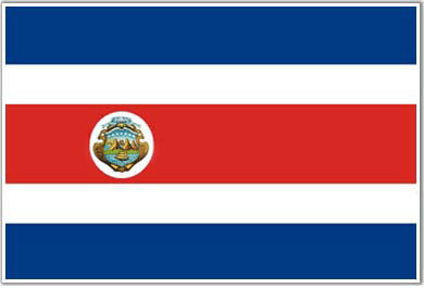 Industries Microprocessors, food processing, textiles and clothing, construction materials, fertilizer, plastic products Currency code Costa Rican colon (CRC) Internet code .cr Ports and terminals Caldera, Puerto Limon Cote d'Ivoire Background Close ties to France since independence in 1960, the development of cocoa production for export, and foreign investment made Cote d'Ivoire one of the most prosperous of the tropical African states, but did not protect it from political turmoil. In December 1999, a military coup - the first ever in Cote d'Ivoire's history - overthrew the government. Junta leader Robert GUEI blatantly rigged elections held in late 2000 and declared himself the winner. Popular protest forced him to step aside and brought runner-up Laurent GBAGBO into power. Ivorian dissidents and disaffected members of the military launched a failed coup attempt in September 2002. Rebel forces claimed the northern half of the country, and in January 2003 were granted ministerial positions in a unity government under the auspices of the Linas-Marcoussis Peace Accord. President GBAGBO and rebel forces resumed implementation of the peace accord in December 2003 after a three-month stalemate, but issues that sparked the civil war, such as land reform and grounds for citizenship, remain unresolved. The central government has yet to exert control over the northern regions and tensions remain high between GBAGBO and opposition leaders. Several thousand French and West African troops remain in Cote d'Ivoire to maintain peace and facilitate the disarmament, demobilization, and rehabilitation process. Location Western Africa, bordering the North Atlantic Ocean, between Ghana and Liberia Geographic co-ordinates 8 00 N, 5 00 W Map references Africa Area Total: 322,460 sq km ; land: 318,000 sq km ; water: 4,460 sq km Area- comparative Slightly larger than New Mexico Climate Tropical along coast, semiarid in far north; three seasons - warm and dry (November to March), hot and dry (March to May), hot and wet (June to October) Terrain Mostly flat to undulating plains; mountains in northwest Natural resources Petroleum, natural gas, diamonds, manganese, iron ore, cobalt, bauxite, copper, gold, nickel, tantalum, silica sand, clay, cocoa beans, coffee, palm oil, hydropower Natural Hazards Coast has heavy surf and no natural harbors; during the rainy season torrential flooding is possible Nationality Noun: Ivoirian(s) ; adjective: Ivoirian Languages French (official), 60 native dialects with Dioula the most widely spoken Country name Conventional long form: Republic of Cote d'Ivoire ; conventional short form: Cote d'Ivoire ; local long form: Republique de Cote d'Ivoire ; local short form: Cote d'Ivoire ; former: Ivory Coast Capital Name: Yamoussoukro ; geographic coordinates: 5 19 N, 4 02 W ; time difference: UTC 0 (5 hours ahead of Washington, DC during Standard Time) ; note: although Yamoussoukro has been the official capital since 1983, Abidjan remains the commercial and administrative center; the US, like other countries, maintains its Embassy in Abidjan Administrative division 19 regions; Agneby, Bafing, Bas-Sassandra, Denguele, Dix-Huit Montagnes, Fromager, Haut-Sassandra, Lacs, Lagunes, Marahoue, Moyen-Cavally, Moyen-Comoe, N'zi-Comoe, Savanes, Sud-Bandama, Sud-Comoe, Vallee du Bandama, Worodougou, Zanzan National holiday Independence Day, 7 August (1960) Suffrage 18 years of age; universal Flag Industries Foodstuffs, beverages; wood products, oil refining, truck and bus assembly, textiles, fertilizer, building materials, electricity, ship construction and repair Currency code Communaute Financiere Africaine franc (XOF) Internet code .ci Ports and terminals Abidjan, Aboisso, Dabou, San-Pedro Croatia Background The lands that today comprise Croatia were part of the Austro-Hungarian Empire until the close of World War I. In 1918, the Croats, Serbs, and Slovenes formed a kingdom known after 1929 as Yugoslavia. Following World War II, Yugoslavia became a federal independent Communist state under the strong hand of Marshal TITO. Although Croatia declared its independence from Yugoslavia in 1991, it took four years of sporadic, but often bitter, fighting before occupying Serb armies were mostly cleared from Croatian lands. Under UN supervision, the last Serb-held enclave in eastern Slavonia was returned to Croatia in 1998 Location Southeastern Europe, bordering the Adriatic Sea, between Bosnia and Herzegovina and Slovenia Geographic co-ordinates 45 10 N, 15 30 E Map references Europe Area Total: 56,542 sq km ; land: 56,414 sq km ; water: 128 sq km Area- comparative Slightly smaller than West Virginia Climate Mediterranean and continental; continental climate predominant with hot summers and cold winters; mild winters, dry summers along coast Terrain Geographically diverse; flat plains along Hungarian border, low mountains and highlands near Adriatic coastline and islands Natural resources Oil, some coal, bauxite, low-grade iron ore, calcium, gypsum, natural asphalt, silica, mica, clays, salt, hydropower Natural Hazards Destructive earthquakes Nationality Noun: Croat(s), Croatian(s) ; adjective: Croatian Country name Conventional long form: Republic of Croatia ; conventional short form: Croatia ; local long form: Republika Hrvatska ; local short form: Hrvatska ; former: People's Republic of Croatia, Socialist Capital Name: Zagreb ; geographic coordinates: 45 48 N, 15 58 E ; time difference: UTC+1 (6 hours ahead of Washington, DC during Standard Time) ; daylight saving time: +1hr, begins last Sunday in March; ends last Sunday in October Administrative division 20 counties (zupanije, zupanija - singular) and 1 city* (grad - singular); Bjelovarsko-Bilogorska Zupanija, Brodsko-Posavska Zupanija, Dubrovacko-Neretvanska Zupanija, Istarska Zupanija, Karlovacka Zupanija, Koprivnicko-Krizevacka Zupanija, Krapinsko-Zagorska Zupanija, Licko-Senjska Zupanija, Medimurska Zupanija, Osjecko-Baranjska Zupanija, Pozesko-Slavonska Zupanija, Primorsko-Goranska Zupanija, Sibensko-Kninska Zupanija, Sisacko-Moslavacka Zupanija, Splitsko-Dalmatinska Zupanija, Varazdinska Zupanija, Viroviticko-Podravska Zupanija, Vukovarsko-Srijemska Zupanija, Zadarska Zupanija, Zagreb*, Zagrebacka Zupanija National holiday Independence Day, 8 October (1991); note - 25 June 1991 is the day the Croatian Parliament voted for independence; following a three-month moratorium to allow the European Community to solve the Yugoslav crisis peacefully, Parliament adopted a decision on 8 October 1991 to sever constitutional relations with Yugoslavia Suffrage 18 years of age; universal (16 years of age, if employed) Flag 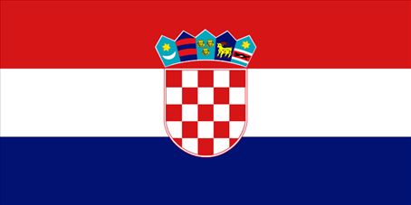 Industries Chemicals and plastics, machine tools, fabricated metal, electronics, pig iron and rolled steel products, aluminum, paper, wood products, construction materials, textiles, shipbuilding, petroleum and petroleum refining, food and beverages, tourism Currency code Kuna (HRK) Internet code .hr Ports and terminals Omisalj, Ploce, Rijeka, Sibenik, Vukovar (on Danube) Cuba Background The native Amerindian population of Cuba began to decline after the European discovery of the island by Christopher COLUMBUS in 1492 and following its development as a Spanish colony during the next several centuries. Large numbers of African slaves were imported to work the coffee and sugar plantations, and Havana became the launching point for the annual treasure fleets bound for Spain from Mexico and Peru. Spanish rule, marked initially by neglect, became increasingly repressive, provoking an independence movement and occasional rebellions that were harshly suppressed. It was US intervention during the Spanish-American War in 1898 that finally overthrew Spanish rule. The subsequent Treaty of Paris established Cuban independence, which was granted in 1902 after a three-year transition period. Fidel CASTRO led a rebel army to victory in 1959; his iron rule has held the regime together since then. Cuba's Communist revolution, with Soviet support, was exported throughout Latin America and Africa during the 1960s, 1970s, and 1980s. The country is now slowly recovering from a severe economic recession in 1990, following the withdrawal of former Soviet subsidies, worth $4 billion to $6 billion annually. Cuba portrays its difficulties as the result of the US embargo in place since 1961. Illicit migration to the US - using homemade rafts, alien smugglers, air flights, or via the southwest border - is a continuing problem. The US Coast Guard intercepted 2,810 individuals attempting to cross the Straits of Florida in fiscal year 2006. Location Caribbean, island between the Caribbean Sea and the North Atlantic Ocean, 150 km south of Key West, Florida Geographic co-ordinates 21 30 N, 80 00 W Map references Central America and the Caribbean Area Total: 110,860 sq km ; land: 110,860 sq km ; water: 0 sq km Area- comparative Slightly smaller than Pennsylvania Climate Tropical; moderated by trade winds; dry season (November to April); rainy season (May to October) Terrain Mostly flat to rolling plains, with rugged hills and mountains in the southeast Natural resources Cobalt, nickel, iron ore, chromium, copper, salt, timber, silica, petroleum, arable land Natural Hazards The east coast is subject to hurricanes from August to November (in general, the country averages about one hurricane every other year); droughts are common Nationality Noun: Cuban(s) ; adjective: Cuban Languages Spanish Country name Conventional long form: Republic of Cuba ; conventional short form: Cuba ; local long form: Republica de Cuba ; local short form: Cuba Capital Name: Havana ; geographic coordinates: 23 08 N, 82 22 W ; time difference: UTC-5 (same time as Washington, DC during Standard Time) ; daylight saving time: +1hr, begins last Sunday in March; ends last Sunday in October Administrative division 14 provinces (provincias, singular - provincia) and 1 special municipality* (municipio especial); Camaguey, Ciego de Avila, Cienfuegos, Ciudad de La Habana, Granma, Guantanamo, Holguin, Isla de la Juventud*, La Habana, Las Tunas, Matanzas, Pinar del Rio, Sancti Spiritus, Santiago de Cuba, Villa Clara National holiday Triumph of the Revolution, 1 January (1959) Suffrage 16 years of age; universal Flag  Industries Sugar, petroleum, tobacco, construction, nickel, steel, cement, agricultural machinery, pharmaceuticals Currency code CUP (nonconvertible Cuban peso) and CUC (convertible Cuban peso) Internet code .cu Ports and terminals Cienfuegos, Havana, Matanzas Cyprus Background A former British colony, Cyprus became independent in 1960 following years of resistance to British rule. Tensions between the Greek Cypriot majority and Turkish Cypriot minority came to a head in December 1963, when violence broke out in the capital of Nicosia. Despite the deployment of UN peacekeepers in 1964, sporadic intercommunal violence continued forcing most Turkish Cypriots into enclaves throughout the island. In 1974, a Greek Government-sponsored attempt to seize control of Cyprus was met by military intervention from Turkey, which soon controlled more than a third of the island. In 1983, the Turkish-held area declared itself the "Turkish Republic of Northern Cyprus," but it is recognized only by Turkey. The latest two-year round of UN-brokered talks - between the leaders of the Greek Cypriot and Turkish Cypriot communities to reach an agreement to reunite the divided island - ended when the Greek Cypriots rejected the UN settlement plan in an April 2004 referendum. The entire island entered the EU on 1 May 2004, although the EU acquis - the body of common rights and obligations - applies only to the areas under direct Republic of Cyprus control, and is suspended in the areas administered by Turkish Cypriots. At present, every Cypriot carrying a Cyprus passport has the status of a European citizen; however, EU laws do not apply to north Cyprus. Nicosia continues to oppose EU efforts to establish direct trade and economic links to north Cyprus as a way of encouraging the Turkish Cypriot community to continue to support reunification. Location Middle East, island in the Mediterranean Sea, south of Turkey Geographic co-ordinates 35 00 N, 33 00 E Map references Middle East Area Total: 9,250 sq km (of which 3,355 sq km are in north Cyprus) ; land: 9,240 sq km ; water: 10 sq km Area- comparative About 0.6 times the size of Connecticut Climate Temperate; Mediterranean with hot, dry summers and cool winters Terrain Central plain with mountains to north and south; scattered but significant plains along southern coast Natural resources Copper, pyrites, asbestos, gypsum, timber, salt, marble, clay earth pigment Natural Hazards Moderate earthquake activity; droughts Nationality Noun: Cypriot(s) ; adjective: Cypriot Languages Greek, Turkish, English Country name Conventional long form: Republic of Cyprus ; conventional short form: Cyprus ; local long form: Kypriaki Dimokratia/Kibris Cumhuriyeti ; local short form: Kypros/Kibris ; note: the Turkish Cypriot community (north Cyprus) refers to itself as the "Turkish Republic of Northern Cyprus" (TRNC) Capital Name: Nicosia (Lefkosia) ; geographic coordinates: 35 10 N, 33 22 E ; time difference: UTC+2 (7 hours ahead of Washington, DC during Standard Time) ; daylight saving time: +1hr, begins last Sunday in March; ends last Sunday in October Administrative division 6 districts; Famagusta, Kyrenia, Larnaca, Limassol, Nicosia, Paphos; note - Turkish Cypriot area's administrative divisions include Kyrenia, all but a small part of Famagusta, and small parts of Lefkosia (Nicosia) and Larnaca National holiday Independence Day, 1 October (1960); note - Turkish Cypriots celebrate 15 November (1983) as Independence Day Suffrage 18 years of age; universal Flag  Industries Tourism, food and beverage processing, cement and gypsum production, ship repair and refurbishment, textiles, light chemicals, metal products, wood, paper, stone, and clay products Currency code Republic of Cyprus: Cypriot pound (CYP) Internet code .cy Ports and terminals Famagusta, Kyrenia, Larnaca, Limassol, Vasilikos Czech Republic Background Following the First World War, the closely related Czechs and Slovaks of the former Austro-Hungarian Empire merged to form Czechoslovakia. During the interwar years, the new country's leaders were frequently preoccupied with meeting the demands of other ethnic minorities within the republic, most notably the Sudeten Germans and the Ruthenians (Ukrainians). After World War II, a truncated Czechoslovakia fell within the Soviet sphere of influence. In 1968, an invasion by Warsaw Pact troops ended the efforts of the country's leaders to liberalize Communist party rule and create "socialism with a human face." Anti-Soviet demonstrations the following year ushered in a period of harsh repression. With the collapse of Soviet authority in 1989, Czechoslovakia regained its freedom through a peaceful "Velvet Revolution." On 1 January 1993, the country underwent a "velvet divorce" into its two national components, the Czech Republic and Slovakia. The Czech Republic joined NATO in 1999 and the European Union in 2004. Location Central Europe, southeast of Germany Geographic co-ordinates 49 45 N, 15 30 E Map references Europe Area Total: 78,866 sq km ; land: 77,276 sq km ; water: 1,590 sq km Area- comparative Slightly smaller than South Carolina Climate Temperate; cool summers; cold, cloudy, humid winters Terrain Bohemia in the west consists of rolling plains, hills, and plateaus surrounded by low mountains; Moravia in the east consists of very hilly country Natural Hazards Flooding Nationality Noun: Czech(s) ; adjective: Czech Country name Conventional long form: Czech Republic ; conventional short form: Czech Republic ; local long form: Ceska Republika ; local short form: Cesko Capital Name: Prague ; geographic coordinates: 40 55 N, 21 00 E ; time difference: UTC+1 (6 hours ahead of Washington, DC during Standard Time) ; daylight saving time: +1hr, begins last Sunday in March; ends last Sunday in October Administrative division 13 regions (kraje, singular - kraj) and 1 capital city* (hlavni mesto); Jihocesky Kraj, Jihomoravsky Kraj, Karlovarsky Kraj, Kralovehradecky Kraj, Liberecky Kraj, Moravskoslezsky Kraj, Olomoucky Kraj, Pardubicky Kraj, Plzensky Kraj, Praha (Prague)*, Stredocesky Kraj, Ustecky Kraj, Vysocina, Zlinsky Kraj National holiday Czech Founding Day, 28 October (1918) Suffrage 18 years of age; universal Flag  Industries Metallurgy, machinery and equipment, motor vehicles, glass, armaments Currency code Czech koruna (CZK) Internet code .cz Ports and terminals Decin, Prague, Usti nad Labem
__________________
Time is the longest distance between two places.
|
|
#13
Tuesday, June 17, 2008
|
||||
|
||||
|
Denmark Background Once the seat of Viking raiders and later a major north European power, Denmark has evolved into a modern, prosperous nation that is participating in the general political and economic integration of Europe. It joined NATO in 1949 and the EEC (now the EU) in 1973. However, the country has opted out of certain elements of the European Union's Maastricht Treaty, including the European Economic and Monetary Union (EMU), European defense cooperation, and issues concerning certain justice and home affairs. Location Northern Europe, bordering the Baltic Sea and the North Sea, on a peninsula north of Germany (Jutland); also includes two major islands (Sjaelland and Fyn) Geographic co-ordinates 56 00 N, 10 00 E Map references Europe Area Total: 43,094 sq km ; land: 42,394 sq km ; water: 700 sq km ; note: includes the island of Bornholm in the Baltic Sea and the rest of metropolitan Denmark (the Jutland Peninsula, and the major islands of Sjaelland and Fyn), but excludes the Faroe Islands and Greenland Area- comparative Slightly less than twice the size of Massachusetts Climate Temperate; humid and overcast; mild, windy winters and cool summers Terrain Low and flat to gently rolling plains Natural resources Petroleum, natural gas, fish, salt, limestone, chalk, stone, gravel and sand Natural Hazards Flooding is a threat in some areas of the country (e.g., parts of Jutland, along the southern coast of the island of Lolland) that are protected from the sea by a system of dikes Nationality Noun: Dane(s) ; adjective: Danish Languages Danish, Faroese, Greenlandic (an Inuit dialect), German (small minority) ; note: English is the predominant second language Country name Conventional long form: Kingdom of Denmark ; conventional short form: Denmark ; local long form: Kongeriget Danmark ; local short form: Danmark Capital Name: Copenhagen ; geographic coordinates: 55 40 N, 12 35 E ; time difference: UTC+1 (6 hours ahead of Washington, DC during Standard Time) ; daylight saving time: +1hr, begins last Sunday in March; ends last Sunday in October National holiday None designated; Constitution Day, 5 June (1849) is generally viewed as the National Day Suffrage 18 years of age; universal Flag  Industries Iron, steel, nonferrous metals, chemicals, food processing, machinery and transportation equipment, textiles and clothing, electronics, construction, furniture and other wood products, shipbuilding and refurbishment, windmills, pharmaceuticals, medical equipment Currency code Danish krone (DKK) Internet code .dk Ports and terminals Aalborg, Aarhus, Asnaesvaerkets, Copenhagen, Elsinore, Ensted, Esbjerg, Fredericia, Frederikshavn, Kalundborg, Odense, Roenne Dhekelia Background By terms of the 1960 Treaty of Establishment that created the independent Republic of Cyprus, the UK retained full sovereignty and jurisdiction over two areas of almost 254 square kilometers - Akrotiri and Dhekelia. The larger of these is the Dhekelia Sovereign Base Area, which is also referred to as the Eastern Sovereign Base Area. Location On the southeast coast of Cyprus near Famagusta Geographic co-ordinates 34 59 N, 33 45 E Map references Middle East Area Total: 130.8 sq km ; note: area surrounds three Cypriot enclaves Area- comparative About three-quarters the size of Washington, DC total: NA; note - boundary with Cyprus is being resurveyed Languages English, Greek Country name Conventional long form: Dhekelia Sovereign Base Area ; conventional short form: Dhekelia Capital Name: Episkopi Cantonment; located in Akrotiri ; geographic coordinates: 34 40 N, 32 51 E ; time difference: UTC+2 (7 hours ahead of Washington, DC during Standard Time) ; daylight saving time: +1hr, begins last Sunday in March; ends last Sunday in October Flag  Currency code Cypriot pound (CYP) Djibouti Background The French Territory of the Afars and the Issas became Djibouti in 1977. Hassan Gouled APTIDON installed an authoritarian one-party state and proceeded to serve as president until 1999. Unrest among the Afars minority during the 1990s led to a civil war that ended in 2001 following the conclusion of a peace accord between Afar rebels and the Issa-dominated government. In 1999, Djibouti's first multi-party presidential elections resulted in the election of Ismail Omar GUELLEH; he was re-elected to a second and final term in 2005. Djibouti occupies a strategic geographic location at the mouth of the Red Sea and serves as an important transshipment location for goods entering and leaving the east African highlands. The present leadership favors close ties to France, which maintains a significant military presence in the country, but is also developing stronger ties with the US. Djibouti hosts the only US military base in sub-Saharan Africa and is a front-line state in the global war on terrorism. Location Eastern Africa, bordering the Gulf of Aden and the Red Sea, between Eritrea and Somalia Geographic co-ordinates 11 30 N, 43 00 E Map references Africa Area Total: 23,000 sq km ; land: 22,980 sq km ; water: 20 sq km Area- comparative Slightly smaller than Massachusetts Climate Desert; torrid, dry Terrain Coastal plain and plateau separated by central mountains Natural resources Geothermal areas, gold, clay, granite, limestone, marble, salt, diatomite, gypsum, pumice, petroleum Natural Hazards Earthquakes; droughts; occasional cyclonic Nationality Noun: Djiboutian(s) ; adjective: Djiboutian Languages French (official), Arabic (official), Somali, Afar Country name Conventional long form: Republic of Djibouti ; conventional short form: Djibouti ; local long form: Republique de Djibouti/Jumhuriyat Jibuti ; local short form: Djibouti/Jibuti ; former: French Territory of the Afars and Issas, French Somaliland Capital Name: Djibouti ; geographic coordinates: 11 30 N, 43 15 E ; time difference: UTC+3 (8 hours ahead of Washington, DC during Standard Time) Administrative division 6 districts (cercles, singular - cercle); Ali Sabieh, Arta, Dikhil, Djibouti, Obock, Tadjourah National holiday Independence Day, 27 June (1977) Suffrage 18 years of age; universal adult Flag  Industries Construction, agricultural processing, salt Currency code Djiboutian franc (DJF) Internet code .dj Ports and terminals Djibouti Dominica Background Dominica was the last of the Caribbean islands to be colonized by Europeans due chiefly to the fierce resistance of the native Caribs. France ceded possession to Great Britain in 1763, which made the island a colony in 1805. In 1980, two years after independence, Dominica's fortunes improved when a corrupt and tyrannical administration was replaced by that of Mary Eugenia CHARLES, the first female prime minister in the Caribbean, who remained in office for 15 years. Some 3,000 Carib Indians still living on Dominica are the only pre-Columbian population remaining in the eastern Caribbean. Location Caribbean, island between the Caribbean Sea and the North Atlantic Ocean, about one-half of the way from Puerto Rico to Trinidad and Tobago Geographic co-ordinates 15 25 N, 61 20 W Map references Central America and the Caribbean Area Total: 754 sq km ; land: 754 sq km ; water: 0 sq km Area- comparative Slightly more than four times the size of Washington, DC Climate Tropical; moderated by northeast trade winds; heavy rainfall Terrain Rugged mountains of volcanic origin Natural resources Timber, hydropower, arable land Natural Hazards Flash floods are a constant threat; destructive hurricanes can be expected during the late summer months Nationality Noun: Dominican(s) ; adjective: Dominican Languages English (official), French patois Country name Conventional long form: Commonwealth of Dominica ; conventional short form: Dominica Capital Name: Roseau ; geographic coordinates: 15 18 N, 61 24 W ; time difference: UTC-4 (1 hour ahead of Washington, DC during Standard Time) Administrative division 10 parishes; Saint Andrew, Saint David, Saint George, Saint John, Saint Joseph, Saint Luke, Saint Mark, Saint Patrick, Saint Paul, Saint Peter National holiday Independence Day, 3 November (1978) Suffrage 18 years of age; universal Flag  Industries Soap, coconut oil, tourism, copra, furniture, cement blocks, shoes Currency code East Caribbean dollar (XCD) Internet code .dm Ports and terminals Portsmouth, Roseau Dominican Republic Background Explored and claimed by Christopher COLUMBUS on his first voyage in 1492, the island of Hispaniola became a springboard for Spanish conquest of the Caribbean and the American mainland. In 1697, Spain recognized French dominion over the western third of the island, which in 1804 became Haiti. The remainder of the island, by then known as Santo Domingo, sought to gain its own independence in 1821, but was conquered and ruled by the Haitians for 22 years; it finally attained independence as the Dominican Republic in 1844. In 1861, the Dominicans voluntarily returned to the Spanish Empire, but two years later they launched a war that restored independence in 1865. A legacy of unsettled, mostly non-representative rule followed, capped by the dictatorship of Rafael Leonidas TRUJILLO from 1930-1961. Juan BOSCH was elected president in 1962, but was deposed in a military coup in 1963. In 1965, the United States led an intervention in the midst of a civil war sparked by an uprising to restore BOSCH. In 1966, Joaquin BALAGUER defeated BOSCH in an election to become president. BALAGUER maintained a tight grip on power for most of the next 30 years when international reaction to flawed elections forced him to curtail his term in 1996. Since then, regular competitive elections have been held in which opposition candidates have won the presidency. Former President (1996-2000) Leonel FERNANDEZ Reyna won election to a second term in 2004 following a constitutional amendment allowing presidents to serve more than one term. Location Caribbean, eastern two-thirds of the island of Hispaniola, between the Caribbean Sea and the North Atlantic Ocean, east of Haiti Geographic co-ordinates 19 00 N, 70 40 W Map references Central America and the Caribbean Area Total: 48,730 sq km ; land: 48,380 sq km ; water: 350 sq km Area- comparative Slightly more than twice the size of New Hampshire Climate Tropical maritime; little seasonal temperature variation; seasonal variation in rainfall Terrain Rugged highlands and mountains with fertile valleys interspersed Natural resources Nickel, bauxite, gold, silver Natural Hazards Severe storms from June to October; occasional flooding; periodic droughts Nationality Noun: Dominican(s) ; adjective: Dominican Languages Spanish Country name Conventional long form: Dominican Republic ; conventional short form: The Dominican ; local long form: Republica Dominicana ; local short form: La Dominicana Capital Name: Santo Domingo ; geographic coordinates: 18 28 N, 69 54 W ; time difference: UTC-4 (1 hour ahead of Washington, DC during Standard Time) Administrative division 31 provinces (provincias, singular - provincia) and 1 district* (distrito); Azua, Baoruco, Barahona, Dajabon, Distrito Nacional*, Duarte, El Seibo, Elias Pina, Espaillat, Hato Mayor, Independencia, La Altagracia, La Romana, La Vega, Maria Trinidad Sanchez, Monsenor Nouel, Monte Cristi, Monte Plata, Pedernales, Peravia, Puerto Plata, Salcedo, Samana, San Cristobal, San Jose de Ocoa, San Juan, San Pedro de Macoris, Sanchez Ramirez, Santiago, Santiago Rodriguez, Santo Domingo, Valverde National holiday Independence Day, 27 February (1844) Suffrage 18 years of age, universal and compulsory; married persons regardless of age ; note: members of the armed forces and national police cannot vote Flag  Industries Tourism, sugar processing, ferronickel and gold mining, textiles, cement, tobacco Currency code Dominican peso (DOP) Internet code .do Ports and terminals Boca Chica, Puerto Plata, Rio Haina, Santo Domingo Army, Navy, Air Force
__________________
Time is the longest distance between two places.
|
|
#14
Tuesday, July 01, 2008
|
||||
|
||||
|
East Timor Background The Portuguese began to trade with the island of Timor in the early 16th century and colonized it in mid-century. Skirmishing with the Dutch in the region eventually resulted in an 1859 treaty in which Portugal ceded the western portion of the island. Imperial Japan occupied East Timor from 1942 to 1945, but Portugal resumed colonial authority after the Japanese defeat in World War II. East Timor declared itself independent from Portugal on 28 November 1975 and was invaded and occupied by Indonesian forces nine days later. It was incorporated into Indonesia in July 1976 as the province of East Timor. An unsuccessful campaign of pacification followed over the next two decades, during which an estimated 100,000 to 250,000 individuals lost their lives. On 30 August 1999, in a UN-supervised popular referendum, an overwhelming majority of the people of East Timor voted for independence from Indonesia. Between the referendum and the arrival of a multinational peacekeeping force in late September 1999, anti-independence Timorese militias - organized and supported by the Indonesian military - commenced a large-scale, scorched-earth campaign of retribution. The militias killed approximately 1,400 Timorese and forcibly pushed 300,000 people into West Timor as refugees. The majority of the country's infrastructure, including homes, irrigation systems, water supply systems, and schools, and nearly 100% of the country's electrical grid were destroyed. On 20 September 1999 the Australian-led peacekeeping troops of the International Force for East Timor (INTERFET) deployed to the country and brought the violence to an end. On 20 May 2002, East Timor was internationally recognized as an independent state. In March of 2006, a military strike led to violence and a near breakdown of law and order. Over 2,000 Australian, New Zealand, and Portuguese police and peacekeepers deployed to East Timor in late May. Although many of the peacekeepers were replaced by UN police officers, 850 Australian soldiers remained as of 1 January 2007. Location Southeastern Asia, northwest of Australia in the Lesser Sunda Islands at the eastern end of the Indonesian archipelago; note - East Timor includes the eastern half of the island of Timor, the Oecussi (Ambeno) region on the northwest portion of the island of Timor, and the islands of Pulau Atauro and Pulau Jaco Geographic co-ordinates 8 50 S, 125 55 E Map references Southeast Asia Area Total: 15,007 sq km ; land: NA sq km ; water: NA sq km Area- comparative Slightly larger than Connecticut Climate Tropical; hot, humid; distinct rainy and dry seasons Terrain Mountainous Natural resources Gold, petroleum, natural gas, manganese, marble Natural Hazards Floods and landslides are common; earthquakes, tsunamis, tropical cyclones Nationality Noun: Timorese ; adjective: Timorese Languages Tetum (official), Portuguese (official), Indonesian, English ; note: there are about 16 indigenous languages; Tetum, Galole, Mambae, and Kemak are spoken by significant numbers of people Country name Conventional long form: Democratic Republic of Timor-Leste ; conventional short form: East Timor ; local long form: Republika Demokratika Timor Lorosa'e [Tetum]; Republica Democratica de Timor-Leste [Portuguese] ; local short form: Timor Lorosa'e [Tetum]; Timor-Leste [Portuguese] ; former: Portuguese Timor Capital Name: Dili ; geographic coordinates: 8 35 S, 125 36 E ; time difference: UTC+9 (14 hours ahead of Washington, DC during Standard Time) Administrative division 13 administrative districts; Aileu, Ainaro, Baucau, Bobonaro (Maliana), Cova-Lima (Suai), Dili, Ermera, Lautem (Los Palos), Liquica, Manatuto, Manufahi (Same), Oecussi (Ambeno), Viqueque National holiday Independence Day, 28 November (1975) Suffrage 17 years of age; universal Flag  Industries Printing, soap manufacturing, handicrafts, woven cloth Currency code US dollar (USD) Internet code .tl Ports and terminals Dili Ecuador Background What is now Ecuador formed part of the northern Inca Empire until the Spanish conquest in 1533. Quito became a seat of Spanish colonial government in 1563 and part of the Viceroyalty of New Granada in 1717. The territories of the Viceroyalty - New Granada (Colombia), Venezuela, and Quito - gained their independence by 1819 and formed a federation known as Gran Colombia. When Quito withdrew in 1830, the traditional name was changed in favor of the "Republic of the Equator." Between 1904 and 1942, Ecuador lost territories in a series of conflicts with its neighbors. A border war with Peru that flared in 1995 was resolved in 1999. Although Ecuador marked 25 years of civilian governance in 2004, the period has been marred by political instability. Protests in Quito have contributed to the mid-term ouster of Ecuador's last three democratically elected Presidents. Location Western South America, bordering the Pacific Ocean at the Equator, between Colombia and Peru Geographic co-ordinates 2 00 S, 77 30 W Map references South America Area Total: 283,560 sq km ; land: 276,840 sq km ; water: 6,720 sq km ; note: includes Galapagos Islands Area- comparative Slightly smaller than Nevada Climate Tropical along coast, becoming cooler inland at higher elevations; tropical in Amazonian jungle lowlands Terrain Coastal plain (costa), inter-Andean central highlands (sierra), and flat to rolling eastern jungle (oriente) Natural resources Petroleum, fish, timber, hydropower Natural Hazards Frequent earthquakes, landslides, volcanic activity; floods; periodic droughts Nationality Noun: Ecuadorian(s) ; adjective: Ecuadorian Languages Spanish (official), Amerindian languages (especially Quechua) Country name Conventional long form: Republic of Ecuador ; conventional short form: Ecuador ; local long form: Republica del Ecuador ; local short form: Ecuador Capital Name: Quito ; geographic coordinates: 0 13 S, 78 30 W ; time difference: UTC-5 (same time as Washington, DC during Standard Time) Administrative division 22 provinces (provincias, singular - provincia); Azuay, Bolivar, Canar, Carchi, Chimborazo, Cotopaxi, El Oro, Esmeraldas, Galapagos, Guayas, Imbabura, Loja, Los Rios, Manabi, Morona-Santiago, Napo, Orellana, Pastaza, Pichincha, Sucumbios, Tungurahua, Zamora-Chinchipe National holiday Independence Day (independence of Quito), 10 August (1809) Suffrage 18 years of age; universal, compulsory for literate persons ages 18-65, optional for other eligible voters Flag  Industries Petroleum, food processing, textiles, wood products, chemicals Currency code US dollar (USD) Internet code .ec Ports and terminals Esmeraldas, Guayaquil, La Libertad, Manta, Puerto Bolivar Egypt Background The regularity and richness of the annual Nile River flood, coupled with semi-isolation provided by deserts to the east and west, allowed for the development of one of the world's great civilizations. A unified kingdom arose circa 3200 B.C., and a series of dynasties ruled in Egypt for the next three millennia. The last native dynasty fell to the Persians in 341 B.C., who in turn were replaced by the Greeks, Romans, and Byzantines. It was the Arabs who introduced Islam and the Arabic language in the 7th century and who ruled for the next six centuries. A local military caste, the Mamluks took control about 1250 and continued to govern after the conquest of Egypt by the Ottoman Turks in 1517. Following the completion of the Suez Canal in 1869, Egypt became an important world transportation hub, but also fell heavily into debt. Ostensibly to protect its investments, Britain seized control of Egypt's government in 1882, but nominal allegiance to the Ottoman Empire continued until 1914. Partially independent from the UK in 1922, Egypt acquired full sovereignty following World War II. The completion of the Aswan High Dam in 1971 and the resultant Lake Nasser have altered the time-honored place of the Nile River in the agriculture and ecology of Egypt. A rapidly growing population (the largest in the Arab world), limited arable land, and dependence on the Nile all continue to overtax resources and stress society. The government has struggled to ready the economy for the new millennium through economic reform and massive investment in communications and physical infrastructure. Location Northern Africa, bordering the Mediterranean Sea, between Libya and the Gaza Strip, and the Red Sea north of Sudan, and includes the Asian Sinai Peninsula Geographic co-ordinates 27 00 N, 30 00 E Map references Africa Area Total: 1,001,450 sq km ; land: 995,450 sq km ; water: 6,000 sq km Area- comparative Slightly more than three times the size of New Mexico Climate Desert; hot, dry summers with moderate winters Terrain Vast desert plateau interrupted by Nile valley and delta Natural resources Petroleum, natural gas, iron ore, phosphates, manganese, limestone, gypsum, talc, asbestos, lead, zinc Natural Hazards Periodic droughts; frequent earthquakes, flash floods, landslides; hot, driving windstorm called khamsin occurs in spring; dust storms, sandstorms Nationality Noun: Egyptian(s) ; adjective: Egyptian Languages Arabic (official), English and French widely understood by educated classes Country name Conventional long form: Arab Republic of Egypt ; conventional short form: Egypt ; local long form: Jumhuriyat Misr al-Arabiyah ; local short form: Misr ; former: United Arab Republic (with Syria) Capital Name: Cairo ; geographic coordinates: 30 03 N, 31 15 E ; time difference: UTC+2 (7 hours ahead of Washington, DC during Standard Time) ; daylight saving time: +1hr, begins last Friday in April; ends last Thursday in September Administrative division 26 governorates (muhafazat, singular - muhafazah); Ad Daqahliyah, Al Bahr al Ahmar, Al Buhayrah, Al Fayyum, Al Gharbiyah, Al Iskandariyah, Al Isma'iliyah, Al Jizah, Al Minufiyah, Al Minya, Al Qahirah, Al Qalyubiyah, Al Wadi al Jadid, As Suways, Ash Sharqiyah, Aswan, Asyut, Bani Suwayf, Bur Sa'id, Dumyat, Janub Sina', Kafr ash Shaykh, Matruh, Qina, Shamal Sina', Suhaj National holiday Revolution Day, 23 July (1952) Suffrage 18 years of age; universal and compulsory Flag  Industries Textiles, food processing, tourism, chemicals, pharmaceuticals, hydrocarbons, construction, cement, metals, light manufactures Currency code Egyptian pound (EGP) Internet code .eg Ports and terminals Alexandria, Damietta, El Dekheila, Port Said, Suez, Zeit El Salvador Background El Salvador achieved independence from Spain in 1821 and from the Central American Federation in 1839. A 12-year civil war, which cost about 75,000 lives, was brought to a close in 1992 when the government and leftist rebels signed a treaty that provided for military and political reforms. Location Central America, bordering the North Pacific Ocean, between Guatemala and Honduras Geographic co-ordinates 13 50 N, 88 55 W Map references Central America and the Caribbean Area Total: 21,040 sq km ; land: 20,720 sq km ; water: 320 sq km Area- comparative Slightly smaller than Massachusetts Climate Tropical; rainy season (May to October); dry season (November to April); tropical on coast; temperate in uplands Terrain Mostly mountains with narrow coastal belt and central plateau Natural resources Hydropower, geothermal power, petroleum, arable land Natural Hazards Deforestation; soil erosion; water pollution; contamination of soils from disposal of toxic wastes Nationality Noun: Salvadoran(s) ; adjective: Salvadoran Languages Conventional long form: Republic of El Salvador ; conventional short form: El Salvador ; local long form: Republica de El Salvador ; local short form: El Salvador Country name Name: San Salvador ; geographic coordinates: 13 42 N, 89 12 W ; time difference: UTC-6 (1 hour behind Washington, DC during Standard Time) Capital Name: San Salvador ; geographic coordinates: 13 42 N, 89 12 W ; time difference: UTC-6 (1 hour behind Washington, DC during Standard Time) Administrative division 14 departments (departamentos, singular - departamento); Ahuachapan, Cabanas, Chalatenango, Cuscatlan, La Libertad, La Paz, La Union, Morazan, San Miguel, San Salvador, San Vicente, Santa Ana, Sonsonate, Usulutan National holiday Independence Day, 15 September (1821) Suffrage 18 years of age; universal Flag  Industries Food processing, beverages, petroleum, chemicals, fertilizer, textiles, furniture, light metals Currency code US dollar (USD) Internet code .sv Ports and terminals Acajutla, Puerto Cutuco Equatorial Guinea Background Equatorial Guinea gained independence in 1968 after 190 years of Spanish rule. This tiny country, composed of a mainland portion plus five inhabited islands, is one of the smallest on the African continent. President Teodoro OBIANG NGUEMA MBASOGO has ruled the country since 1979 when he seized power in a coup. Although nominally a constitutional democracy since 1991, the 1996 and 2002 presidential elections - as well as the 1999 and 2004 legislative elections - were widely seen as flawed. The president exerts almost total control over the political system and has discouraged political opposition. Equatorial Guinea has experienced rapid economic growth due to the discovery of large offshore oil reserves, and in the last decade has become Sub-Saharan Africa's third largest oil exporter. Despite the country's economic windfall from oil production resulting in a massive increase in government revenue in recent years, there have been few improvements in the population's living standards. Location Western Africa, bordering the Bight of Biafra, between Cameroon and Gabon Geographic co-ordinates 2 00 N, 10 00 E Map references Africa Area Total: 28,051 sq km ; land: 28,051 sq km ; water: 0 sq km Area- comparative Slightly smaller than Maryland Climate Total: 539 km ; border countries: Cameroon 189 km, Gabon 350 km Terrain Topical; always hot, humid Natural resources Petroleum, natural gas, timber, gold, bauxite, diamonds, tantalum, sand and gravel, clay Natural Hazards Violent windstorms, flash floods Nationality Noun: Equatorial Guinean(s) or Equatoguinean(s) ; adjective: Equatorial Guinean or Equatoguinean Languages Spanish (official), French (official), pidgin English, Fang, Bubi, Ibo Country name Conventional long form: Republic of Equatorial Guinea ; conventional short form: Equatorial Guinea ; local long form: Republica de Guinea Ecuatorial/Republique de Guinee equatoriale ; local short form: Guinea Ecuatorial/Guinee equatoriale ; former: Spanish Guinea Capital Name: Malabo ; geographic coordinates: 3 45 N, 8 47 E ; time difference: UTC+1 (6 hours ahead of Washington, DC during Standard Time) Administrative division 7 provinces (provincias, singular - provincia); Annobon, Bioko Norte, Bioko Sur, Centro Sur, Kie-Ntem, Litoral, Wele-Nzas National holiday Independence Day, 12 October (1968) Suffrage 18 years of age; universal adult Flag  Industries Petroleum, fishing, sawmilling, natural gas Currency code Communaute Financiere Africaine franc (XAF) Internet code .gq Ports and terminals Malabo Eritrea Background Eritrea was awarded to Ethiopia in 1952 as part of a federation. Ethiopia's annexation of Eritrea as a province 10 years later sparked a 30-year struggle for independence that ended in 1991 with Eritrean rebels defeating governmental forces; independence was overwhelmingly approved in a 1993 referendum. A two-and-a-half-year border war with Ethiopia that erupted in 1998 ended under UN auspices in December 2000. Eritrea currently hosts a UN peacekeeping operation that is monitoring a 25 km-wide Temporary Security Zone on the border with Ethiopia. An international commission, organized to resolve the border dispute, posted its findings in 2002 but final demarcation is on hold due to Ethiopian objections. Location Eastern Africa, bordering the Red Sea, between Djibouti and Sudan Geographic co-ordinates 15 00 N, 39 00 E Map references Africa Area Total: 121,320 sq km ; land: 121,320 sq km ; water: 0 sq km Area- comparative Slightly larger than Pennsylvania Climate Hot, dry desert strip along Red Sea coast; cooler and wetter in the central highlands (up to 61 cm of rainfall annually, heaviest June to September); semiarid in western hills and lowlands Terrain Dominated by extension of Ethiopian north-south trending highlands, descending on the east to a coastal desert plain, on the northwest to hilly terrain and on the southwest to flat-to-rolling plains Natural resources Gold, potash, zinc, copper, salt, possibly oil and natural gas, fish Natural Hazards Frequent droughts; locust swarms Nationality Noun: Eritrean(s) ; adjective: Eritrean Languages Afar, Arabic, Tigre and Kunama, Tigrinya, other Cushitic languages Country name Conventional long form: State of Eritrea ; conventional short form: Eritrea ; local long form: Hagere Ertra ; local short form: Ertra ; former: Eritrea Autonomous Region in Ethiopia Capital Name: Asmara (Asmera) ; geographic coordinates: 15 20 N, 38 53 E ; time difference: UTC+3 (8 hours ahead of Washington, DC during Standard Time) Administrative division 6 regions (zobatat, singular - zoba); Anseba, Debub (Southern), Debubawi K'eyih Bahri (Southern Red Sea), Gash Barka, Ma'akel (Central), Semenawi Keyih Bahri (Northern Red Sea) National holiday Independence Day, 24 May (1993) Suffrage 18 years of age; universal Flag  Industries Food processing, beverages, clothing and textiles, salt, cement, commercial ship repair Currency code Nakfa (ERN) Internet code .er Ports and terminals Assab, Massawa
__________________
Time is the longest distance between two places.
|
|
#15
Tuesday, July 01, 2008
|
||||
|
||||
|
Estonia Background After centuries of Danish, Swedish, German, and Russian rule, Estonia attained independence in 1918. Forcibly incorporated into the USSR in 1940, it regained its freedom in 1991, with the collapse of the Soviet Union. Since the last Russian troops left in 1994, Estonia has been free to promote economic and political ties with Western Europe. It joined both NATO and the EU in the spring of 2004. Location Eastern Europe, bordering the Baltic Sea and Gulf of Finland, between Latvia and Russia Geographic co-ordinates 59 00 N, 26 00 E Map references Europe Area Total: 45,226 sq km ; land: 43,211 sq km ; water: 2,015 sq km ; note: includes 1,520 islands in the Baltic Sea Area- comparative Slightly smaller than New Hampshire and Vermont combined Climate Maritime, wet, moderate winters, cool summers Terrain Marshy, lowlands; flat in the north, hilly in the south Natural resources Oil shale, peat, phosphorite, clay, limestone, sand, dolomite, arable land, sea mud Natural Hazards Sometimes flooding occurs in the spring Nationality Noun: Estonian(s) ; adjective: Estonian Country name Conventional long form: Republic of Estonia ; conventional short form: Estonia ; local long form: Eesti Vabariik ; local short form: Eesti ; former: Estonian Soviet Socialist Republic Capital Name: Tallinn ; geographic coordinates: 59 25 N, 24 45 E ; time difference: UTC+2 (7 hours ahead of Washington, DC during Standard Time) ; daylight saving time: +1hr, begins last Sunday in March; ends last Sunday in October Administrative division 15 counties (maakonnad, singular - maakond): Harjumaa (Tallinn), Hiiumaa (Kardla), Ida-Virumaa (Johvi), Jarvamaa (Paide), Jogevamaa (Jogeva), Laanemaa (Haapsalu), Laane-Virumaa (Rakvere), Parnumaa (Parnu), Polvamaa (Polva), Raplamaa (Rapla), Saaremaa (Kuressaare), Tartumaa (Tartu), Valgamaa (Valga), Viljandimaa (Viljandi), Vorumaa (Voru) ; note: counties have the administrative center name following in parentheses National holiday Independence Day, 24 February (1918) Suffrage 18 years of age; universal for all Estonian citizens Flag  Industries Engineering, electronics, wood and wood products, textile; information technology, telecommunications Currency code Estonian kroon (EEK) Internet code .ee Ports and terminals Kopli, Kuivastu, Muuga, Tallinn, Virtsu Ethiopia Background Unique among African countries, the ancient Ethiopian monarchy maintained its freedom from colonial rule with the exception of the 1936-41 Italian occupation during World War II. In 1974, a military junta, the Derg, deposed Emperor Haile SELASSIE (who had ruled since 1930) and established a socialist state. Torn by bloody coups, uprisings, wide-scale drought, and massive refugee problems, the regime was finally toppled in 1991 by a coalition of rebel forces, the Ethiopian People's Revolutionary Democratic Front (EPRDF). A constitution was adopted in 1994, and Ethiopia's first multiparty elections were held in 1995. A border war with Eritrea late in the 1990's ended with a peace treaty in December 2000. Final demarcation of the boundary is currently on hold due to Ethiopian objections to an international commission's finding requiring it to surrender territory considered sensitive to Ethiopia. Location Eastern Africa, west of Somalia Geographic co-ordinates 8 00 N, 38 00 E Map references Africa Area Total: 1,127,127 sq km ; land: 1,119,683 sq km ; water: 7,444 sq km Area- comparative Slightly less than twice the size of Texas Climate Tropical monsoon with wide topographic-induced variation Terrain High plateau with central mountain range divided by Great Rift Valley Natural resources Small reserves of gold, platinum, copper, potash, natural gas, hydropower Natural Hazards Deforestation; overgrazing; soil erosion; desertification; water shortages in some areas from water-intensive farming and poor management Nationality Noun: Ethiopian(s) ; adjective: Ethiopian Country name Conventional long form: Federal Democratic Republic of Ethiopia ; conventional short form: Ethiopia ; local long form: Ityop'iya Federalawi Demokrasiyawi Ripeblik ; local short form: Ityop'iya ; former: Abyssinia, Italian East Africa ; abbreviation: FDRE Capital Name: Addis Ababa ; geographic coordinates: 9 02 N, 38 42 E ; time difference: UTC+3 (8 hours ahead of Washington, DC during Standard Time) Administrative division 9 ethnically-based states (kililoch, singular - kilil) and 2 self-governing administrations* (astedaderoch, singular - astedader); Adis Abeba* (Addis Ababa), Afar, Amara (Amhara), Binshangul Gumuz, Dire Dawa*, Gambela Hizboch (Gambela Peoples), Hareri Hizb (Harari People), Oromiya (Oromia), Sumale (Somali), Tigray, Ye Debub Biheroch Bihereseboch na Hizboch (Southern Nations, Nationalities and Peoples) National holiday National Day (defeat of MENGISTU regime), 28 May (1991) Suffrage 18 years of age; universal Flag  Industries Food processing, beverages, textiles, leather, chemicals, metals processing, cement Currency code Birr (ETB) Internet code .et European Union Background Following the two devastating World Wars of the first half of the 20th century, a number of European leaders in the late 1940s became convinced that the only way to establish a lasting peace was to unite the two chief belligerent nations - France and Germany - both economically and politically. In 1950, the French Foreign Minister Robert SCHUMAN proposed an eventual union of all Europe, the first step of which would be the integration of the coal and steel industries of Western Europe. The following year the European Coal and Steel Community (ECSC) was set up when six members, Belgium, France, West Germany, Italy, Luxembourg, and the Netherlands, signed the Treaty of Paris.The ECSC was so successful that within a few years the decision was made to integrate other parts of the countries' economies. In 1957, the Treaties of Rome created the European Economic Community (EEC) and the European Atomic Energy Community (Euratom), and the six member states undertook to eliminate trade barriers among themselves by forming a common market. In 1967, the institutions of all three communities were formally merged into the European Community (EC), creating a single Commission, a single Council of Ministers, and the European Parliament. Members of the European Parliament were initially selected by national parliaments, but in 1979 the first direct elections were undertaken and they have been held every five years since.In 1973, the first enlargement of the EC took place with the addition of Denmark, Ireland, and the United Kingdom. The 1980s saw further membership expansion with Greece joining in 1981 and Spain and Portugal in 1986. The 1992 Treaty of Maastricht laid the basis for further forms of cooperation in foreign and defense policy, in judicial and internal affairs, and in the creation of an economic and monetary union - including a common currency. This further integration created the European Union (EU). In 1995, Austria, Finland, and Sweden joined the EU, raising the membership total to 15.A new currency, the euro, was launched in world money markets on 1 January 1999; it became the unit of exchange for all of the EU states except the United Kingdom, Sweden, and Denmark. In 2002, citizens of the 12 euro-area countries began using the euro banknotes and coins. Ten new countries joined the EU in 2004 - Cyprus, the Czech Republic, Estonia, Hungary, Latvia, Lithuania, Malta, Poland, Slovakia, and Slovenia - and in 2007 Bulgaria and Romania joined, bringing the current membership to 27. In order to ensure that the EU can continue to function efficiently with an expanded membership, the 2003 Treaty of Nice set forth rules streamlining the size and procedures of EU institutions. An EU Constitutional Treaty, signed in Rome on 29 October 2004, gave member states two years to ratify the document before it was scheduled to take effect on 1 November 2006. Referenda held in France and the Netherlands in May-June 2005 rejected the proposed constitution. This development suspended the ratification effort and left the longer-term political integration of the EU in limbo. The evolution of the European Union (EU) from a regional economic agreement among six neighboring states in 1951 to today's supranational organization of 25 countries across the European continent stands as an unprecedented phenomenon in the annals of history. Dynastic unions for territorial consolidation were long the norm in Europe. On a few occasions even country-level unions were arranged - the Polish-Lithuanian Commonwealth and the Austro-Hungarian Empire were examples - but for such a large number of nation-states to cede some of their sovereignty to an overarching entity is truly unique. Although the EU is not a federation in the strict sense, it is far more than a free-trade association such as ASEAN, NAFTA, or Mercosur, and it has many of the attributes associated with independent nations: its own flag, anthem, founding date, and currency, as well as an incipient common foreign and security policy in its dealings with other nations. In the future, many of these nation-like characteristics are likely to be expanded. Thus, inclusion of basic intelligence on the EU has been deemed appropriate as a new, separate entity in The World Factbook. However, because of the EU's special status, this description is placed after the regular country entries. Location Europe between the North Atlantic Ocean in the west and Russia, Belarus, and Ukraine to the east Map references Europe Area Total: 4,324,782 sq km Area- comparative Less than one-half the size of the US Climate Cold temperate; potentially subarctic in the north to temperate; mild wet winters; hot dry summers in the south Terrain Fairly flat along the Baltic and Atlantic coast; mountainous in the central and southern areas Natural resources Iron ore, natural gas, petroleum, coal, copper, lead, zinc, bauxite, uranium, potash, salt, hydropower, arable land, timber, fish Natural Hazards Flooding along coasts; avalanches in mountainous area; earthquakes in the south; volcanic eruptions in Italy; periodic droughts in Spain; ice floes in the Baltic Capital Name: Brussels (Belgium) ; geographic coordinates: 50 50 N, 4 20 E ; time difference: UTC+1 (6 hours ahead of Washington, DC during Standard Time) ; daylight saving time: +1hr, begins last Sunday in March; ends last Sunday in October ; note: the Council of the European Union meets in Brussels, the European Parliament meets in Brussels and Strasbourg, France, and the Court of Justice of the European Communities meets in Luxembourg National holiday Europe Day 9 May (1950) Suffrage 18 years of age; universal Flag  Industries Among the world's largest and most technologically advanced, the European Union industrial base includes: ferrous and non-ferrous metal production and processing, metal products, petroleum, coal, cement, chemicals, pharmaceuticals, aerospace, rail transportation equipment, passenger and commercial vehicles, construction equipment, industrial equipment, shipbuilding, electrical power equipment, machine tools and automated manufacturing systems, electronics and telecommunications equipment, fishing, food and beverage processing, furniture, paper, textiles, tourism Currency code EUR Internet code .eu Ports and terminals Antwerp (Belgium), Barcelona (Spain), Braila (Romania), Bremen (Germany), Burgas (Bulgaria), Constanta (Romania), Copenhagen (Denmark), Galati (Romania), Gdansk (Poland), Hamburg (Germany), Helsinki (Finland), Las Palmas (Canary Islands, Spain), Le Havre (France), Lisbon (Portugal), London (UK), Marseille (France), Naples (Italy), Peiraiefs or Piraeus (Greece), Riga (Latvia), Rotterdam (Netherlands), Stockholm (Sweden), Talinn (Estonia), Tulcea (Romania), Varna (Bulgaria)
__________________
Time is the longest distance between two places.
|
|
#16
Saturday, August 23, 2008
|
||||
|
||||
|
Falkland Islands (Islas Malvinas) Background Although first sighted by an English navigator in 1592, the first landing (English) did not occur until almost a century later in 1690, and the first settlement (French) was not established until 1764. The colony was turned over to Spain two years later and the islands have since been the subject of a territorial dispute, first between Britain and Spain, then between Britain and Argentina. The UK asserted its claim to the islands by establishing a naval garrison there in 1833. Argentina invaded the islands on 2 April 1982. The British responded with an expeditionary force that landed seven weeks later and after fierce fighting forced Argentine surrender on 14 June 1982. Location Southern South America, islands in the South Atlantic Ocean, east of southern Argentina Geographic co-ordinates 51 45 S, 59 00 W Map references South America Area Total: 12,173 sq km ; land: 12,173 sq km ; water: 0 sq km ; note: includes the two main islands of East and West Falkland and about 200 small islands Area- comparative Slightly smaller than Connecticut Climate Cold marine; strong westerly winds, cloudy, humid; rain occurs on more than half of days in year; average annual rainfall is 24 inches in Stanley; occasional snow all year, except in January and February, but does not accumulate Terrain Rocky, hilly, mountainous with some boggy, undulating plains Natural resources Fish, squid, wildlife, calcified seaweed, sphagnum moss Natural Hazards Strong winds persist throughout the year Nationality Noun: Falkland Islander(s) ; adjective: Falkland Island Languages English Country name Conventional long form: none ; conventional short form: Falkland Islands (Islas Malvinas) Capital Name: Stanley ; geographic coordinates: 51 42 S, 57 41 W ; time difference: UTC-4 (1 hour ahead of Washington, DC during Standard Time) ; daylight saving time: +1hr, begins first Sunday in September; ends third Sunday in April National holiday Liberation Day, 14 June (1982) Suffrage 18 years of age; universal Flag  Industries Fish and wool processing; tourism Currency code Falkland pound (FKP) Internet code .fk Faroe Island Background The population of the Faroe Islands is largely descended from Viking settlers who arrived in the 9th century. The islands have been connected politically to Denmark since the 14th century. A high degree of self government was attained in 1948. Location Northern Europe, island group between the Norwegian Sea and the North Atlantic Ocean, about one-half of the way from Iceland to Norway Geographic co-ordinates 62 00 N, 7 00 W Map references Europe Area Total: 1,399 sq km ; land: 1,399 sq km ; water: 0 sq km (some lakes and streams) Area- comparative Eight times the size of Washington, DC Climate Mild winters, cool summers; usually overcast; foggy, windy Terrain Rugged, rocky, some low peaks; cliffs along most of coast Natural Hazards Fish, whales, hydropower, possible oil and gas Nationality Noun: Faroese (singular and plural) ; adjective: Faroese Languages Faroese (derived from Old Norse), Danish Country name Conventional long form: none ; conventional short form: Faroe Islands ; local long form: none ; local short form: Foroyar Capital Name: Torshavn ; geographic coordinates: 62 01 N, 6 46 W ; time difference: UTC (5 hours ahead of Washington, DC during Standard Time) ; daylight saving time: +1hr, begins last Sunday in March; ends last Sunday in October Administrative division None (part of the Kingdom of Denmark; self-governing overseas administrative division of Denmark); there are no first-order administrative divisions as defined by the US Government, but there are 34 municipalities National holiday 5 June 1953 (Danish constitution) Suffrage 18 years of age; universal Flag  Industries Fishing, fish processing, small ship repair and refurbishment, handicrafts Currency code Danish krone (DKK) Internet code .fo Fiji Background Fiji became independent in 1970, after nearly a century as a British colony. Democratic rule was interrupted by two military coups in 1987, caused by concern over a government perceived as dominated by the Indian community (descendants of contract laborers brought to the islands by the British in the 19th century). The coups and a 1990 constitution that cemented native Melanesian control of Fiji, led to heavy Indian emigration; the population loss resulted in economic difficulties, but ensured that Melanesians became the majority. A new constitution enacted in 1997 was more equitable. Free and peaceful elections in 1999 resulted in a government led by an Indo-Fijian, but a civilian-led coup in May 2000 ushered in a prolonged period of political turmoil. Parliamentary elections held in August 2001 provided Fiji with a democratically elected government led by Prime Minister Laisenia QARASE. Re-elected in May 2006, QARASE was ousted in a December 2006 military coup led by Commodore Voreqe BAINIMARAMA, who initially appointed himself acting president. In January 2007, BAINIMARAMA was appointed interim prime minister. Location Oceania, island group in the South Pacific Ocean, about two-thirds of the way from Hawaii to New Zealand Geographic co-ordinates 18 00 S, 175 00 E Map references Oceania Area Total: 18,270 sq km ; land: 18,270 sq km ; water: 0 sq km Area- comparative Slightly smaller than New Jersey Climate Tropical marine; only slight seasonal temperature variation Terrain Mostly mountains of volcanic origin Natural resources Timber, fish, gold, copper, offshore oil potential, hydropower Natural Hazards Cyclonic storms can occur from November to January Nationality Noun: Fijian(s) ; adjective: Fijian Languages English (official), Fijian (official), Hindustani Country name Conventional long form: Republic of the Fiji Islands ; conventional short form: Fiji ; local long form: Republic of the Fiji Islands/Matanitu ko Viti ; local short form: Fiji/Viti Capital Name: Suva (on Viti Levu) ; geographic coordinates: 18 08 S, 178 25 E ; time difference: UTC+12 (17 hours ahead of Washington, DC during Standard Time) Administrative divisions 4 divisions and 1 dependency*; Central, Eastern, Northern, Rotuma*, Western National holiday Independence Day, second Monday of October (1970) Suffrage 21 years of age; universal Flag  Industries Tourism, sugar, clothing, copra, gold, silver, lumber, small cottage industries Currency code Fijian dollar (FJD) Internet code .fj Ports and terminals Lambasa, Lautoka, Suva Finland Background Finland was a province and then a grand duchy under Sweden from the 12th to the 19th centuries and an autonomous grand duchy of Russia after 1809. It won its complete independence in 1917. During World War II, it was able to successfully defend its freedom and resist invasions by the Soviet Union - albeit with some loss of territory. In the subsequent half century, the Finns made a remarkable transformation from a farm/forest economy to a diversified modern industrial economy; per capita income is now on par with Western Europe. A member of the European Union since 1995, Finland was the only Nordic state to join the euro system at its initiation in January 1999. Location Northern Europe, bordering the Baltic Sea, Gulf of Bothnia, and Gulf of Finland, between Sweden and Russia Geographic co-ordinates 64 00 N, 26 00 E Map references Europe Area Total: 338,145 sq km ; land: 304,473 sq km ; water: 33,672 sq km Area- comparative Slightly smaller than Montana Climate Cold temperate; potentially subarctic but comparatively mild because of moderating influence of the North Atlantic Current, Baltic Sea, and more than 60,000 lakes Terrain Mostly low, flat to rolling plains interspersed with lakes and low hills Natural resources Timber, iron ore, copper, lead, zinc, chromite, nickel, gold, silver, limestone Natural Hazards Air pollution from manufacturing and power plants contributing to acid rain; water pollution from industrial wastes, agricultural chemicals; habitat loss threatens wildlife populations Nationality Noun: Finn(s) ; adjective: Finnish Country name Conventional long form: Republic of Finland ; conventional short form: Finland ; local long form: Suomen tasavalta/Republiken Finland ; local short form: Suomi/Finland Capital Name: Helsinki ; geographic coordinates: 60 10 N, 24 58 E ; time difference: UTC+2 (7 hours ahead of Washington, DC during Standard Time) ; daylight saving time: +1hr, begins last Sunday in March; ends last Sunday in October Administrative division 6 provinces (laanit, singular - laani); Aland, Etela-Suomen Laani, Ita-Suomen Laani, Lansi-Suomen Laani, Lappi, Oulun Laani National holiday Independence Day, 6 December (1917) Suffrage 18 years of age; universal Flag  Industries Metals and metal products, electronics, machinery and scientific instruments, shipbuilding, pulp and paper, foodstuffs, chemicals, textiles, clothing Currency code euro (EUR) Internet code .fi Ports and terminals Hamina, Hanko, Helsinki, Kotka, Naantali, Pori, Porvoo, Raahe, Rauma, Turku France Background Although ultimately a victor in World Wars I and II, France suffered extensive losses in its empire, wealth, manpower, and rank as a dominant nation-state. Nevertheless, France today is one of the most modern countries in the world and is a leader among European nations. Since 1958, it has constructed a presidential democracy resistant to the instabilities experienced in earlier parliamentary democracies. In recent years, its reconciliation and cooperation with Germany have proved central to the economic integration of Europe, including the introduction of a common exchange currency, the euro, in January 1999. At present, France is at the forefront of efforts to develop the EU's military capabilities to supplement progress toward an EU foreign policy. Location Western Europe, bordering the Bay of Biscay and English Channel, between Belgium and Spain, southeast of the UK; bordering the Mediterranean Sea, between Italy and Spain ; French Guiana: Northern South America, bordering the North Atlantic Ocean, between Brazil and Suriname ; Guadeloupe: Caribbean, islands between the Caribbean Sea and the North Atlantic Ocean, southeast of Puerto Rico ; Martinique: Caribbean, island between the Caribbean Sea and North Atlantic Ocean, north of Trinidad and Tobago ; Reunion: Southern Africa, island in the Indian Ocean, east of Madagascar Geographic co-ordinates 46 00 N, 2 00 E ; French Guiana: 4 00 N, 53 00 W ; Guadeloupe: 16 15 N, 61 35 W ; Martinique: 14 40 N, 61 00 W ; Reunion: 21 06 S, 55 36 E Map references Europe ; French Guiana: South America ; Guadeloupe: Central America and the Caribbean ; Martinique: Central America and the Caribbean ; Reunion: World Area Total: 643,427 sq km; 547,030 sq km (metropolitan France) ; land: 640,053 sq km; 545,630 sq km sq km (metropolitan France) ; water: 3,374 sq km; 1,400 sq km (metropolitan France) Area- comparative Slightly less than the size of Texas Climate Generally cool winters and mild summers, but mild winters and hot summers along the Mediterranean; occasional strong, cold, dry, north-to-northwesterly wind known as mistral ; French Guiana: tropical; hot, humid; little seasonal temperature variation ; Guadeloupe and Martinique: subtropical tempered by trade winds; moderately high humidity; rainy season (June to October); vulnerable to devasting cyclones (hurricanes) every eight years on average ; Reunion: tropical, but temperature moderates with elevation; cool and dry (May to November), hot and rainy (November to April) Terrain Mostly flat plains or gently rolling hills in north and west; remainder is mountainous, especially Pyrenees in south, Alps in east ; French Guiana: low-lying coastal plains rising to hills and small mountains ; Guadeloupe: Basse-Terre is volcanic in origin with interior mountains; Grande-Terre is low limestone formation; most of the seven other islands are volcanic in origin ; Martinique: mountainous with indented coastline; dormant volcano ; Reunion: mostly rugged and mountainous; fertile lowlands along coast Natural resources Coal, iron ore, bauxite, zinc, uranium, antimony, arsenic, potash, feldspar, fluorospar, gypsum, timber, fish ; French Guiana: gold deposits, petroleum, kaolin, niobium, tantalum, clay Natural Hazards Metropolitan France: flooding; avalanches; midwinter windstorms; drought; forest fires in south near the Mediterranean ; overseas departments: hurricanes (cyclones), flooding, volcanic activity (Guadeloupe, Martinique, Reunion) Nationality Noun: Frenchman(men), Frenchwoman(women) ; adjective: French Languages Basque, Flemish) ; overseas departments: French, Creole patois Country name Conventional long form: French Republic ; conventional short form: France ; local long form: Republique francaise ; local short form: France Capital Name: Paris ; geographic coordinates: 48 52 N, 2 20 E ; time difference: UTC+1 (6 hours ahead of Washington, DC during Standard Time) ; daylight saving time: +1hr, begins last Sunday in March; ends last Sunday in October Administrative division 26 regions (regions, singular - region); Alsace, Aquitaine, Auvergne, Basse-Normandie, Bourgogne, Bretagne, Centre, Champagne-Ardenne, Corse, Franche-Comte, Guadeloupe, Guyane, Haute-Normandie, Ile-de-France, Languedoc-Roussillon, Limousin, Lorraine, Martinique, Reunion, Midi-Pyrenees, Nord-Pas-de-Calais, Pays de la Loire, Picardie, Poitou-Charentes, Provence-Alpes-Cote d'Azur, Rhone-Alpes ; note: France is divided into 22 metropolitan regions (including the "territorial collectivity" of Corse or Corsica) and 4 overseas regions and is subdivided into 96 metropolitan departments and 4 overseas departments Suffrage 18 years of age; universal Flag  Industries Machinery, chemicals, automobiles, metallurgy, aircraft, electronics; textiles, food processing; tourism Currency code euro (EUR) Ports and terminals Basse-Terre (Guadeloupe), Bordeaux, Calais, Degrad de Cannes (French Guiana), Dunkerque, Fort-de-France (Martinique), Gustavia (Guadeloupe), La Pallice, La Trinite (Martinique), Le Havre, Le Port (Reunion), Marin (Martinique), Marseille, Nantes, Paris, Pointe-a-Pitre (Guadeloupe), Rouen, Strasbourg French Polynesia Background The French annexed various Polynesian island groups during the 19th century. In September 1995, France stirred up widespread protests by resuming nuclear testing on the Mururoa atoll after a three-year moratorium. The tests were suspended in January 1996. In recent years, French Polynesia's autonomy has been considerably expanded. Location Oceania, archipelagoes in the South Pacific Ocean about one-half of the way from South America to Australia Geographic co-ordinates 15 00 S, 140 00 W Map references Oceania Area Total: 4,167 sq km (118 islands and atolls) ; land: 3,660 sq km ; water: 507 sq km Area- comparative Slightly less than one-third the size of Connecticut Climate Tropical, but moderate Terrain Mixture of rugged high islands and low islands with reefs Natural resources Timber, fish, cobalt, hydropower Natural hazards Occasional cyclonic storms in January Nationality Noun: French Polynesian(s) ; adjective: French Polynesian Country name Conventional long form: Overseas Lands of French Polynesia ; conventional short form: French Polynesia ; local long form: Pays d'outre-mer de la Polynesie Francaise ; local short form: Polynesie Francaise ; former: French Colony of Oceania Capital Name: Papeete ; geographic coordinates: 17 32 S, 149 34 W ; time difference: UTC-10 (5 hours behind Washington, DC during Standard Time) National holiday 4 October 1958 (French Constitution) Suffrage 18 years of age; universal Flag  Industries Tourism, pearls, agricultural processing, handicrafts, phosphates Currency code Comptoirs Francais du Pacifique franc (XPF) Internet code .pf French Southern and Antarctic Lands Background The Southern Lands consist of two archipelagos, Iles Crozet and Iles Kerguelen, and two volcanic islands, Ile Amsterdam and Ile Saint-Paul. They contain no permanent inhabitants and are visited only by researchers studying the native fauna. The Antarctic portion consists of "Adelie Land," a thin slice of the Antarctic continent discovered and claimed by the French in 1840. Location Southeast of Africa, islands in the southern Indian Ocean, about equidistant between Africa, Antarctica, and Australia; note - French Southern and Antarctic Lands include Ile Amsterdam, Ile Saint-Paul, Iles Crozet, and Iles Kerguelen in the southern Indian Ocean, along with the French-claimed sector of Antarctica, "Adelie Land"; the US does not recognize the French claim to "Adelie Land" Geographic co-ordinates 43 00 S, 67 00 E Map references Antarctic Region Area Total: 7,829 sq km ; land: 7,829 sq km ; water: 0 sq km ; note: includes Ile Amsterdam, Ile Saint-Paul, Iles Crozet, and Iles Kerguelen; excludes "Adelie Land" claim of about 500,000 sq km in Antarctica that is not recognized by the US Area- comparative Slightly less than 1.3 times the size of Delaware Climate Antarctic Terrain Volcanic Natural resources Fish, crayfish Country name Conventional long form: Territory of the French Southern and Antarctic Lands ; conventional short form: French Southern and Antarctic Lands ; local long form: Territoire des Terres Australes et Antarctiques Francaises ; local short form: Terres Australes et Antarctiques Francaises ; abbreviation: TAAF Flag  Ports and Terminals None; offshore anchorage only
__________________
Time is the longest distance between two places.
|
|
«
Previous Thread
|
Next Thread
»
|
|

 Similar Threads
|
||||
| Thread | Thread Starter | Forum | Replies | Last Post |
| The Religion Of Islam | MUKHTIAR ALI | Islamiat | 3 | Friday, April 03, 2020 10:31 AM |
| Islamic Information | safdarmehmood | Islamiat | 4 | Thursday, June 28, 2018 08:09 AM |
| Enligtened Moderation | Aarwaa | Current Affairs Notes | 3 | Sunday, March 30, 2008 08:22 AM |
| The Globalization of World Politics: Revision guide 3eBaylis & Smith: | hellowahab | International Relations | 0 | Wednesday, October 17, 2007 03:13 PM |
| What Is The New World Order?? | MUKHTIAR ALI | International Relations | 1 | Monday, January 08, 2007 09:39 PM |

